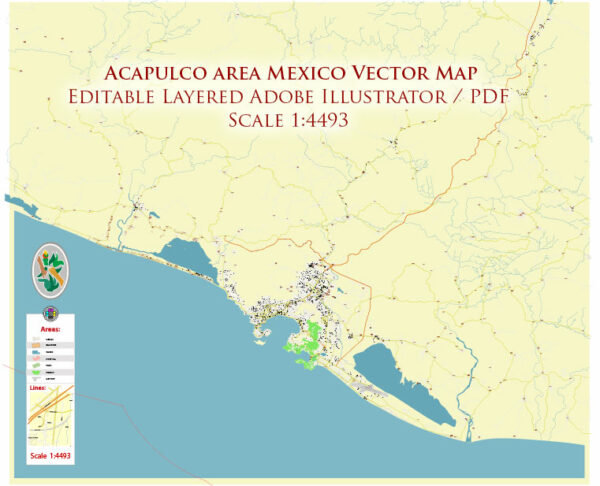
Acapulco, a popular coastal city in Mexico, has a road system that consists of various types of roads and highways to facilitate transportation in and around the city. As of my last knowledge update in September 2021, I can provide you with a general overview of the road system in Acapulco. Please note that there may have been developments or changes in the road infrastructure since then.
- Avenida Costera Miguel Alemán: This is one of the main roads in Acapulco, running along the coastline. It is known for its scenic views and is lined with hotels, restaurants, shops, and entertainment venues.
- Autopista del Sol (Mexican Federal Highway 95D): The Autopista del Sol is a major toll highway that connects Acapulco with Mexico City. It offers a faster and more direct route for travelers coming from the capital.
- Avenida Cuauhtémoc: This road runs parallel to Avenida Costera Miguel Alemán and provides access to various neighborhoods, residential areas, and commercial districts in Acapulco.
- Avenida Ruiz Cortines: Another important avenue in Acapulco, it connects different parts of the city and provides access to the Acapulco International Airport.
- Avenida Farallón: This road connects the city center to the Diamante area and is a major route for reaching the newer, upscale resorts and developments.
- Carretera Escénica: This scenic road provides stunning views of the city and the bay. It’s a popular route for tourists and locals alike.
- Avenida Universidad: It connects various parts of Acapulco and is often used by students attending the local university.
- Other Local Roads: Acapulco has a network of local roads and streets that connect different neighborhoods, communities, and attractions.
It’s important to note that Acapulco’s road system can be subject to traffic congestion, especially during peak tourist seasons. Travelers should be aware of local driving conditions, obey traffic rules, and consider using alternative transportation methods, such as taxis or public buses, to navigate the city more easily. Additionally, road conditions and infrastructure may have changed since my last update, so it’s a good idea to consult a current map or GPS navigation system for the most up-to-date information if you plan to visit Acapulco.


 Author: Kirill Shrayber, Ph.D. FRGS