Marine Charts in Vector Formats – Vectorization on demand
We vectorize marine charts on request (exclusive + non-exclusive).
High quality, excellent accuracy and relevance.
Marine charts, also known as nautical charts, are detailed maps specifically designed for navigation on bodies of water. They provide essential information to mariners, including water depths, the locations of reefs, rocks, and shipwrecks, as well as navigational aids like buoys and lighthouses. These charts also indicate the shoreline, harbors, and other significant coastal features. Unlike regular maps, marine charts often include tidal information, currents, and details about the seabed, which are critical for safe and efficient marine navigation.
Bespoke custom marine chart: Just fill this form!
Your map will be ready within 72 hours, and we will notify you by Email.
We will contact you immediately to clarify the details.
Examples:
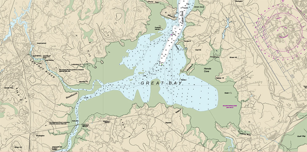
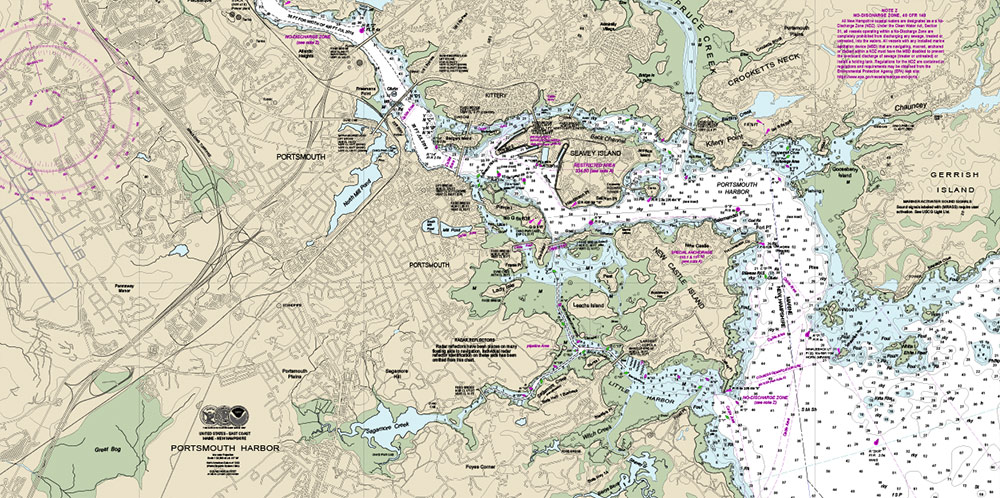
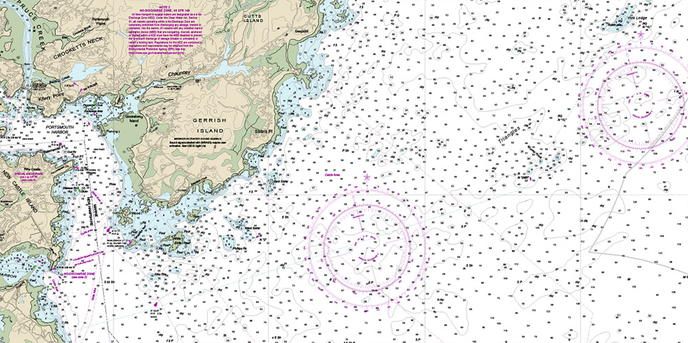
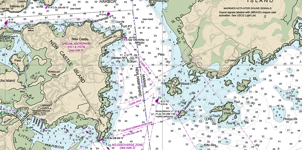
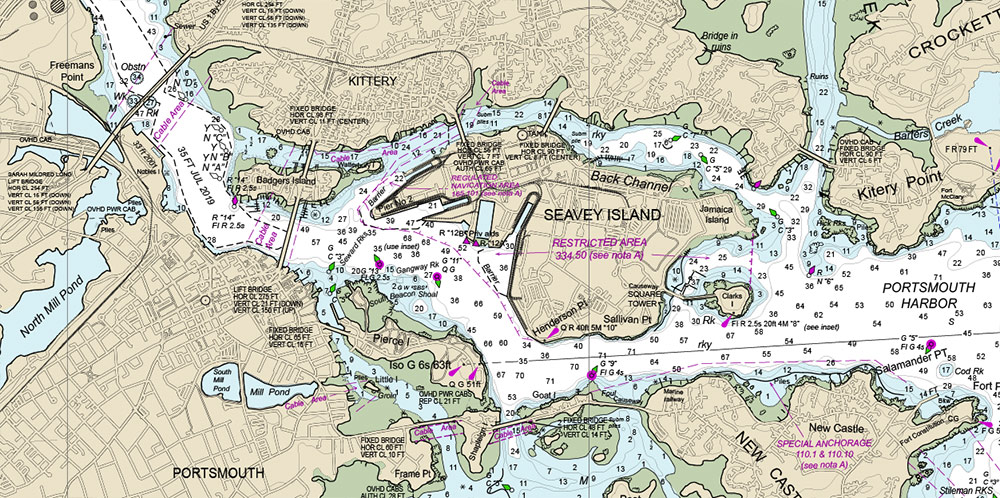
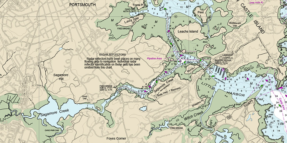
Marine chart of the Portsmouth Harbor New Hampshire
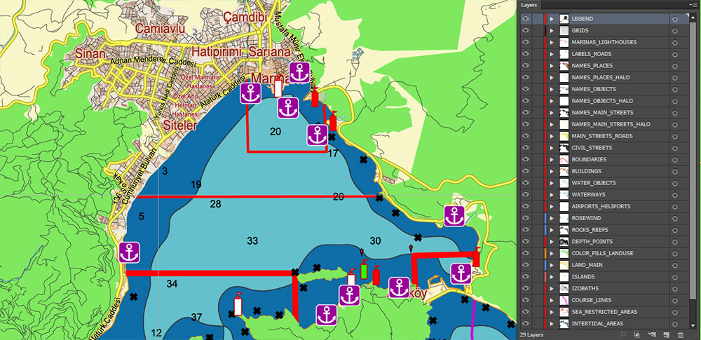
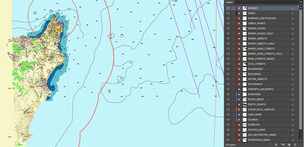
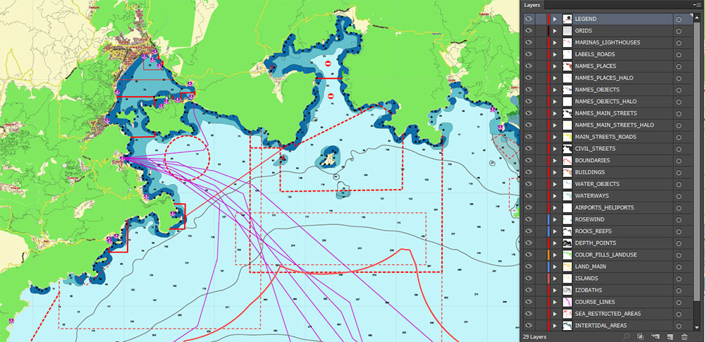
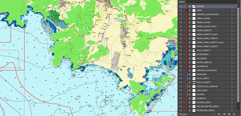
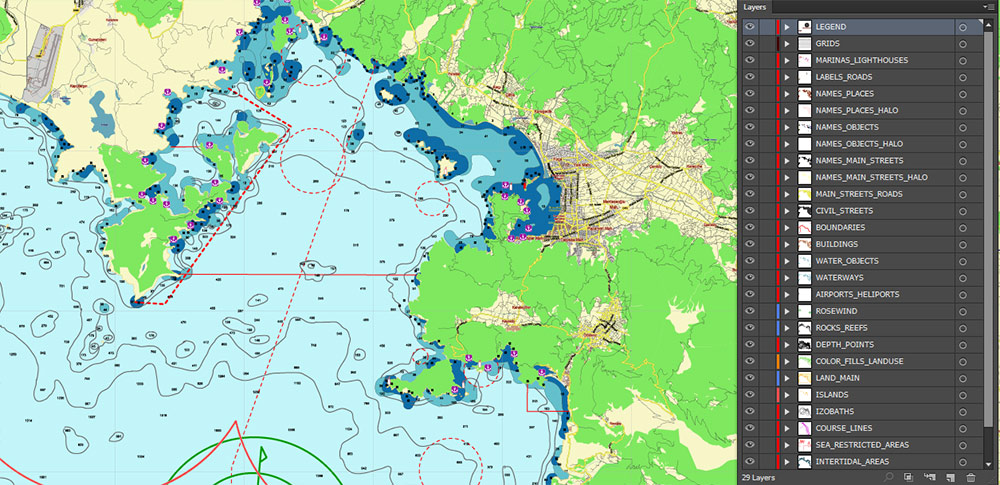
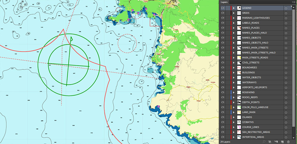
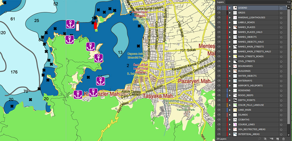
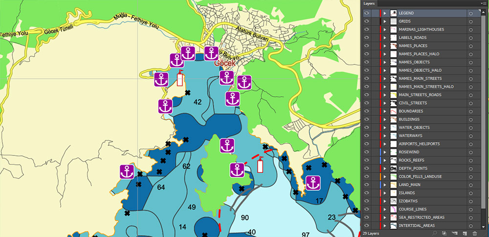
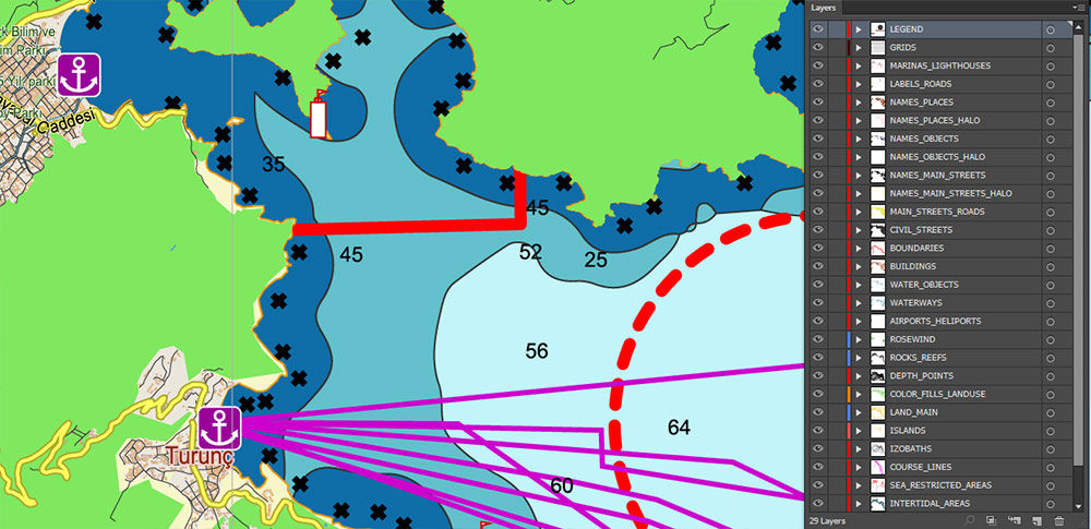
Marine charts of the Marmaris area (Turkey)
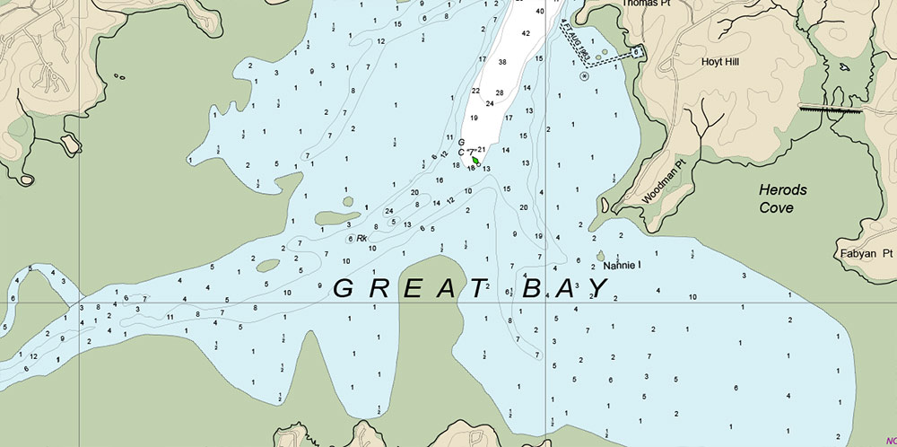
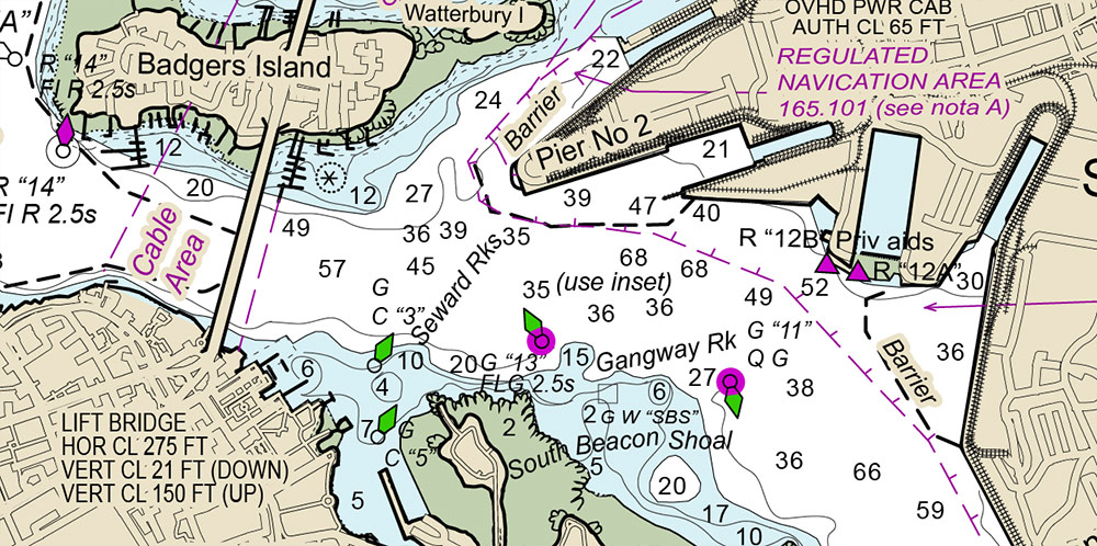
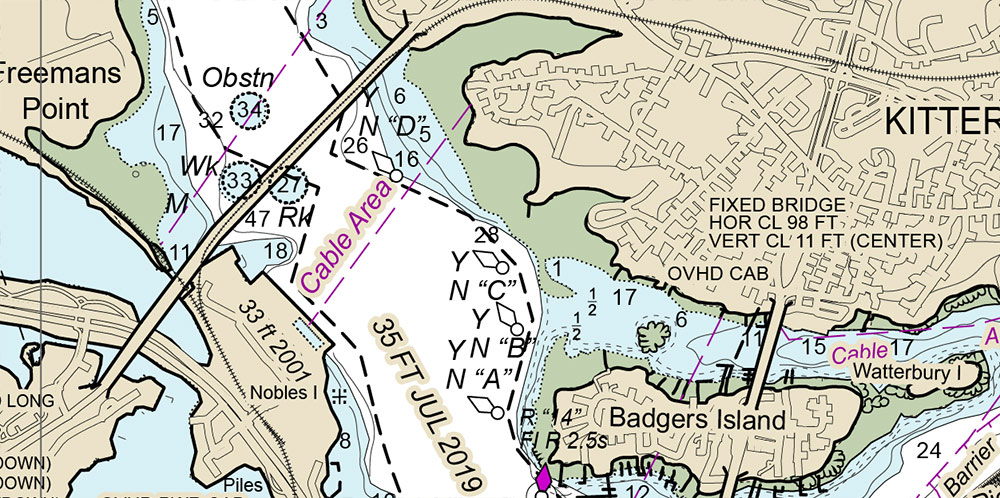
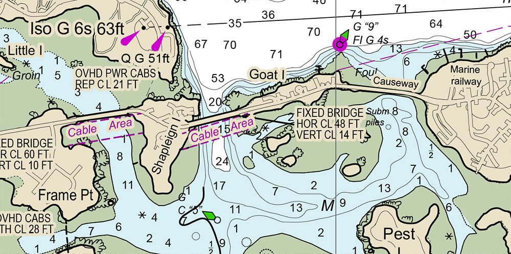
Portsmouth Harbor, New Hampshire, vectorize marine chart on request (exclusive)
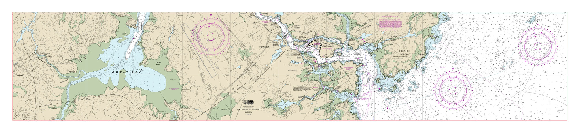
Marine chart of the Portsmouth Harbor New Hampshire
Portsmouth Harbor in New Hampshire is a historically significant and active port located along the Piscataqua River, near the border between New Hampshire and Maine.
The harbor serves as a major hub for commercial shipping, fishing, and recreational boating. It features a mix of deep-water docks, marinas, and shipyards, along with the Portsmouth Naval Shipyard, which is actually located on an island in Kittery, Maine, but is closely associated with Portsmouth.
The harbor is characterized by its strong tidal currents and the presence of navigational challenges such as rocks and shoals, making accurate marine charts essential for safe passage.
The historic downtown area of Portsmouth, with its colonial architecture and waterfront attractions, lies adjacent to the harbor, adding cultural and touristic appeal.
Marine chart of the Portsmouth Harbor New Hampshire
Marine chart of the Portsmouth Harbor New Hampshire
Marine chart of the Portsmouth Harbor New Hampshire
Marine chart of the Portsmouth Harbor New Hampshire
Marine chart of the Portsmouth Harbor New Hampshire
Marine chart of the Portsmouth Harbor New Hampshire
Marine chart of the Portsmouth Harbor New Hampshire
Marine chart of the Portsmouth Harbor New Hampshire
Marine chart of the Portsmouth Harbor New Hampshire
Marine chart of the Portsmouth Harbor New Hampshire
Marine chart of the Portsmouth Harbor New Hampshire
Marmaris, Turkey, vectorize marine chart on request (non-exclusive) here you can see offer >>>
Marmaris Harbor, located on the southwestern coast of Turkey along the Turkish Riviera, is one of the most popular and picturesque harbors in the Mediterranean.
It is nestled in a large, sheltered bay surrounded by forested mountains, making it a scenic and well-protected spot for yachts and boats.
Marmaris is renowned for its vibrant marinas, including the large and modern Netsel Marina, which can accommodate hundreds of yachts and offers a wide range of facilities such as restaurants, shops, and repair services.
The harbor area is a bustling hub for both commercial and recreational maritime activities, including ferry services to nearby Greek islands, chartered yacht tours, and water sports.
The town of Marmaris, adjacent to the harbor, is a lively tourist destination known for its beaches, nightlife, and historic sites, including Marmaris Castle.
The harbor and marinas are also the starting point for many blue cruises, which explore the stunning coastline and hidden coves of the region.
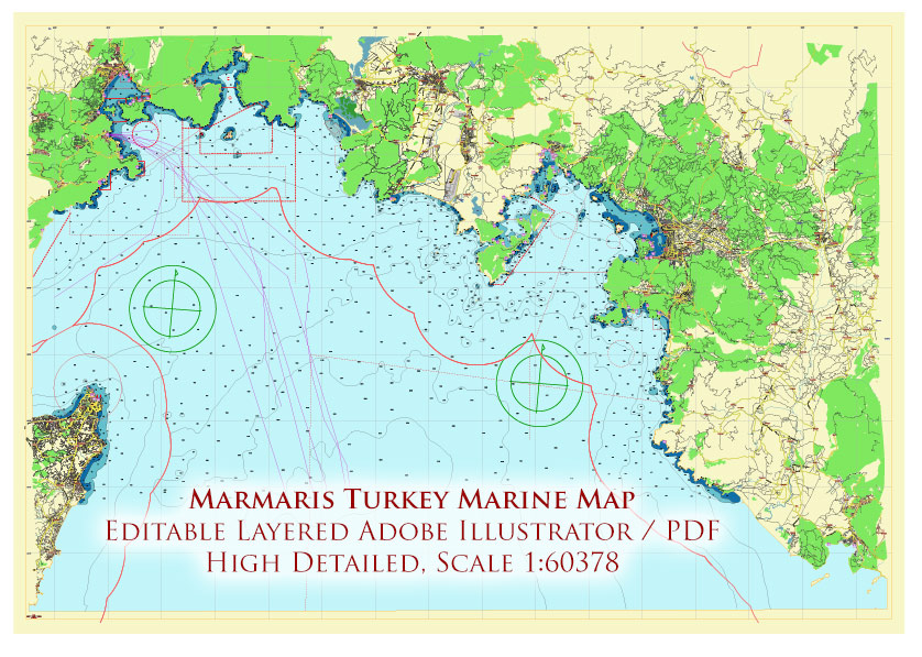
Marmaris area Turkey Marine Vector Map high detailed editable layered Adobe Illustrator
Marmaris area Turkey Marine Vector Map high detailed editable layered Adobe Illustrator
Marmaris area Turkey Marine Vector Map high detailed editable layered Adobe Illustrator
Marmaris area Turkey Marine Vector Map high detailed editable layered Adobe Illustrator
Marmaris area Turkey Marine Vector Map high detailed editable layered Adobe Illustrator
Marmaris area Turkey Marine Vector Map high detailed editable layered Adobe Illustrator
Marmaris area Turkey Marine Vector Map high detailed editable layered Adobe Illustrator
Marmaris area Turkey Marine Vector Map high detailed editable layered Adobe Illustrator
Marmaris area Turkey Marine Vector Map high detailed editable layered Adobe Illustrator
Marmaris area Turkey Marine Vector Map high detailed editable layered Adobe Illustrator