Map Projections
Why Every Map Distorts Reality — and Why That Is Normal
A map is not reality.
It is a transformation.
The Earth is a sphere (more precisely, an oblate spheroid).
A map is flat.
To transfer curved space onto a plane, distortion is unavoidable.
There is no “perfect” projection.
There is only a projection appropriate for your task.
What Is a Map Projection?
A map projection is a mathematical method of converting geographic coordinates (latitude and longitude) into flat, two-dimensional coordinates.
Every projection transforms:
-
Shape
-
Area
-
Distance
-
Direction
You cannot preserve all four simultaneously.
You must choose what matters.
The Four Types of Distortion
Understanding distortion is critical for professional cartography.
1. Shape Distortion
Objects may become stretched or compressed.
Example:
Greenland appears much larger in Mercator projection than it actually is.
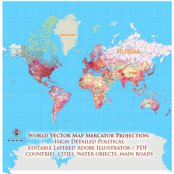
Figure 1. Mercator Projection Example.
2. Area Distortion
Some projections preserve shape but distort size.
Equal-area projections preserve true size relationships.
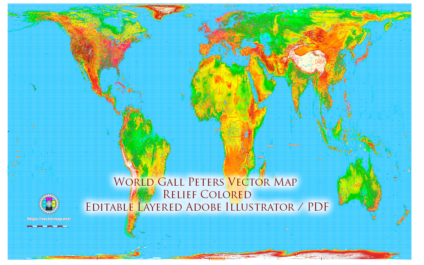
Figure 2. Equal Area – Gall Peters Projection Example.
3. Distance Distortion
Distances may be accurate only along specific lines or directions.
4. Direction Distortion
Certain projections preserve compass bearings, others do not.
There Is No Perfect Projection
This is one of the most important principles in cartography.
If someone says:
“This projection is correct.”
They are wrong.
The correct question is:
“Correct for what purpose?”
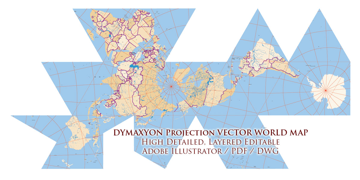
Figure 3. Dymaxion Projection Example.
Common Projections Used in Modern Cartography
Mercator Projection
Most commonly used for web maps.
Advantages:
-
Preserves angles
-
Useful for navigation
-
Rectangular grid
Disadvantages:
-
Extreme area distortion near poles
Suitable for:
-
City maps
-
Navigation
-
Small regional projects
Equal-Area Projections
Preserve true area relationships.
Useful for:
-
Thematic maps
-
Statistical visualization
-
Environmental maps
Shapes may appear distorted,
but area is correct.
Robinson Projection
A compromise projection.
Balanced distortion of area and shape.
Used in:
-
Educational atlases
-
World maps

Figure 4. Robinson Projection Example.
Goode Homolosine Projection
Interrupts oceans to preserve landmass proportions.
Suitable for:
-
Continental emphasis
-
Thematic world maps
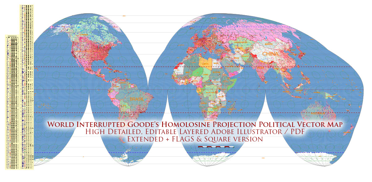
Figure 5. Goode Homolosine Projection Example.
Dymaxion Projection
Projects Earth onto an icosahedron.
Advantages:
-
Preserves continental continuity
-
Minimizes distortion across land
Disadvantages:
-
Visually unconventional
-
Requires careful design
Used in:
-
Experimental cartography
-
Global thematic projects
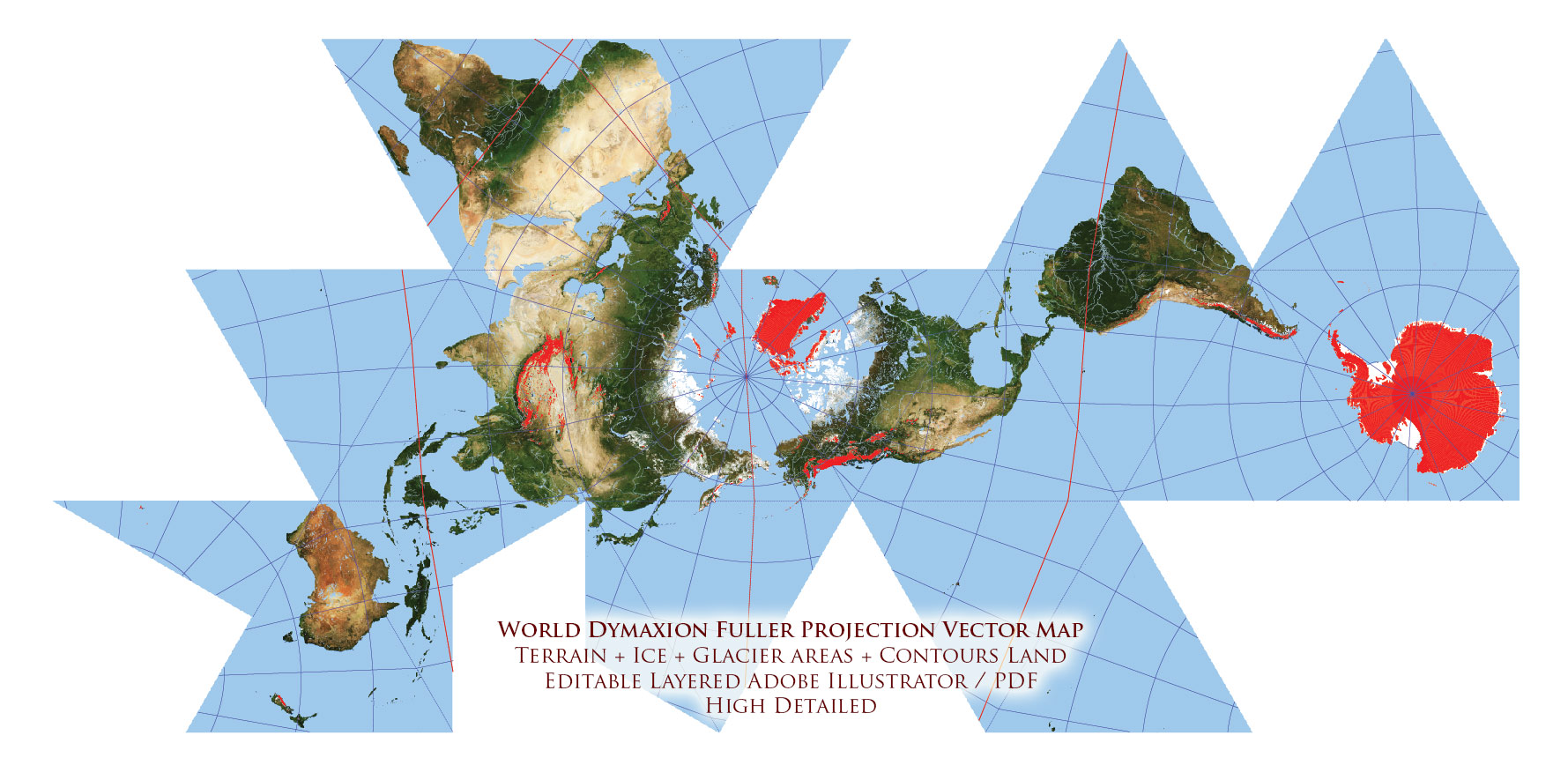
Figure 6. Dymaxion Projection Example – Dymaxion World Vector Map Fuller Projection Terrain + Ice – glaciers, continental and shelves Precision Areas Adobe Illustrator
Choosing a Projection for Print Maps
For most city maps:
Projected coordinate systems or Mercator-based systems are acceptable.
For country maps:
Consider equal-area or compromise projections.
For world maps:
Avoid naive Mercator unless distortion is intentional.
Projection choice must match:
-
Map scale
-
Geographic extent
-
Purpose of the map
-
Audience expectations
Practical Rule for Beginners
If you are mapping:
-
A single city → local projected system
-
A region → suitable national projection
-
A continent → equal-area or compromise
-
The world → avoid web Mercator
Projection should serve clarity.
Not habit.
Projection and Production Workflow
Projection affects:
-
Scale accuracy
-
Label spacing
-
Line curvature
-
Generalization behavior
-
File export precision
Changing projection mid-production is risky.
Choose projection at the beginning.
Stick with it.
What Happens If You Ignore Projection
You may experience:
-
Misaligned layers
-
Incorrect distances
-
Distorted shapes
-
Printing inconsistencies
-
Inaccurate measurements
Projection mistakes are subtle.
They become visible only when it is too late.
Professional Mindset
Projection is not decoration.
It is structural geometry.
Treat it as:
-
Engineering decision
-
Mathematical transformation
-
Foundational layer of the map
Not as a stylistic option.
Summary
A map projection:
-
Converts spherical Earth to flat space
-
Introduces unavoidable distortion
-
Must be chosen according to purpose
There is no distortion-free map.
There is only informed distortion.
Understanding projection is what separates a map user from a cartographer.
Next Chapter
Now that projection is defined,
we address a production-critical topic:
→ Chapter 6 — Map Generalization and Scale Control
Go to Start Page: Technology of Vector Map Production
Frequently Asked Questions
Is there a projection without distortion?
No. Every map projection introduces distortion in shape, area, distance, or direction.
Why is Mercator distorted near the poles?
Mercator preserves angles but significantly enlarges areas near the poles.
Which projection is best for world maps?
There is no universal best projection. Equal-area or compromise projections are often preferred over Mercator.
Should projection be changed mid-project?
No. Projection should be chosen at the beginning and kept consistent.
Table of contents
Chapter 1 — What Is a Vector Map?
Chapter 2 — Obtaining and Preparing Geodata (SHP, OSM, GeoJSON)
Chapter 3 — Street Network as a Graph (Nodes and Edges Explained)
Chapter 4 — Cartographic Layer Hierarchy and Visual Structure
Chapter 5 — Map Projections and Why Distortion Is Inevitable
Chapter 6 — Map Generalization and Scale Control
Chapter 7 — Vector Formats: SHP, GeoJSON, AI and PDF
Chapter 8 — Professional Map Production Workflow
Chapter 9 — Preparing a Vector Map for Print in Illustrator
Chapter 10 — Common Mistakes in Vector Map Production
 Author: Kirill Shrayber, Ph.D. FRGS