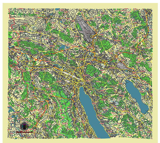
Editable Vector Map of the Zurich Switzerland in SVG format.
Can be edited in the following programs: Adobe Illustrator, CorelDraw, InkScape
Principal streets and roads, names places, residential streets and roads, road number labels, water objects, land use areas.

Zurich Switzerland editable vector map svg free
DOWNLOAD ARCHIVE FOR FREE >>>
Distributed with Creative Commons CC-Zero = Creative Commons CC0 1.0 Universal Public Domain Dedication International License
SEE ALSO FULL VERSION OF THE Zurich Switzerland vector map (Adobe Illustrator, PDF etc.)
Zurich, Switzerland, is a vibrant city known for its financial prowess, cultural richness, and scenic beauty. Here are some of the principal streets, roads, and districts that define Zurich:
Streets and Roads:
- Bahnhofstrasse: One of the world’s most famous shopping streets, lined with luxury boutiques, department stores, and cafes.
- Limmatquai: Runs alongside the Limmat River in the Old Town (Altstadt), offering picturesque views and historical architecture.
- Langstrasse: Known for its lively nightlife, multicultural atmosphere, and diverse dining options.
- Seestrasse: Follows the shore of Lake Zurich, offering stunning lake views and access to parks and recreational areas.
- Hardbrücke: A major bridge and road connecting different parts of Zurich, known for its distinctive architecture and urban views.
City Districts (Quartiere):
- Altstadt (Old Town): The historic heart of Zurich, with narrow cobblestone streets, medieval buildings, and landmarks like Grossmünster and Fraumünster churches.
- Zürich-West: Formerly an industrial area, now transformed into a trendy district with art galleries, hip bars, and restaurants. Home to the Prime Tower and Schiffbau cultural center.
- Enge: A residential area near Lake Zurich, known for its upscale villas, parks, and the Museum Rietberg.
- Hochschulen: Home to Zurich’s university district, with the ETH Zurich (Swiss Federal Institute of Technology) and the University of Zurich campuses.
- Wiedikon: A lively residential and commercial district with a mix of local shops, cafes, and parks.
- Seefeld: Located along the eastern shore of Lake Zurich, known for its upscale residential areas, trendy bars, and lakeside promenade.
Notable Areas:
- Zürich Hauptbahnhof (Main Train Station): One of Europe’s busiest railway stations, serving as a major transportation hub and gateway to the city.
- Bahnhof Enge: A smaller train station in the Enge district, connecting to regional and local trains.
- Bahnhof Stadelhofen: An architecturally significant railway station designed by Santiago Calatrava, located near Lake Zurich.
These streets, roads, and districts collectively showcase Zurich’s blend of historical charm, modernity, and natural beauty, making it a popular destination for tourists and a desirable place to live.

 Author: Kirill Shrayber, Ph.D. FRGS