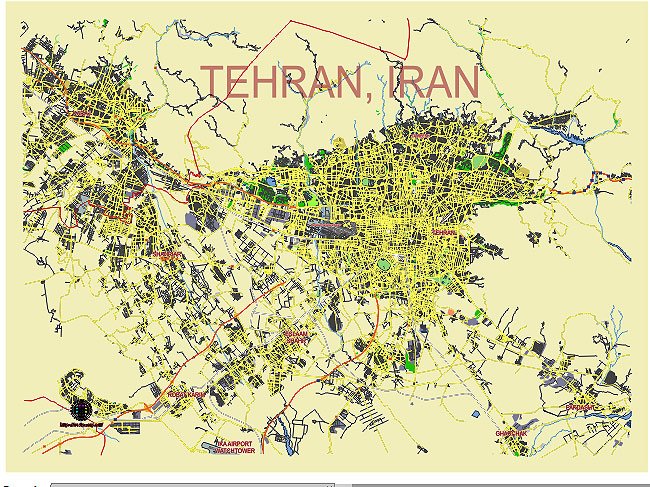
Editable Vector Map of the Tehran Iran in SVG format.
Can be edited in the following programs: Adobe Illustrator, CorelDraw, InkScape
Principal streets and roads, names places, residential streets and roads, road number labels, water objects, land use areas.

Tehran Iran editable vector map svg free
DOWNLOAD ARCHIVE FOR FREE >>>
Distributed with Creative Commons CC-Zero = Creative Commons CC0 1.0 Universal Public Domain Dedication International License
SEE ALSO FULL VERSION OF THE Tehran Iran vector map (Adobe Illustrator, PDF etc.)
Tehran, the capital of Iran, is a sprawling metropolis known for its vibrant city life, historical sites, and cultural diversity. Below are some of the principal streets, roads, and districts of Tehran:
Principal Streets and Roads
- Valiasr Street:
- The longest street in Tehran, stretching from the northernmost to the southernmost part of the city.
- Lined with shops, cafes, parks, and historical landmarks.
- Enghelab Street:
- A major east-west thoroughfare.
- Known for being a cultural hub, with bookstores, theaters, and universities, including the University of Tehran.
- Shariati Street:
- Another major north-south street, running parallel to Valiasr.
- Known for its commercial areas and restaurants.
- Modarres Expressway:
- A key north-south expressway, facilitating quick travel through central Tehran.
- Connects major areas such as the city center and northern suburbs.
- Hemmat Expressway:
- An important east-west expressway.
- Connects various districts and serves as a major route for commuters.
- Kordestan Expressway:
- A north-south route that intersects with Hemmat and other major expressways.
- Helps ease traffic congestion in western Tehran.
- Hakim Expressway:
- Runs east-west, parallel to Hemmat.
- Named after the Persian philosopher and physician Avicenna (Hakim in Persian).
Principal Districts
- District 1 (Northern Tehran):
- Known for its upscale neighborhoods such as Tajrish, Niavaran, and Elahieh.
- Home to many parks, including Jamshidieh Park and Darband, a popular hiking area.
- District 3:
- Contains neighborhoods like Mirdamad, Gholhak, and Zafaraniyeh.
- Known for its embassies, luxury shopping centers, and residential areas.
- District 6:
- Central district including important areas such as Valiasr Square and Enghelab Square.
- Contains many educational institutions and administrative buildings.
- District 12:
- The historical core of Tehran, encompassing the Grand Bazaar, Golestan Palace, and many other historical sites.
- Characterized by its traditional architecture and busy markets.
- District 22:
- Located in western Tehran.
- Known for the modern development of residential complexes and commercial centers, including the Chitgar Lake and Park.
- District 5:
- Encompasses western Tehran areas like Ekbatan, Sadeghieh, and Shahrak-e Gharb.
- Features a mix of residential, commercial, and recreational areas.
Notable Areas and Squares
- Azadi Square:
- An iconic symbol of Tehran with the Azadi Tower.
- Located near the western entrance of the city.
- Tajrish Square:
- A bustling area in northern Tehran.
- Known for the Tajrish Bazaar and Imamzadeh Saleh Shrine.
- Enghelab Square:
- Located along Enghelab Street.
- A central hub for cultural activities and public demonstrations.
- Vanak Square:
- A major traffic junction in central Tehran.
- Surrounded by commercial offices, shops, and restaurants.
These streets, roads, and districts are crucial for navigating Tehran, offering a mix of historical, cultural, and modern experiences.

 Author: Kirill Shrayber, Ph.D. FRGS