Editable Vector Map of the Tauranga New Zealand in SVG format.
Can be edited in the following programs: Adobe Illustrator, CorelDraw, InkScape
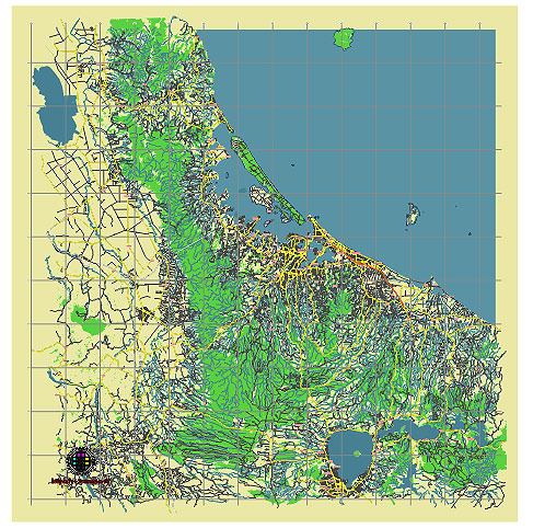
Principal streets and roads, names places, residential streets and roads, road number labels, water objects, land use areas.
Tauranga New Zealand editable vector map svg free
DOWNLOAD ARCHIVE FOR FREE >>>
Distributed with Creative Commons CC-Zero = Creative Commons CC0 1.0 Universal Public Domain Dedication International License
SEE ALSO FULL VERSION OF THE Tauranga New Zealand vector map (Adobe Illustrator, PDF etc.)
Tauranga, located in the Bay of Plenty region on New Zealand’s North Island, is a vibrant city with various districts, streets, and roads that contribute to its unique character. Here are some of the principal streets, roads, and city districts:
Principal Streets and Roads
- Cameron Road: One of Tauranga’s main thoroughfares, Cameron Road runs through the heart of the city, connecting the central business district (CBD) with several suburbs.
- Devonport Road: This street is known for its shops, cafes, and offices, and it is one of the main commercial streets in the downtown area.
- Maunganui Road: Located in Mount Maunganui, this road is lined with shops, restaurants, and cafes, leading to the popular Main Beach and Mount Maunganui summit.
- Fraser Street: Another significant road that runs parallel to Cameron Road, connecting various residential areas with the CBD.
- Chadwick Road: Located in the suburb of Greerton, this road is known for its shopping village and local amenities.
- State Highway 2 (SH2): This major highway connects Tauranga to other parts of the Bay of Plenty and beyond, including Whakatane and Auckland.
- State Highway 29 (SH29): This highway runs from Tauranga over the Kaimai Range to the Waikato region, serving as a key route for transport and logistics.
City Districts
- Tauranga CBD: The central business district is the commercial and administrative heart of the city, featuring a mix of shops, cafes, restaurants, and offices. It is also home to the Tauranga Waterfront and The Strand, a popular area for dining and entertainment.
- Mount Maunganui: A prominent district known for its beautiful beaches, surf culture, and the iconic Mauao (Mount Maunganui). This area is a major tourist destination with a vibrant retail and dining scene.
- Papamoa: A rapidly growing suburb known for its long sandy beach and residential developments. Papamoa Plaza is a key shopping center in this district.
- Bethlehem: A suburban area that combines residential living with commercial amenities. Bethlehem Town Centre is a major shopping destination in this area.
- Greerton: A family-friendly suburb known for its village-like atmosphere, local shops, and parks. It hosts regular markets and community events.
- Welcome Bay: A residential suburb located to the southeast of the city center, known for its scenic views and suburban living.
- Otumoetai: One of Tauranga’s older suburbs, featuring a mix of residential areas and local amenities. It is known for its proximity to the harbor and attractive views.
- Pyes Pa: A developing suburb with a mix of new residential areas and rural properties. The Tauranga Crossing shopping center is a major attraction here.
- Tauriko: This district includes both industrial and residential areas. The Tauriko Business Estate is a significant industrial and commercial hub.
These streets and districts are integral to Tauranga’s identity, offering a blend of urban living, commercial activity, and natural beauty.
 Author: Kirill Shrayber, Ph.D. FRGS