Editable Vector Map of the Tampico Mexico in SVG format.
Can be edited in the following programs: Adobe Illustrator, CorelDraw, InkScape
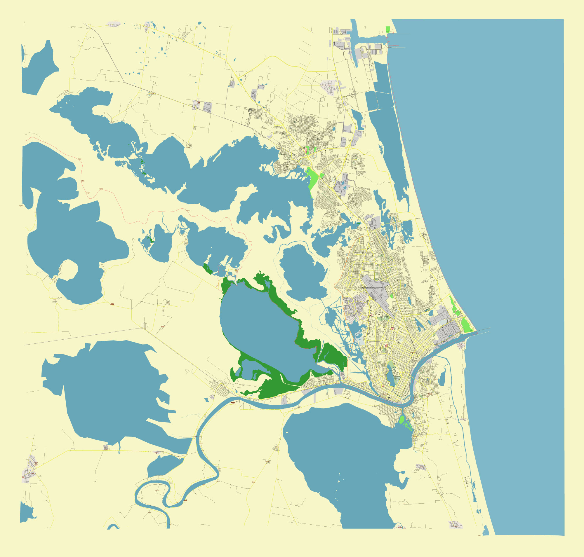
Principal streets and roads, names places, residential streets and roads, road number labels, water objects, land use areas.
 Tampico Mexico editable vector map svg free DOWNLOAD ARCHIVE FOR FREE >>>
Distributed with Creative Commons CC-Zero = Creative Commons CC0 1.0 Universal Public Domain Dedication International License
SEE ALSO FULL VERSION OF THE Tampico Mexico vector map (Adobe Illustrator, PDF etc.)
Tampico, a city in the state of Tamaulipas, Mexico, is known for its port and its role as an important center for commerce and industry. Here are some key streets, roads, and districts in Tampico:
Principal Streets and Roads
- Avenida Hidalgo: One of the main thoroughfares in Tampico, it is a major commercial street lined with shops, restaurants, and businesses.
- Avenida Ejército Mexicano: A significant avenue that runs through various parts of the city, providing connectivity to different neighborhoods.
- Avenida Universidad: Located near educational institutions, this avenue is a central hub for students and academic activities.
- Avenida Miguel Hidalgo y Costilla: Another important street, it serves as a key route for daily commuters.
- Bulevar Adolfo López Mateos: A major boulevard that facilitates traffic flow through the city.
- Carretera Tampico-Mante: This road connects Tampico with other cities and is vital for regional transportation.
Notable Districts
- Centro Histórico (Historic Downtown): The heart of the city, featuring colonial architecture, the Plaza de Armas, and the iconic Tampico Cathedral.
- Colonia Águila: A residential area known for its quiet streets and family-friendly environment.
- Colonia Petrolera: A district that reflects Tampico’s history with the oil industry, featuring several industrial and residential areas.
- Colonia Lomas de Rosales: A modern residential neighborhood with various amenities.
- Zona Dorada (Golden Zone): A bustling commercial district with upscale shops, restaurants, and hotels.
- Tampico Altamira: An industrial zone significant for its port facilities and industrial complexes.
These streets and districts are vital to the daily life and economic activities in Tampico, making the city a dynamic place to live and work.
 Author: Kirill Shrayber, Ph.D. FRGS