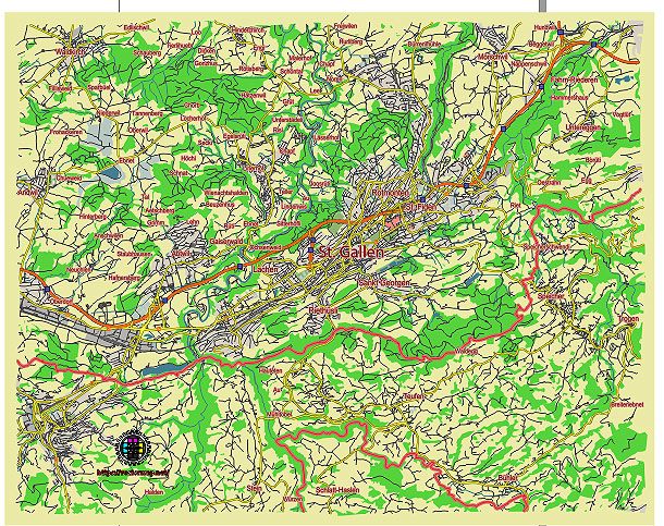
Editable Vector Map of the St. Gallen Switzerland in SVG format.
Can be edited in the following programs: Adobe Illustrator, CorelDraw, InkScape
Principal streets and roads, names places, residential streets and roads, road number labels, water objects, land use areas.

St. Gallen Switzerland editable vector map svg free
DOWNLOAD ARCHIVE FOR FREE >>>
Distributed with Creative Commons CC-Zero = Creative Commons CC0 1.0 Universal Public Domain Dedication International License
SEE ALSO FULL VERSION OF THE St. Gallen Switzerland vector map (Adobe Illustrator, PDF etc.)
St. Gallen, Switzerland, is a city known for its rich history and beautiful architecture. Here are some of its principal streets, roads, and districts:
- Marktplatz: The central square of St. Gallen, surrounded by historic buildings including the town hall and the Abbey of St. Gall.
- Multergasse: A picturesque street lined with colorful buildings, boutiques, and cafes.
- Vadianstrasse: A major thoroughfare in the city center, named after the humanist scholar Joachim Vadian.
- Spisergasse: Another charming street in the old town, known for its shops and restaurants.
- Bahnhofstrasse: The main street leading from the train station to the city center, bustling with shops and businesses.
- Klostergasse: Leads from the Abbey of St. Gall towards the city center, filled with shops and historical buildings.
- Neudorf: A residential area in the eastern part of the city, known for its parks and quiet streets.
- Rosenberg: A hill on the eastern side of the city with residential areas and a popular viewpoint over St. Gallen.
- St. Georgen: A district on the southern side of the city, known for its historical buildings and churches.
- St. Fiden: A suburban area on the western side of the city, with residential neighborhoods and some local shops.
These streets, roads, and districts reflect the diversity and historical richness of St. Gallen, offering a blend of old-world charm and modern amenities.

 Author: Kirill Shrayber, Ph.D. FRGS