Editable Vector Map of the San Juan Puerto Rico in SVG format.
Can be edited in the following programs: Adobe Illustrator, CorelDraw, InkScape
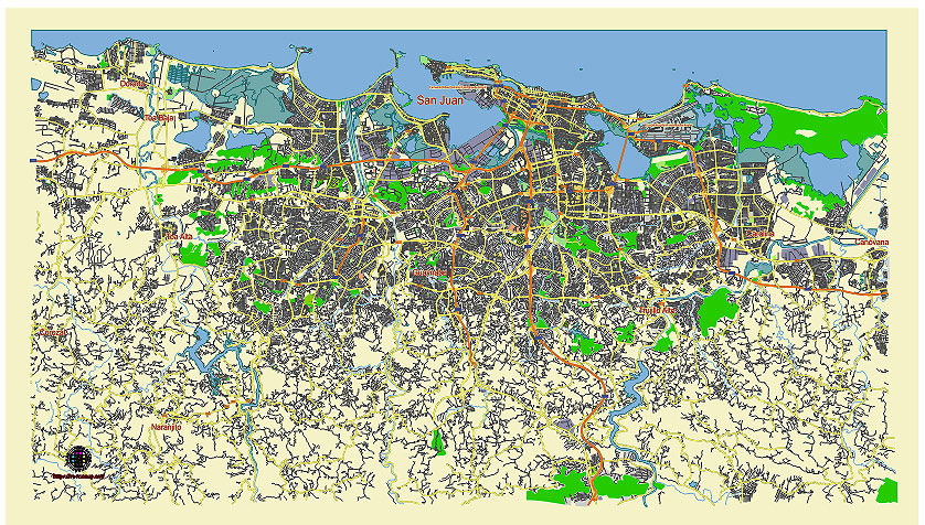
Principal streets and roads, names places, residential streets and roads, road number labels, water objects, land use areas.
San Juan Puerto Rico editable vector map svg free
DOWNLOAD ARCHIVE FOR FREE >>>
Distributed with Creative Commons CC-Zero = Creative Commons CC0 1.0 Universal Public Domain Dedication International License
SEE ALSO FULL VERSION OF THE San Juan Puerto Rico vector map (Adobe Illustrator, PDF etc.)
San Juan, Puerto Rico, is a vibrant and historically rich city with numerous important streets, roads, and districts. Here is an overview:
Principal Streets and Roads
- Avenida Ponce de León:
- One of the main arteries of San Juan, it stretches from Old San Juan through the neighborhoods of Santurce and Hato Rey.
- It is lined with government buildings, businesses, restaurants, and cultural sites.
- Avenida Muñoz Rivera:
- This road connects Old San Juan to other parts of the city and features notable landmarks such as the Capitol Building of Puerto Rico and the University of Puerto Rico’s main campus.
- Calle Fortaleza:
- Located in Old San Juan, this street is famous for La Fortaleza (the Governor’s mansion) and its colorful umbrellas installation.
- Calle San Sebastián:
- Another well-known street in Old San Juan, known for its lively nightlife and the annual San Sebastián Street Festival.
- Avenida Isla Verde (PR-37):
- Runs through the Isla Verde district, a popular tourist area with beaches, hotels, and restaurants.
- Baldorioty de Castro Expressway (PR-26):
- A major expressway connecting Luis Muñoz Marín International Airport to central San Juan and other parts of the metropolitan area.
Principal City Districts
- Old San Juan (Viejo San Juan):
- The historic colonial district, famous for its cobblestone streets, colorful buildings, historic forts (El Morro and San Cristóbal), and vibrant cultural scene.
- Condado:
- A trendy and upscale area known for its beaches, luxury hotels, casinos, and vibrant nightlife.
- Isla Verde:
- A popular beachfront district located close to the airport, known for its resorts, nightlife, and water sports.
- Santurce:
- An artsy and cultural district with galleries, museums, street art, and a burgeoning food scene. Notable areas within Santurce include Miramar and La Placita.
- Hato Rey:
- The financial district of San Juan, home to many banks, corporate offices, and the largest shopping mall in the Caribbean, Plaza Las Américas.
- Río Piedras:
- Known for the University of Puerto Rico’s main campus and its student-oriented atmosphere, with many bookstores, cafes, and affordable eateries.
- Ocean Park:
- A residential and tourist area known for its beautiful beach and relaxed, local vibe.
- Puerta de Tierra:
- Located between Old San Juan and Condado, this area is home to historic sites, government buildings, and residential neighborhoods.
San Juan’s unique blend of historic charm, modern amenities, and cultural vibrancy make it a fascinating city to explore. Each district offers its own distinct atmosphere and attractions, reflecting the diverse character of Puerto Rico’s capital.
 Author: Kirill Shrayber, Ph.D. FRGS