Editable Vector Map of San Francisco Bay Area California US in Adobe Illustrator, PDF and SVG Free.
Can be edited in the following programs: Adobe Illustrator, CorelDraw, InkScape
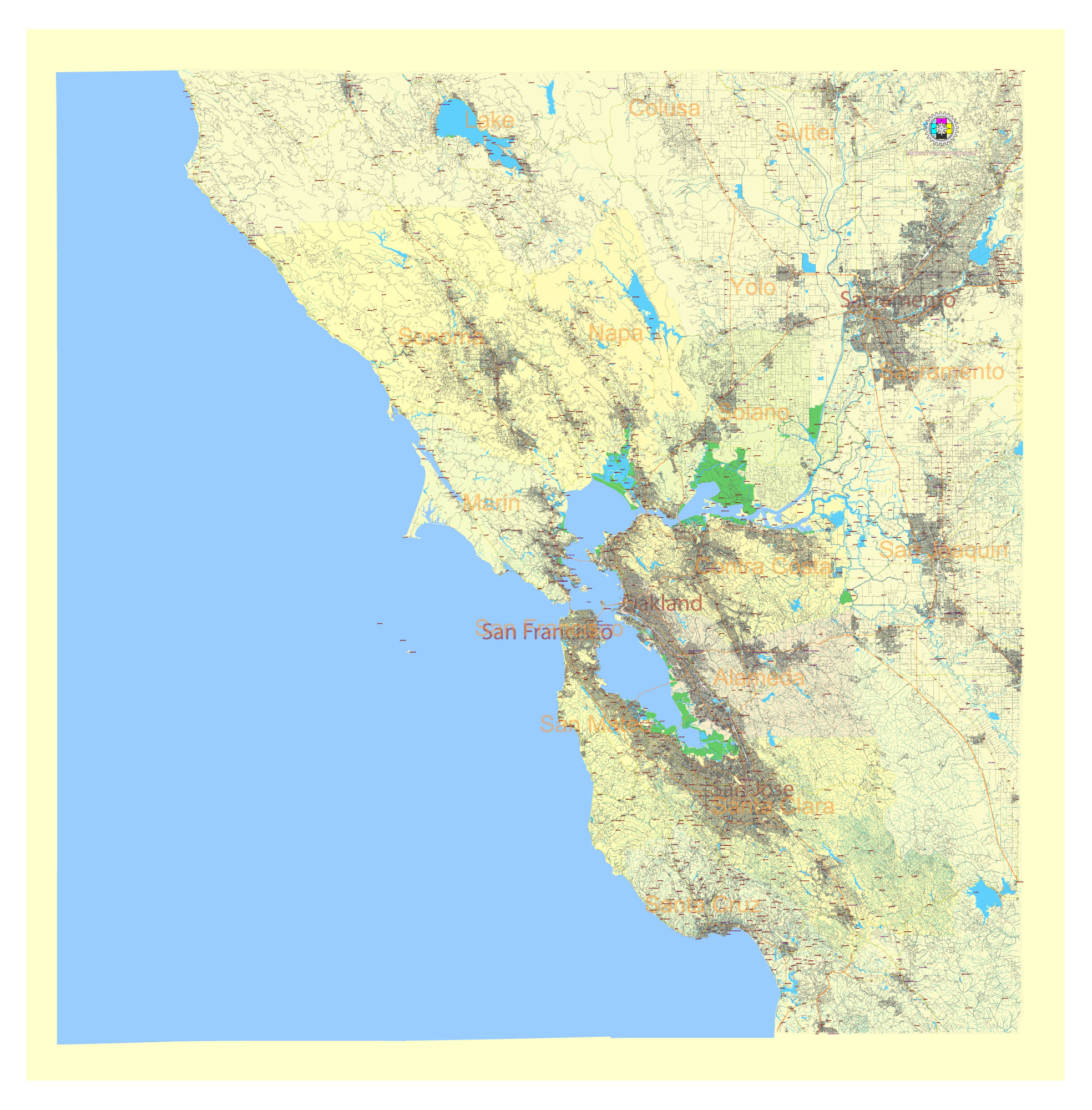
Principal streets and roads, names places, residential streets and roads, water objects, land use areas.
Included counties:
Sonoma, Mapa, Novato, Solano (North Bay area)
Alameda, Contra Costa (East Bay area)
San Francisco, San Mateo (Peninsula area)
Santa Clara (South Bay area)
San Francisco Bay Area California US Vector Map in Adobe Illustrator, PDF and SVG Free
San Francisco Bay Area California US editable vector map SVG free DOWNLOAD ARCHIVE FOR FREE 39 mb >>>
San Francisco Bay Area California US editable vector map Adobe Illustrator free DOWNLOAD ARCHIVE FOR FREE 46 mb >>>
San Francisco Bay Area California US editable vector map Adobe PDF free DOWNLOAD ARCHIVE FOR FREE 83 mb >>>
The San Francisco Bay Area, a populous region in Northern California, encompasses a diverse array of cities and towns, each with its unique charm and importance. Here are some of the principal roads and notable cities and towns in the Bay Area:
Principal Roads
- Interstate 80 (I-80): This major east-west highway runs from San Francisco across the Bay Bridge through Oakland, Berkeley, and Richmond, continuing towards Sacramento and beyond.
- Interstate 580 (I-580): An important freeway connecting the East Bay to the Central Valley, running through cities like Oakland, Dublin, and Livermore.
- Interstate 880 (I-880): Known as the Nimitz Freeway, it runs parallel to the eastern shore of the San Francisco Bay, connecting Oakland, Hayward, and Fremont to San Jose.
- Interstate 680 (I-680): This north-south freeway runs through the eastern part of the Bay Area, connecting cities like Concord, Walnut Creek, Dublin, and San Jose.
- U.S. Route 101 (US 101): A major north-south route that runs along the western side of the Bay through San Francisco, San Mateo, Palo Alto, and San Jose.
- California State Route 1 (CA-1): Also known as the Pacific Coast Highway, it runs along the coast through San Francisco and down the Peninsula, offering scenic views.
- California State Route 92 (CA-92): This highway connects the San Mateo-Hayward Bridge, linking the Peninsula with the East Bay.
- California State Route 24 (CA-24): Connecting Oakland to the cities of Lafayette, Moraga, and Orinda.
- California State Route 4 (CA-4): Serving the northern part of the East Bay, it runs through cities like Hercules, Martinez, and Antioch.
- California State Route 17 (CA-17): Connecting San Jose with Santa Cruz, it is a vital route for commuters and tourists.
Notable Cities and Towns
San Francisco
- San Francisco: The cultural and financial heart of the Bay Area, known for landmarks like the Golden Gate Bridge, Alcatraz Island, and its historic cable cars.
East Bay
- Oakland: A major port city with a vibrant arts scene, diverse population, and significant industrial activity.
- Berkeley: Home to the prestigious University of California, Berkeley, and known for its progressive politics and cultural institutions.
- Fremont: A large suburban city with a strong technology sector and proximity to Silicon Valley.
- Hayward: A diverse city known for its mix of residential, commercial, and industrial areas.
- Walnut Creek: A suburban city known for its shopping, dining, and excellent public schools.
- Richmond: With a significant industrial history and waterfront, it is home to the Rosie the Riveter WWII Home Front National Historical Park.
South Bay
- San Jose: The largest city in Northern California and the heart of Silicon Valley, known for its tech industry and cultural diversity.
- Sunnyvale: Part of Silicon Valley, home to many tech companies and a diverse community.
- Santa Clara: Home to tech giants like Intel and the site of Levi’s Stadium, where the San Francisco 49ers play.
- Mountain View: Headquarters of Google and other tech companies, known for its quality of life and innovative spirit.
- Palo Alto: Known for Stanford University and its high-tech industry, it is a key part of Silicon Valley.
Peninsula
- Redwood City: The county seat of San Mateo County, known for its revitalized downtown and tech companies.
- San Mateo: A significant suburban city with a mix of residential, commercial, and tech industry presence.
- Menlo Park: Known for being the home of Facebook’s headquarters and its affluent neighborhoods.
North Bay
- San Rafael: The county seat of Marin County, known for its historic mission and vibrant downtown.
- Novato: A suburban city in Marin County with a mix of residential and business areas.
- Vallejo: Known for its maritime history and the nearby Six Flags Discovery Kingdom amusement park.
- Napa: Famous worldwide for its wine industry and scenic vineyards.
- Sonoma: Renowned for its wineries, historic plaza, and beautiful landscapes.
These cities and roads form the backbone of the Bay Area, supporting its dynamic economy and diverse communities.
 Author: Kirill Shrayber, Ph.D. FRGS