Editable Vector Map of the Sacramento California US in SVG format.
Can be edited in the following programs: Adobe Illustrator, CorelDraw, InkScape
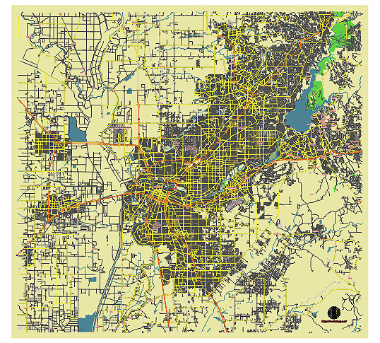
Principal streets and roads, names places, residential streets and roads, road number labels, water objects, land use areas.
Sacramento California US editable vector map svg free
DOWNLOAD ARCHIVE FOR FREE >>>
Distributed with Creative Commons CC-Zero = Creative Commons CC0 1.0 Universal Public Domain Dedication International License
SEE ALSO FULL VERSION OF THE Sacramento California US vector map (Adobe Illustrator, PDF etc.)
Sacramento, the capital city of California, is known for its diverse neighborhoods, vibrant streets, and historic districts. Here’s a breakdown of some of the principal streets, roads, and key city districts in Sacramento:
Principal Streets and Roads
- Capitol Mall: This street runs west to east from the Tower Bridge to the State Capitol, offering a picturesque view of the Capitol building.
- J Street: A major thoroughfare that runs east-west, J Street is known for its lively atmosphere with many restaurants, shops, and businesses.
- K Street: Parallel to J Street, K Street is partially pedestrianized and features the Downtown Commons (DOCO) area, Golden 1 Center, and various entertainment options.
- Broadway: Running through the Oak Park and Land Park neighborhoods, Broadway is home to a mix of historic and modern establishments.
- Stockton Boulevard: This major north-south route passes through multiple neighborhoods and is known for its diverse array of ethnic restaurants and shops.
- Franklin Boulevard: Known for its multicultural vibe, Franklin Boulevard features many local businesses and eateries.
- El Camino Avenue: A major east-west road that traverses several residential neighborhoods and connects with major highways.
- Folsom Boulevard: Running from downtown Sacramento to the eastern suburbs, Folsom Boulevard is a key commercial corridor.
- Freeport Boulevard: Serving the Land Park and South Land Park areas, Freeport Boulevard is lined with residential areas, parks, and local businesses.
Key City Districts
- Downtown Sacramento: The heart of the city, featuring the State Capitol, Capitol Park, the Golden 1 Center, and numerous government buildings, businesses, and cultural attractions.
- Midtown Sacramento: Known for its tree-lined streets, historic homes, and vibrant arts scene, Midtown is a hub for dining, nightlife, and shopping.
- Old Sacramento: A historic district along the Sacramento River, featuring preserved buildings from the Gold Rush era, museums, shops, and restaurants.
- East Sacramento: A residential neighborhood known for its beautiful homes, including the Fab Forties, and close proximity to the American River Parkway.
- Land Park: A primarily residential area, home to William Land Park, which includes the Sacramento Zoo, Fairytale Town, and a golf course.
- Tahoe Park: A family-friendly neighborhood with a large park and a growing number of local eateries and shops.
- Oak Park: A historic and culturally diverse neighborhood with a strong sense of community, home to the Broadway Triangle District and the Guild Theater.
- Natomas: A rapidly growing area north of downtown, including North Natomas and South Natomas, known for newer developments, parks, and the Sacramento International Airport.
- Arden-Arcade: An unincorporated area east of Sacramento, featuring a mix of residential, commercial, and retail establishments, including the Arden Fair Mall.
- Pocket-Greenhaven: A suburban neighborhood characterized by its riverside location, family-friendly atmosphere, and extensive green spaces.
These streets, roads, and districts make up the diverse and dynamic landscape of Sacramento, each contributing to the city’s unique character and charm.
 Author: Kirill Shrayber, Ph.D. FRGS