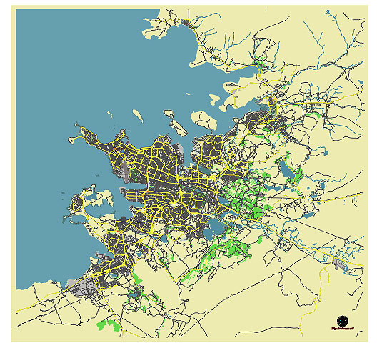
Editable Vector Map of the Reykjavik Iceland in SVG format.
Can be edited in the following programs: Adobe Illustrator, CorelDraw, InkScape
Principal streets and roads, names places, residential streets and roads, road number labels, water objects, land use areas.

Reykjavik Iceland vector map svg free
DOWNLOAD ARCHIVE FOR FREE >>>
Distributed with Creative Commons CC-Zero = Creative Commons CC0 1.0 Universal Public Domain Dedication International License
SEE ALSO FULL VERSION OF THE Reykjavik Iceland vector map (Adobe Illustrator, PDF etc.)
Reykjavik, the capital of Iceland, features several principal streets, roads, and districts that form its urban landscape. Here are some of the key ones:
Streets and Roads:
- Laugavegur – A bustling shopping street in downtown Reykjavik, known for its shops, cafes, and nightlife.
- Skólavörðustígur – Leads up to Hallgrímskirkja, Reykjavik’s iconic church, offering views of the city.
- Hringbraut – An important road that circles around central Reykjavik, connecting various districts.
- Suðurlandsbraut – Runs south from the city center towards the outskirts, connecting to major highways.
- Lækjargata – Runs parallel to the waterfront, known for its historic significance and shops.
Districts:
- Downtown Reykjavik (Miðborg) – The central area, home to many shops, restaurants, and cultural attractions.
- Vesturbær – Located west of the city center, a residential area with parks and schools.
- Laugardalur – East of downtown, known for Laugardalslaug (a geothermal pool) and recreational facilities.
- Breiðholt – A suburban district in southeast Reykjavik, mainly residential with shopping centers.
- Grafarvogur – Located in the eastern part of Reykjavik, known for its coastal views and residential areas.
- Árbær – South of the city center, home to the Árbær Open Air Museum and residential neighborhoods.
These streets and districts provide a glimpse into the layout and character of Reykjavik, a city known for its compact size and vibrant cultural scene amidst Iceland’s stunning natural surroundings.

 Author: Kirill Shrayber, Ph.D. FRGS