Editable Vector Map of the Reading Pennsylvania US in SVG format.
Can be edited in the following programs: Adobe Illustrator, CorelDraw, InkScape
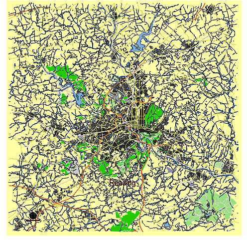
Principal streets and roads, names places, residential streets and roads, road number labels, water objects, land use areas.
Reading Pennsylvania US vector map svg free
DOWNLOAD ARCHIVE FOR FREE >>>
Distributed with Creative Commons CC-Zero = Creative Commons CC0 1.0 Universal Public Domain Dedication International License
SEE ALSO FULL VERSION OF THE Reading Pennsylvania US vector map (Adobe Illustrator, PDF etc.)
Reading, Pennsylvania, has several key streets, roads, and city districts that are notable. Here’s an overview:
Principal Streets and Roads
- Penn Street: One of the main thoroughfares, running through downtown Reading, it is a hub of business and cultural activities.
- Fifth Street: A major north-south route that connects several neighborhoods and passes through the heart of the city.
- Route 422 (Benjamin Franklin Highway): A major east-west route providing access to the suburbs and connecting Reading to other regional cities.
- Route 12 (Warren Street Bypass): A crucial route for east-west travel, linking Reading with nearby areas and facilitating access to Route 222.
- Route 222 (Lancaster Avenue/5th Street Highway): A significant north-south artery that connects Reading to Lancaster and Allentown.
- Perkiomen Avenue: A primary road on the east side of the city, running through Mount Penn and into the city.
- Schuylkill Avenue: An important route on the west side of Reading, parallel to the Schuylkill River.
Principal Districts
- Downtown Reading: The central business district, characterized by historic buildings, Penn Square, Santander Arena, and the Reading Public Museum.
- Centre Park Historic District: Known for its beautiful Victorian architecture, it is a residential area with a rich history and many restored homes.
- Callowhill Historic District: A residential area with a mix of architectural styles and several historic landmarks.
- Northwest Reading: A residential area with a mix of homes and small businesses, featuring the popular Reading Area Community College.
- Glenside: A suburban neighborhood with a mix of residential and commercial properties, located northwest of downtown.
- Northeast Reading: A diverse residential area with a range of housing types, schools, and community parks.
- South Reading: Primarily residential, featuring the Oakbrook Homes and several parks and community centers.
- East Reading: A residential area with a mix of homes, schools, and small businesses, offering views of the Pagoda on Mount Penn.
- Wyomissing: While technically a separate borough, it is often associated with Reading and features upscale residential areas, shopping centers, and business parks.
Notable Landmarks
- The Pagoda: Located on Mount Penn, offering panoramic views of the city.
- Reading Public Museum: Featuring art, science, and cultural exhibits.
- Santander Arena: Hosting concerts, sports events, and other entertainment.
- FirstEnergy Stadium: Home to the Reading Fightin Phils, a minor league baseball team.
These principal streets, roads, and districts are integral to the city’s layout, providing vital connectivity and reflecting the cultural and historical richness of Reading, Pennsylvania.
 Author: Kirill Shrayber, Ph.D. FRGS