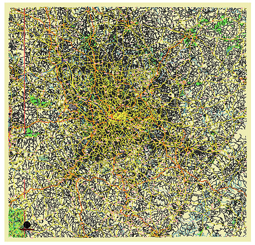
Editable Vector Map of the Pittsburgh Pennsylvania US in SVG format.
Can be edited in the following programs: Adobe Illustrator, CorelDraw, InkScape
Principal streets and roads, names places, residential streets and roads, road number labels, water objects, land use areas.

Pittsburgh Pennsylvania US vector map svg free
DOWNLOAD ARCHIVE FOR FREE >>>
Distributed with Creative Commons CC-Zero = Creative Commons CC0 1.0 Universal Public Domain Dedication International License
SEE ALSO FULL VERSION OF THE Pittsburgh Pennsylvania US vector map (Adobe Illustrator, PDF etc.)
Pittsburgh, Pennsylvania, is known for its unique geography and vibrant neighborhoods. Here’s an overview of the principal streets, roads, and city districts:
Principal Streets and Roads
- Grant Street: Located in the heart of downtown, Grant Street is lined with government buildings, banks, and skyscrapers. It’s one of the major thoroughfares in the city’s central business district.
- Liberty Avenue: This major road runs through downtown Pittsburgh and the Strip District, known for its vibrant markets, restaurants, and nightlife.
- Forbes Avenue: Running through the Oakland neighborhood, Forbes Avenue passes by several educational institutions including the University of Pittsburgh and Carnegie Mellon University.
- Fifth Avenue: Parallel to Forbes Avenue, this road also runs through Oakland and is another key artery for accessing educational and medical facilities.
- Carson Street: Located in the South Side, East Carson Street is famous for its extensive range of bars, restaurants, and shops.
- Penn Avenue: Running through the Strip District and into Lawrenceville, Penn Avenue is a key road for accessing local businesses, shops, and nightlife.
- Boulevard of the Allies: This road provides a connection from downtown to the universities in Oakland and is an important commuter route.
- Bigelow Boulevard: An important connector between downtown and Oakland, running through the Hill District and providing access to several neighborhoods.
City Districts
- Downtown (Central Business District): The heart of the city, featuring skyscrapers, Point State Park, cultural venues like the Benedum Center, and shopping areas like Market Square.
- Oakland: Home to the University of Pittsburgh, Carnegie Mellon University, and major hospitals like UPMC, this district is a hub of education and healthcare.
- Shadyside: Known for its upscale shopping, dining, and historic homes. Walnut Street and Ellsworth Avenue are popular destinations here.
- Lawrenceville: A rapidly growing neighborhood known for its arts scene, boutique shops, and trendy restaurants. Butler Street is the main commercial thoroughfare.
- South Side: Famous for its vibrant nightlife, East Carson Street is lined with bars, restaurants, and shops. The SouthSide Works development adds to its appeal with shopping and entertainment options.
- North Shore: Located along the Allegheny River, this area is home to PNC Park (home of the Pittsburgh Pirates) and Acrisure Stadium (home of the Pittsburgh Steelers), as well as the Andy Warhol Museum and Heinz Field.
- Strip District: A bustling area with food markets, specialty shops, and ethnic grocers. Known for its lively atmosphere and historic buildings.
- Squirrel Hill: A diverse, residential neighborhood with a strong Jewish community. Forbes and Murray Avenues are key streets here, offering a variety of dining and shopping options.
- Bloomfield: Often referred to as Pittsburgh’s Little Italy, known for its Italian restaurants, bakeries, and shops along Liberty Avenue.
- Mount Washington: Famous for its stunning views of the Pittsburgh skyline from Grandview Avenue and the inclines that transport residents and visitors up and down the steep hillside.
These streets and districts highlight the rich diversity and unique character of Pittsburgh, making it a city with a lot to offer both residents and visitors.

 Author: Kirill Shrayber, Ph.D. FRGS