Editable Vector Map of the Philadelphia Pennsylvania US in SVG format.
Can be edited in the following programs: Adobe Illustrator, CorelDraw, InkScape
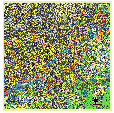
Principal streets and roads, names places, residential streets and roads, road number labels, water objects, land use areas.
Philadelphia Pennsylvania US vector map svg free
DOWNLOAD ARCHIVE FOR FREE >>>
Distributed with Creative Commons CC-Zero = Creative Commons CC0 1.0 Universal Public Domain Dedication International License
SEE ALSO FULL VERSION OF THE Philadelphia Pennsylvania US vector map (Adobe Illustrator, PDF etc.)
Philadelphia, Pennsylvania, is a historic city with a rich tapestry of streets, roads, and districts, each contributing to the city’s unique character. Here are some of the principal streets, roads, and city districts of Philadelphia:
Principal Streets and Roads:
- Broad Street:
- One of the city’s main north-south arteries, running from the Navy Yard in South Philadelphia to the northern neighborhoods.
- Notable landmarks include City Hall, the Avenue of the Arts, and Temple University.
- Market Street:
- A major east-west street that runs from the Delaware River to 69th Street.
- Key sites along Market Street include Independence Mall, the Liberty Bell, and Reading Terminal Market.
- Chestnut Street:
- Parallel to Market Street, known for its shopping, dining, and historic sites.
- Passes through Rittenhouse Square and the University City area.
- Walnut Street:
- Another prominent east-west thoroughfare, renowned for its upscale shopping and dining.
- Connects historic Old City to the bustling Rittenhouse Square.
- South Street:
- Known for its vibrant nightlife, eclectic shops, and diverse dining options.
- Extends from the Delaware River to 33rd Street.
- Girard Avenue:
- Runs east-west across the city, notable for its historic trolleys and access to the Philadelphia Zoo and Fairmount Park.
- Roosevelt Boulevard (U.S. Route 1):
- A major north-south highway that traverses Northeast Philadelphia.
- Known for its heavy traffic and commercial corridors.
- Benjamin Franklin Parkway:
- A scenic boulevard modeled after the Champs-Élysées in Paris.
- Connects City Hall to the Philadelphia Museum of Art and Logan Circle.
Principal City Districts:
- Center City:
- The central business district and cultural hub of Philadelphia.
- Includes neighborhoods such as Rittenhouse Square, Old City, and Society Hill.
- Home to major attractions like Independence Hall, the Liberty Bell, and City Hall.
- South Philadelphia:
- Known for its vibrant Italian and Irish American communities.
- Includes areas like the Italian Market, sports complex (Wells Fargo Center, Lincoln Financial Field), and neighborhoods such as Queen Village and Pennsport.
- North Philadelphia:
- Encompasses diverse neighborhoods, including Northern Liberties, Fishtown, and Temple University’s main campus.
- Notable for its historic and cultural sites, as well as a burgeoning arts scene.
- West Philadelphia:
- Home to the University of Pennsylvania and Drexel University.
- Includes neighborhoods like University City, Spruce Hill, and Powelton Village.
- Known for its Victorian architecture and vibrant cultural diversity.
- Northeast Philadelphia:
- A largely residential area with a mix of urban and suburban characteristics.
- Includes neighborhoods like Mayfair, Frankford, and Bustleton.
- Northwest Philadelphia:
- Known for its green spaces and historic sites.
- Includes neighborhoods like Germantown, Chestnut Hill, and Manayunk.
- Features attractions such as Wissahickon Valley Park and the Morris Arboretum.
- Fairmount and Art Museum Area:
- Named after the Philadelphia Museum of Art and Fairmount Park.
- Includes attractions like the Eastern State Penitentiary and the Rodin Museum.
Philadelphia’s diverse neighborhoods and principal streets contribute to the city’s rich cultural tapestry and offer a wide range of experiences for residents and visitors alike.
 Author: Kirill Shrayber, Ph.D. FRGS