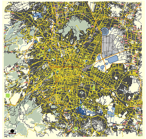
Editable Vector Map of the Mexico City MX in SVG format.
Can be edited in the following programs: Adobe Illustrator, CorelDraw, InkScape
Principal streets and roads, names places, residential streets and roads, road number labels, water objects, land use areas.
DOWNLOAD ARCHIVE FOR FREE >>>
Distributed with Creative Commons Attribution 4.0 International License
SEE ALSO FULL VERSION OF THE Mexico City MX vector map (Adobe Illustrator, PDF etc.)
Mexico City, the capital of Mexico, is a sprawling metropolis with a rich history and a diverse cultural landscape. The city is organized into various boroughs (delegaciones) and neighborhoods (colonias), each with its unique character and key streets or roads. Here are some of the principal streets, roads, and city districts:
Principal Streets and Roads
- Paseo de la Reforma:
- One of the most famous avenues in Mexico City, it stretches from the city center to the Chapultepec Park. It is lined with important landmarks, monuments, and modern skyscrapers.
- Avenida Insurgentes:
- One of the longest avenues in the world, running north to south through the city. It connects many key districts and is a major thoroughfare for public transportation.
- Avenida de los Insurgentes Sur:
- A major continuation of Avenida Insurgentes, running through the southern parts of the city, including important business and commercial areas.
- Eje Central Lázaro Cárdenas:
- A major north-south axis road that cuts through the historical center and connects various neighborhoods.
- Avenida Juárez and Avenida Madero:
- Important streets in the historic center, leading to the Zócalo, the main square of Mexico City.
- Avenida Presidente Masaryk:
- Located in the upscale neighborhood of Polanco, it is known for luxury shopping, restaurants, and embassies.
- Calzada de Tlalpan:
- One of the oldest roads in the city, running south from the historic center and passing through several residential and commercial districts.
- Periférico (Anillo Periférico):
- A major ring road that encircles much of the city, providing access to many districts and connecting to various highways.
- Circuito Interior:
- An inner ring road that helps in navigating around the central parts of the city, easing traffic flow.
Principal City Districts
- Centro Histórico:
- The historic center of Mexico City, home to the Zócalo, the Metropolitan Cathedral, and the National Palace. It is a UNESCO World Heritage site.
- Polanco:
- An affluent neighborhood known for luxury shopping, fine dining, and embassies. It’s a major commercial and business district.
- Condesa and Roma:
- Trendy neighborhoods known for their vibrant nightlife, cultural scene, and beautiful parks.
- Coyoacán:
- A culturally rich area known for its colonial architecture, cobblestone streets, and the Frida Kahlo Museum.
- San Ángel:
- Known for its well-preserved historic architecture, art markets, and traditional atmosphere.
- Zona Rosa:
- A lively commercial district known for shopping, nightlife, and the LGBTQ+ community.
- Chapultepec:
- Home to the expansive Chapultepec Park, which includes museums, a zoo, and the Chapultepec Castle.
- Santa Fe:
- A modern business district located in the western part of the city, known for its skyscrapers, shopping centers, and universities.
- Xochimilco:
- Famous for its canals and colorful trajineras (boats), it is a popular tourist destination with a distinct traditional feel.
- Tlalpan:
- One of the largest boroughs, known for its historical center, ecological reserves, and medical facilities.
Each of these streets, roads, and districts contributes to the diverse and dynamic character of Mexico City, making it a unique metropolis with a blend of history, culture, and modernity.
 Author: Kirill Shrayber, Ph.D. FRGS