Editable Vector Map of the Martha’s Vineyard Massachusetts US in SVG format.
Can be edited in the following programs: Adobe Illustrator, CorelDraw, InkScape
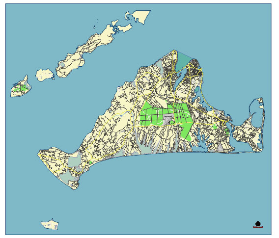
Principal streets and roads, names places, residential streets and roads, road number labels, water objects, land use areas.
Martha’s Vineyard Massachusetts US editable vector map svg free
DOWNLOAD ARCHIVE FOR FREE >>>
Distributed with Creative Commons Attribution 4.0 International License
Martha’s Vineyard is an island located south of Cape Cod in Massachusetts, known for its charming towns, scenic beauty, and historical significance. Here are the principal streets, roads, and towns on Martha’s Vineyard:
Principal Towns
- Edgartown
- One of the most picturesque and historic towns on the island, known for its beautiful harbor, historic homes, and lighthouses.
- Oak Bluffs
- Famous for its Victorian architecture, “Gingerbread Cottages,” and vibrant summer atmosphere. It also features the oldest operating platform carousel in the country.
- Vineyard Haven (Tisbury)
- A major port town with a bustling harbor, serving as the primary entry point for ferries coming from the mainland. It has a charming downtown area with shops and restaurants.
- West Tisbury
- A more rural and agricultural town, known for its rolling landscapes, farmers’ markets, and the annual Agricultural Fair.
- Chilmark
- Known for its scenic beauty, rolling hills, and fishing village of Menemsha, which offers stunning sunsets and fresh seafood.
- Aquinnah (formerly Gay Head)
- Known for the stunning Aquinnah Cliffs, which are made of colorful clay and offer breathtaking views of the ocean. It is also home to the Wampanoag Tribe.
Principal Streets and Roads
- State Road (MA-5)
- Runs through several towns including Tisbury, West Tisbury, and Chilmark. It’s one of the main roads for traversing the island from Vineyard Haven to Aquinnah.
- Edgartown-Vineyard Haven Road
- Connects the towns of Edgartown and Vineyard Haven, passing through the center of the island and serving as a major thoroughfare.
- Beach Road
- Runs along the coast between Edgartown and Oak Bluffs, offering scenic ocean views and access to several popular beaches.
- Circuit Avenue
- Located in Oak Bluffs, this is one of the main commercial streets lined with shops, restaurants, and entertainment venues.
- Main Street (Edgartown)
- The main commercial and historic street in Edgartown, featuring boutique shops, restaurants, and historic sites.
- Lamberts Cove Road
- A scenic road in West Tisbury, known for its beautiful landscapes and access to Lamberts Cove Beach.
- South Road
- Runs from West Tisbury to Chilmark, offering access to the island’s rural and agricultural heartlands.
- North Road
- Another important road in the Chilmark area, running parallel to South Road but closer to the northern coast.
These towns and roads highlight the charm and diversity of Martha’s Vineyard, from its bustling harbors and commercial centers to its serene rural landscapes and scenic coastlines.
 Author: Kirill Shrayber, Ph.D. FRGS