Editable Vector Map of the Luxembourg in SVG format.
Can be edited in the following programs: Adobe Illustrator, CorelDraw, InkScape
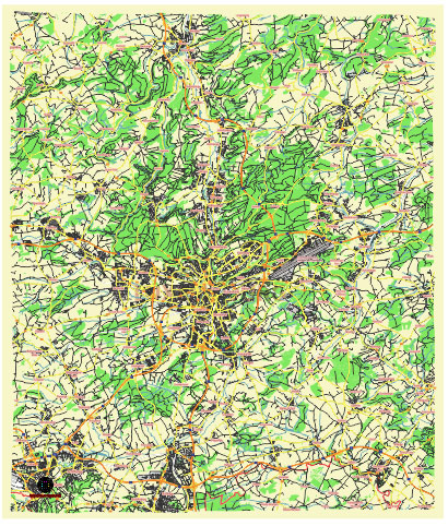
Principal streets and roads, names places, residential streets and roads, road number labels, water objects, land use areas.
Luxembourg editable vector map svg free
DOWNLOAD ARCHIVE FOR FREE >>>
Distributed with Creative Commons Attribution 4.0 International License
SEE ALSO FULL VERSION OF THE Luxembourg vector map (Adobe Illustrator, PDF etc.)
Luxembourg City, the capital of the Grand Duchy of Luxembourg, is a vibrant and picturesque city known for its mix of modern and historical architecture. Here are some of the principal streets, roads, and city districts of Luxembourg City:
Principal Streets and Roads
- Avenue de la Liberté: A major thoroughfare running from the central train station (Gare Centrale) to the Adolphe Bridge, featuring shops, offices, and historic buildings.
- Boulevard Royal: An important financial and business street, home to several banks and corporate offices.
- Grand Rue: One of the main shopping streets in the city center, lined with boutiques, cafes, and restaurants.
- Rue Philippe II: Another key shopping street parallel to Grand Rue, featuring high-end retail stores.
- Avenue John F. Kennedy: The main road in the Kirchberg district, hosting European institutions and modern buildings.
- Rue de Hollerich: A significant street in the Hollerich district, known for its nightlife and dining options.
- Rue des Bains: Located in the city center, it is a lively street with shops and eateries.
- Route d’Arlon: An important arterial road connecting Luxembourg City with the west, including the Belair district.
Principal Districts
- Ville Haute (Old Town): The historic heart of Luxembourg City, featuring landmarks like the Grand Ducal Palace, Notre-Dame Cathedral, and Place Guillaume II.
- Gare (Gare Centrale): The area around the main train station, known for its transportation hub, hotels, and multicultural atmosphere.
- Kirchberg: A modern district housing many European Union institutions, office buildings, and cultural venues like the Philharmonie Luxembourg and Mudam (Museum of Modern Art).
- Limpertsberg: A residential area with a mix of housing, educational institutions, and parks.
- Bonnevoie: A densely populated and diverse district, popular with families and offering a range of amenities.
- Clausen: A historic district known for its nightlife, bars, and restaurants along the Alzette River.
- Pfaffenthal: A picturesque valley district with historical significance, connected to the city center by a funicular and a panoramic lift.
- Hollerich: An area undergoing redevelopment, known for its industrial past and vibrant social scene.
- Belair: A well-to-do residential district with a mix of elegant homes and green spaces.
- Grund: A charming district in the valley below Ville Haute, known for its scenic views, old buildings, and riverside paths.
These streets and districts are key components of Luxembourg City’s unique blend of history, culture, and modernity.
 Author: Kirill Shrayber, Ph.D. FRGS