Editable Vector Map of the Lincoln Nebraska US in SVG format.
Can be edited in the following programs: Adobe Illustrator, CorelDraw, InkScape
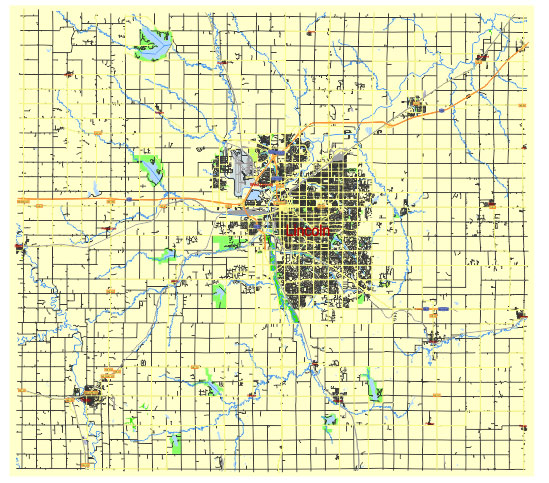
Principal streets and roads, names places, residential streets and roads, road number labels, water objects, land use areas.
Lincoln Nebraska US editable vector map svg free
DOWNLOAD ARCHIVE FOR FREE >>>
Distributed with Creative Commons Attribution 4.0 International License
SEE ALSO FULL VERSION OF THE Lincoln Nebraska US vector map (Adobe Illustrator, PDF etc.)
Lincoln, Nebraska, is structured around several principal streets, roads, and districts that are central to its urban layout. Here are some key ones:
- O Street (O St): This is the primary east-west thoroughfare through Lincoln and is known for its commercial activity, including shopping centers, restaurants, and businesses.
- N Street (N St): Parallel to O Street, N Street also serves as a significant east-west corridor in downtown Lincoln.
- Capitol Parkway: Encircles downtown Lincoln and is a major route for navigating around the core of the city.
- Cornhusker Highway (U.S. Route 6): Runs northeast-southwest and is a major route connecting Lincoln to neighboring communities and Interstate 80.
- 27th Street: Another important north-south corridor through Lincoln, lined with various businesses and residential areas.
- 48th Street: Runs north-south and serves as a boundary between east and west Lincoln, with various shopping centers and residential areas along its route.
- 70th Street: Another north-south corridor that traverses through both residential and commercial areas.
- Downtown Lincoln: The heart of the city, centered around the Capitol building and University of Nebraska-Lincoln campus, with a mix of businesses, government buildings, and cultural venues.
- Haymarket District: Located just west of downtown, known for its historic buildings, restaurants, boutiques, and vibrant atmosphere, especially during events and game days.
- University Place: A neighborhood located north of downtown, adjacent to the University of Nebraska-Lincoln campus, with a mix of residential housing and student amenities.
These streets and districts form the backbone of Lincoln’s urban geography, contributing to its functionality as Nebraska’s state capital and second-most populous city.
 Author: Kirill Shrayber, Ph.D. FRGS