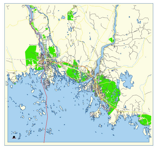
Editable Vector Map of the Kemi and Tornio Finland in SVG format.
Can be edited in the following programs: Adobe Illustrator, CorelDraw, InkScape
Principal streets and roads, names places, residential streets and roads, road number labels, water objects, land use areas.

Kemi and Tornio Finland editable vector map svg free
DOWNLOAD ARCHIVE FOR FREE >>>
Distributed with Creative Commons Attribution 4.0 International License
SEE ALSO FULL VERSION OF THE Kemi and Tornio Finland vector map (Adobe Illustrator, PDF etc.)
Kemi and Tornio are two cities located in the Lapland region of Finland, near the border with Sweden. Here are some principal streets, roads, and city districts in both cities:
Kemi:
Streets and Roads:
- Rantakatu (Waterfront Street)
- Keskuspuisto (Central Park)
- Hallituskatu (Government Street)
- Kirkkopuistikko (Church Park)
- Meripuistokatu (Sea Park Street)
- Keskuskatu (Central Street)
- Kauppakatu (Market Street)
- Satamatie (Harbor Road)
- Valtakatu (Main Street)
- Karhumaantie (Bear Land Road)
City Districts:
- Kemi City Center
- Sauvosaari
- Hermanni
- Karjalahti
- Kivikko
Tornio:
Streets and Roads:
- Hallituskatu (Government Street)
- Kauppakatu (Market Street)
- Rantakatu (Waterfront Street)
- Asemakatu (Station Street)
- Keskuspuisto (Central Park)
- Rajakatu (Border Street)
- Harjuniityntie (Harju Meadow Road)
- Väylänvarsi (Channel Side)
- Torikatu (Market Street)
- Kalkkipellontie (Limestone Field Road)
City Districts:
- Tornio City Center
- Karunki
- Alatornio
- Pudas
- Kyläniemi
These are some of the main streets, roads, and districts in Kemi and Tornio, providing a sense of the layout and structure of these two Finnish cities.

 Author: Kirill Shrayber, Ph.D. FRGS