Editable Vector Map of the Karachi Pakistan in SVG format.
Can be edited in the following programs: Adobe Illustrator, CorelDraw, InkScape
Principal streets and roads, names places, residential streets and roads, road number labels, water objects, land use areas.
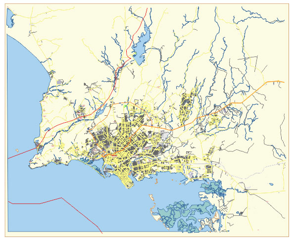
Karachi Pakistan editable vector map svg free
DOWNLOAD ARCHIVE FOR FREE >>>
Distributed with Creative Commons Attribution 4.0 International License
SEE ALSO FULL VERSION OF THE Karachi Pakistan vector map (Adobe Illustrator, PDF etc.)
Karachi, Pakistan’s largest city, is a sprawling metropolis with a complex network of streets, roads, and districts. Here are some of the principal streets, roads, and notable districts in Karachi:
Streets and Roads:
- Shahrah-e-Faisal: A major artery that connects the city center with the Jinnah International Airport and various residential and commercial areas.
- Shahrah-e-Quaideen: Another important road running through central Karachi, connecting various neighborhoods.
- Shahrah-e-Pakistan: One of the longest and busiest roads in Karachi, passing through several residential and commercial areas.
- MA Jinnah Road (formerly Bunder Road): One of the oldest roads in Karachi, running through the heart of the city and lined with markets, businesses, and historical sites.
- Rashid Minhas Road: Connecting various parts of the city, including Gulshan-e-Iqbal and other eastern neighborhoods.
- University Road: Passing through educational institutions and residential areas, this road is a hub of academic activity.
- Korangi Road: Connecting Korangi Industrial Area with other parts of the city, this road is vital for industrial transportation.
- I.I. Chundrigar Road (formerly McLeod Road): Known as the Wall Street of Pakistan, it is the central business district of Karachi, housing numerous banks, financial institutions, and corporate offices.
City Districts:
- Clifton: An upscale residential and commercial area, known for its beachfront, luxury shopping malls, and high-rise apartments.
- Defence Housing Authority (DHA): A planned suburban neighborhood with gated communities, parks, and amenities.
- Gulshan-e-Iqbal: A densely populated residential and commercial area, home to the University of Karachi and various shopping centers.
- Saddar: The historic city center, bustling with markets, shops, and colonial-era buildings.
- North Nazimabad: A residential area known for its parks, schools, and shopping centers.
- Gulistan-e-Johar: A large residential and industrial area, housing several universities and industrial zones.
- Malir: A diverse district with both urban and rural areas, including industrial zones and agricultural land.
- Lyari: One of the oldest neighborhoods in Karachi, known for its vibrant street life, markets, and cultural heritage.
- Karachi South: Encompassing areas like Keamari, Kharadar, and Lyari, it is one of the oldest and most densely populated parts of the city.
- Karachi East: Including areas like Gulshan-e-Iqbal, Gulistan-e-Johar, and Korangi, it is a mix of residential, industrial, and commercial zones.
These are just a few of the many streets, roads, and districts that make up the diverse tapestry of Karachi. The city continues to grow and evolve, with new developments constantly shaping its landscape.
 Author: Kirill Shrayber, Ph.D. FRGS