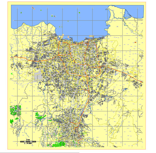
Editable Vector Map of the Jakarta Indonesia in SVG format.
Can be edited in the following programs: Adobe Illustrator, CorelDraw, InkScape
Principal streets and roads, names places, residential streets and roads, road number labels, water objects, land use areas.

Jakarta Indonesia editable vector map svg free
DOWNLOAD ARCHIVE FOR FREE >>>
Distributed with Creative Commons Attribution 4.0 International License
SEE ALSO FULL VERSION OF THE Jakarta Indonesia vector map (Adobe Illustrator, PDF etc.)
Jakarta, the capital city of Indonesia, is a bustling metropolis with a complex network of streets, roads, and districts. Here are some of the principal streets, roads, and city districts in Jakarta:
- Jalan Thamrin: One of the main thoroughfares in Jakarta, running through the heart of the city. It’s lined with skyscrapers, malls, and hotels.
- Jalan Sudirman: Another major road in Jakarta, parallel to Jalan Thamrin, known for its business districts and high-rise buildings.
- Jalan MH Thamrin: Named after Indonesia’s first president, Sukarno, this avenue is a central hub for shopping, dining, and entertainment.
- Jalan Gatot Subroto: A significant arterial road in Jakarta, connecting the southern and northern parts of the city. It’s also home to many office buildings and businesses.
- Jalan Rasuna Said: Located in the Kuningan area, this street is known for its commercial and diplomatic centers, as well as upscale residential areas.
- Jalan Fatmawati: Connecting South Jakarta to other parts of the city, this road is named after Fatmawati, the first wife of Indonesia’s first president.
- Jalan Pangeran Antasari: Running through South Jakarta, this road is named after Pangeran Antasari, a national hero, and is known for its residential and commercial areas.
- Jalan HR Rasuna Said: Another major road in Jakarta’s business district, known for its office towers, shopping malls, and apartments.
- Jalan Prof. Dr. Satrio: Located in the Kuningan area, this street is known for its office buildings, luxury hotels, and dining establishments.
- Jalan Sudirman-Thamrin Boulevard: This boulevard connects Jalan Sudirman and Jalan Thamrin, serving as a major artery for traffic flow through central Jakarta.
As for districts:
- Central Jakarta (Jakarta Pusat): This district encompasses the central business district and many government offices.
- South Jakarta (Jakarta Selatan): Known for its upscale residential areas, shopping centers, and entertainment venues.
- West Jakarta (Jakarta Barat): Home to many industrial areas and middle-class neighborhoods.
- East Jakarta (Jakarta Timur): Characterized by a mix of residential and industrial areas, as well as some recreational spots.
- North Jakarta (Jakarta Utara): Contains the city’s main port, Tanjung Priok, and is known for its coastal areas and diverse communities.
- Thousand Islands (Kepulauan Seribu): A district comprising a chain of islands in the Java Sea, popular for tourism and recreation.
These are just a few of the principal streets, roads, and districts in Jakarta, which together form the bustling and diverse capital city of Indonesia.

 Author: Kirill Shrayber, Ph.D. FRGS