Editable Vector Map of the Hawaii US in SVG format.
Can be edited in the following programs: Adobe Illustrator, CorelDraw, InkScape
Principal streets and roads, names places, residential streets and roads, road number labels, water objects, land use areas.
Hawaii US editable vector map svg free
DOWNLOAD ARCHIVE FOR FREE >>>
Distributed with Creative Commons Attribution 4.0 International License
SEE ALSO FULL VERSION OF THE Hawaii US vector map (Adobe Illustrator, PDF etc.)
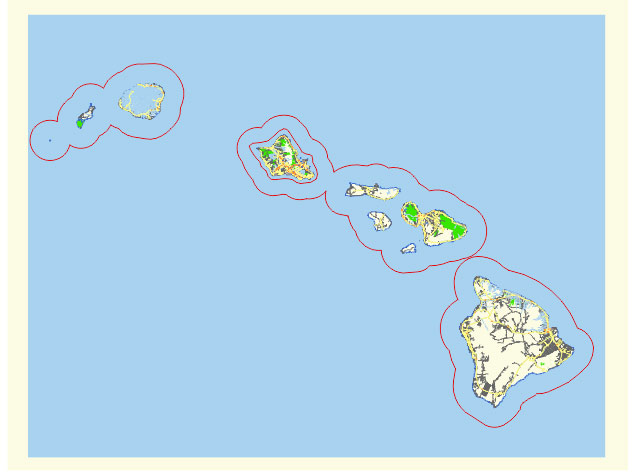
Hawaii is a unique U.S. state consisting of an archipelago of islands in the central Pacific Ocean. Here are the principal islands, cities, towns, and roads in Hawaii:
Principal Islands
- Hawai’i (Big Island):
- The largest island, home to diverse climates and the active volcano, Kilauea.
- Maui:
- Known for its stunning beaches, the scenic Hana Highway, and Haleakalā National Park.
- O’ahu:
- The most populous island, home to the state capital, Honolulu, and famous Waikiki Beach.
- Kaua’i:
- Known as the “Garden Isle” for its lush landscapes and dramatic cliffs of the Na Pali Coast.
- Moloka’i:
- Known for its preserved Hawaiian culture and the Kalaupapa National Historical Park.
- Lana’i:
- Known for its luxury resorts and the Pineapple Island nickname due to its plantation history.
- Ni’ihau:
- A privately owned island with limited access, known for its traditional Hawaiian culture.
- Kaho’olawe:
- An uninhabited island used as a military training ground, now undergoing restoration efforts.
Principal Cities and Towns
- Honolulu (O’ahu):
- The state capital and largest city, serving as the cultural and economic hub of Hawaii.
- Hilo (Big Island):
- The largest town on the Big Island, known for its rainforests, waterfalls, and proximity to Volcanoes National Park.
- Kailua-Kona (Big Island):
- A major tourist destination on the Big Island, known for its sunny weather and historical sites.
- Kahului (Maui):
- The commercial and transportation center of Maui, home to the island’s main airport.
- Lahaina (Maui):
- A historic town on Maui, once the capital of the Hawaiian Kingdom and now a popular tourist destination.
- Kihei (Maui):
- Known for its beaches, Kihei is a growing town with numerous resorts and condominiums.
- Lihue (Kaua’i):
- The county seat of Kaua’i, serving as the island’s commercial and transportation center.
- Princeville (Kaua’i):
- A resort community on Kaua’i’s north shore, known for its luxury accommodations and golf courses.
- Kaunakakai (Moloka’i):
- The largest town on Moloka’i, known for its small-town charm and historical sites.
- Lanai City (Lana’i):
- The main town on Lana’i, with a plantation-era feel and a base for exploring the island.
Principal Roads
- H-1 (O’ahu):
- The longest and most significant freeway in Hawaii, running east-west through Honolulu.
- H-2 (O’ahu):
- Connects H-1 to the central part of O’ahu, terminating near Wahiawa.
- H-3 (O’ahu):
- A scenic highway connecting the windward side of O’ahu with the leeward side, passing through the Ko’olau Range.
- Hana Highway (Maui):
- A scenic, winding road leading to the town of Hana, famous for its lush landscapes and waterfalls.
- Pi’ilani Highway (Maui):
- Runs along the south coast of Maui, connecting Kihei and Wailea with the rest of the island.
- Queen Ka’ahumanu Highway (Big Island):
- A major north-south route on the Big Island, running along the west coast through Kailua-Kona.
- Mamalahoa Highway (Big Island):
- Also known as Hawaii Belt Road, encircles much of the Big Island, connecting Hilo and Kailua-Kona.
- Kaumuali’i Highway (Kaua’i):
- The main highway on the west side of Kaua’i, connecting Lihue with Waimea.
- Kuhio Highway (Kaua’i):
- Runs along the east and north shores of Kaua’i, connecting Lihue with Hanalei.
These islands, cities, towns, and roads are integral to the geography and culture of Hawaii, providing insight into the state’s diverse landscapes and communities.
 Author: Kirill Shrayber, Ph.D. FRGS