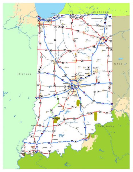
Free vector map State Indiana US Adobe Illustrator and PDF download
Free vector map State Indiana US Adobe Illustrator download now >>>
Free vector map State Indiana US Adobe PDF download now >>>
Indiana See also: Full version high detailed vector maps of the State territory, and Cities
US State
Indiana is a Midwestern U.S. state known for its farmland and renowned auto race, the Indianapolis 500, held at the Indianapolis Motor Speedway. In the capital, Indianapolis, theaters, and galleries line Massachusetts Avenue. The city’s Downtown is home to the iconic Soldiers and Sailors Monument, the Canal Walk promenade and the Indianapolis Museum of Art and its wide-ranging collections.
Capital: Indianapolis
Abbreviation: IN
Zones: Eastern Time Zone (80 counties), Central Time Zone (12 counties)
 Author: Kirill Shrayber, Ph.D. FRGS