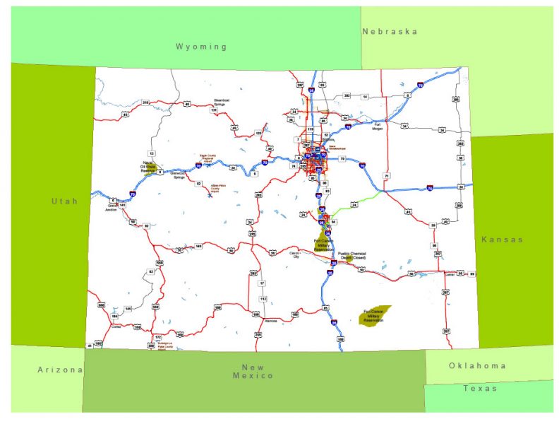
Free vector map State Colorado US Adobe Illustrator and PDF download free
Free vector map State Colorado US Adobe Illustrator download now >>>
Free vector map State Colorado US Adobe PDF download now >>>
Colorado See also: Full version high detailed vector maps of the State territory, and Cities
US State
Colorado, a western U.S. state, has a diverse landscape of arid desert, river canyons and the snow-covered Rocky Mountains, which are partly protected by Rocky Mountain National Park. Elsewhere, Mesa Verde National Park features Ancestral Puebloan cliff dwellings. Perched a mile above sea level, Denver, Colorado’s capital and largest city, features a vibrant downtown area.
Capital: Denver
Abbreviation: CO
See also: Full Version Vector Map Colorado
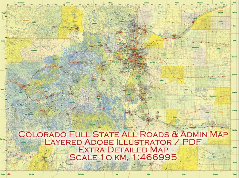
Printable Vector Map Full State of Colorado US, ALL ROADS, extra detailed, exact vector Map 10 km scale full editable, Adobe Illustrator, full vector, scalable, editable text format names, 174 MB ZIP
 Author: Kirill Shrayber, Ph.D. FRGS