Editable Vector Map of the Dresden Germany in SVG format.
Can be edited in the following programs: Adobe Illustrator, CorelDraw, InkScape
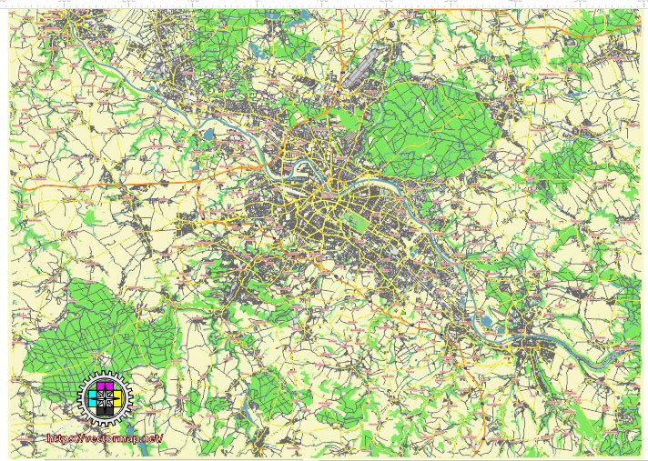
Principal streets and roads, names places, residential streets and roads, road number labels, water objects, land use areas.
Dresden Germany editable vector map svg free
DOWNLOAD ARCHIVE FOR FREE >>>
Distributed with Creative Commons Attribution 4.0 International License
SEE ALSO FULL VERSION OF THE Dresden Germany vector map (Adobe Illustrator, PDF etc.)
Dresden, the capital city of the German state of Saxony, is rich in history and culture. Here’s an overview of its principal streets, roads, and city districts:
Principal Streets and Roads
- Prager Straße: One of the main shopping streets, located in the city center.
- Königsbrücker Straße: A major thoroughfare that runs through the Neustadt district.
- Bautzner Straße: Another important road that connects the city center with the eastern districts.
- Großenhainer Straße: This road runs from the city center towards the northwest.
- Leipziger Straße: A key road that heads north from the city center.
- Wiener Straße: Located near the main railway station, this road connects to the southeastern parts of the city.
- Strehlener Straße: This street is important for connecting the southern districts to the city center.
- Friedrichstraße: A significant street running parallel to the Elbe River in the city center.
- Terrassenufer: This street runs along the Elbe River, offering scenic views and access to many historic sites.
City Districts
- Altstadt (Old Town): The historic heart of Dresden, home to many of its famous landmarks, including the Frauenkirche, Zwinger Palace, and Semper Opera House.
- Neustadt (New Town): Known for its vibrant cultural scene, nightlife, and artistic atmosphere. Key areas within Neustadt include the Äußere Neustadt (Outer Neustadt) and Innere Neustadt (Inner Neustadt).
- Blasewitz: A residential district known for its beautiful villas and proximity to the Elbe River.
- Loschwitz: Famous for the Blaues Wunder (Blue Wonder) bridge and the scenic hillside neighborhoods.
- Striesen: A quiet, residential area with many parks and green spaces.
- Leuben: A southeastern district with a mix of residential and industrial areas.
- Plauen: Located southwest of the city center, this district is known for its residential neighborhoods and historical buildings.
- Pieschen: A district in the northern part of Dresden, known for its industrial heritage and modern developments.
- Cotta: Situated to the west, Cotta is primarily a residential area with historical significance.
- Prohlis: Located in the southeastern part of the city, Prohlis is known for its large housing estates and residential areas.
Notable Landmarks
- Frauenkirche: A reconstructed Lutheran church in the Altstadt.
- Zwinger Palace: A baroque palace with museums and gardens.
- Semper Opera House: An opera house with significant historical and architectural value.
- Dresden Castle: A former royal residence, now home to several museums.
- Brühl’s Terrace: Also known as the “Balcony of Europe,” offering views of the Elbe River and the historic city center.
Dresden’s combination of historical architecture, modern infrastructure, and vibrant cultural scene makes it a unique and attractive city in Germany.
 Author: Kirill Shrayber, Ph.D. FRGS