Editable Vector Map of the Columbus Ohio US in SVG format.
Can be edited in the following programs: Adobe Illustrator, CorelDraw, InkScape
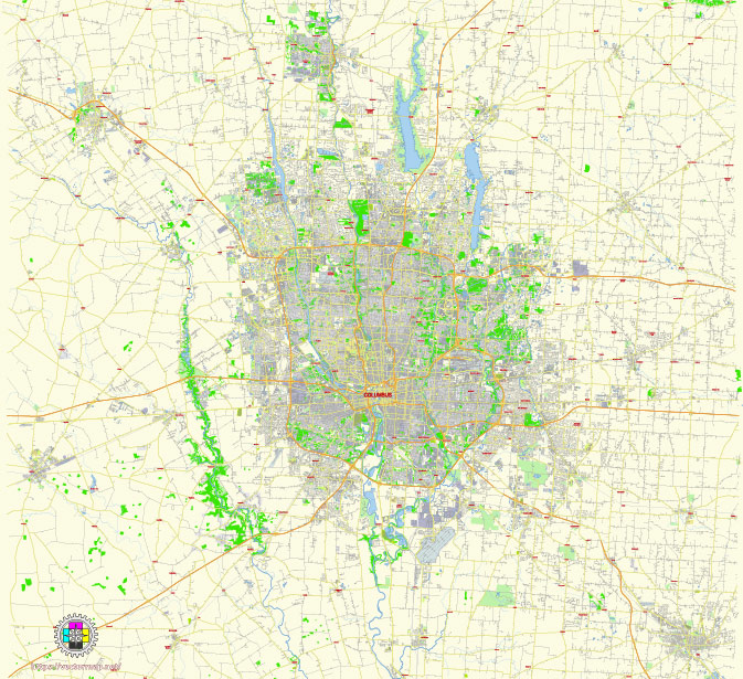
Principal streets and roads, names places, residential streets and roads, road number labels, water objects, land use areas.
Columbus Ohio US editable vector map svg free
DOWNLOAD ARCHIVE FOR FREE >>>
Distributed with Creative Commons Attribution 4.0 International License
SEE ALSO FULL VERSION OF THE Columbus Ohio US vector map (Adobe Illustrator, PDF etc.)
Columbus, Ohio is a vibrant city with several principal streets, roads, and districts. Here are some of the notable ones:
- High Street: High Street is one of the main thoroughfares in Columbus. It runs north-south through the city and is lined with shops, restaurants, and bars. It passes through several important neighborhoods and districts, including the Short North Arts District and the University District.
- Broad Street: Broad Street is another major east-west artery in Columbus. It runs through downtown and extends eastward towards the suburbs. It passes through areas such as the Discovery District and Franklin Park.
- Interstate 71 (I-71): This interstate highway runs north-south through Columbus, connecting it to Cleveland to the north and Cincinnati to the south. It serves as a vital transportation route for both commuters and travelers passing through the city.
- Interstate 70 (I-70): I-70 is an east-west interstate that passes through the southern part of Columbus. It connects the city to Indianapolis in the west and Pittsburgh in the east.
- German Village: German Village is a historic neighborhood located just south of downtown Columbus. It is known for its charming brick streets, 19th-century architecture, and quaint shops and restaurants.
- Short North Arts District: The Short North is a vibrant neighborhood located just north of downtown Columbus along High Street. It is known for its galleries, boutiques, and trendy dining options.
- Arena District: The Arena District is a mixed-use neighborhood located northwest of downtown. It is home to Nationwide Arena, where the Columbus Blue Jackets NHL team plays, as well as restaurants, bars, and entertainment venues.
- University District: The University District is located near The Ohio State University campus and is home to many students, faculty, and staff. It is a lively area with a variety of shops, restaurants, and nightlife options catering to the university community.
These are just a few of the principal streets, roads, and districts in Columbus, Ohio. The city is large and diverse, with many other neighborhoods and attractions to explore.
 Author: Kirill Shrayber, Ph.D. FRGS