Editable Vector Map of the Cleveland Ohio US in SVG format.
Can be edited in the following programs: Adobe Illustrator, CorelDraw, InkScape
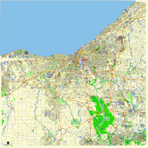
Principal streets and roads, names places, residential streets and roads, road number labels, water objects, land use areas.
Cleveland Ohio US editable vector map svg free
DOWNLOAD ARCHIVE FOR FREE >>>
Distributed with Creative Commons Attribution 4.0 International License
SEE ALSO FULL VERSION OF THE Cleveland Ohio US vector map (Adobe Illustrator, PDF etc.)
Cleveland, Ohio, has a well-established network of streets, roads, and districts. Here are some of the principal ones:
Streets:
- Euclid Avenue: One of the main thoroughfares, known for its historical significance and diverse neighborhoods.
- Chester Avenue: Runs east-west through downtown and several neighborhoods.
- Carnegie Avenue: Another important east-west route, connecting downtown with the University Circle area.
- Superior Avenue: Major east-west street running through downtown.
- Detroit Avenue: Runs west from downtown, passing through the Ohio City neighborhood.
- Lorain Avenue: Major route running west from downtown.
- St. Clair Avenue: East-west route that passes through various neighborhoods.
- Broadway Avenue: Major thoroughfare on the east side of Cleveland.
Roads:
- Interstate 90 (I-90): Runs east-west through Cleveland, connecting it with other major cities like Chicago and Buffalo.
- Interstate 71 (I-71): Runs south-north through the western part of the city.
- Interstate 77 (I-77): Runs south-north through the eastern part of the city.
- Interstate 480 (I-480): Forms a partial beltway around the southern and eastern suburbs of Cleveland.
- US Route 20 (US-20): Major east-west route that passes through Cleveland.
- US Route 422 (US-422): East-west route that passes through the eastern suburbs of Cleveland.
City Districts:
- Downtown Cleveland: The central business district, home to many offices, shops, restaurants, and cultural attractions.
- Ohio City: Historic neighborhood just west of downtown, known for its breweries, restaurants, and the West Side Market.
- University Circle: Cultural, educational, and medical district, home to Case Western Reserve University, the Cleveland Clinic, and several museums.
- Tremont: Hip and historic neighborhood known for its Victorian architecture, trendy restaurants, and art galleries.
- The Flats: Entertainment district located along the Cuyahoga River, known for its bars, restaurants, and nightlife.
- Little Italy: Charming neighborhood known for its Italian culture, restaurants, and annual festivals.
- Shaker Square: Historic commercial district located at the intersection of Shaker Boulevard and Moreland Boulevard, known for its shops and restaurants.
- Collinwood: Residential neighborhood located on the northeast side of Cleveland, with a diverse community and strong arts scene.
These are just some of the principal streets, roads, and districts in Cleveland. The city has many more neighborhoods and thoroughfares that contribute to its vibrant character.
 Author: Kirill Shrayber, Ph.D. FRGS