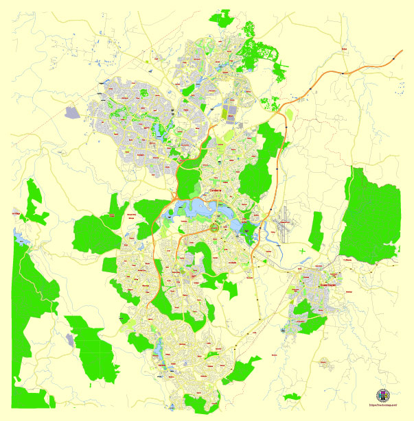
Editable Vector Map of the Canberra Australia in SVG format.
Can be edited in the following programs: Adobe Illustrator, CorelDraw, InkScape
Principal streets and roads, names places, residential streets and roads, road number labels, water objects, land use areas.

Canberra Australia editable vector map svg free
DOWNLOAD ARCHIVE FOR FREE >>>
Distributed with Creative Commons Attribution 4.0 International License
SEE ALSO FULL VERSION OF THE Canberra Australia vector map (Adobe Illustrator, PDF etc.)
Canberra, the capital city of Australia, has several principal streets, roads, and districts that are key to its layout and navigation. Here’s an overview:
Principal Streets and Roads
- Northbourne Avenue: This is one of the main thoroughfares in Canberra, running from the northern suburbs through the city center to the Parliamentary Triangle. It is a major route for buses and light rail.
- Commonwealth Avenue: This avenue connects the city center to the Parliamentary Triangle and crosses Lake Burley Griffin via the Commonwealth Avenue Bridge.
- Kings Avenue: Running parallel to Commonwealth Avenue, Kings Avenue also connects the city center to the Parliamentary Triangle and crosses Lake Burley Griffin via the Kings Avenue Bridge.
- Constitution Avenue: This road links Commonwealth Avenue and Kings Avenue, forming part of the Parliamentary Triangle and running alongside Lake Burley Griffin.
- London Circuit: A loop road in the city center, it encircles the Canberra City Centre and connects with major avenues.
- Parkes Way: A major expressway that runs east-west through the city, connecting Russell and Barton with the city center and the suburbs to the west.
- Monaro Highway: This highway runs from the south of Canberra through the industrial suburb of Fyshwick and connects with the city’s southeastern suburbs.
- Majura Parkway: A major road that connects the northern and eastern parts of Canberra, providing a bypass for traffic around the city center.
City Districts
- City (Civic): The central business district of Canberra, often referred to as Civic. It contains major shopping areas, offices, and entertainment venues.
- Braddon: Located just north of Civic, known for its cafes, restaurants, boutiques, and nightlife.
- Kingston: One of Canberra’s oldest suburbs, known for its vibrant food and shopping scene, particularly around the Kingston Foreshore.
- Manuka: An upscale shopping and dining precinct in the suburb of Griffith, adjacent to Kingston.
- Parliamentary Triangle: A district that contains many of Canberra’s national institutions, including the Australian Parliament House, the National Library, and the High Court.
- Barton: A suburb within the Parliamentary Triangle, home to many government departments and the historic Hotel Kurrajong.
- Belconnen: A major district in the north-west of Canberra, housing many residential suburbs, a large shopping mall, and the University of Canberra.
- Gungahlin: One of the fastest-growing districts in Canberra, located in the north, with extensive new housing developments and shopping centers.
- Woden Valley: A district to the south of the city center, with a major town center, government offices, and residential suburbs.
- Tuggeranong: A district further south of Woden Valley, with extensive residential areas and a town center.
- Weston Creek: Located to the west of Woden Valley, comprising several residential suburbs and the Cooleman Court shopping center.
- Molonglo Valley: A newer district located between Weston Creek and Belconnen, with rapidly developing residential areas.
These streets, roads, and districts form the essential framework of Canberra, making it a well-organized and navigable city.

 Author: Kirill Shrayber, Ph.D. FRGS