Editable Vector Map of the Burlington Vermont US in SVG format.
Can be edited in the following programs: Adobe Illustrator, CorelDraw, InkScape
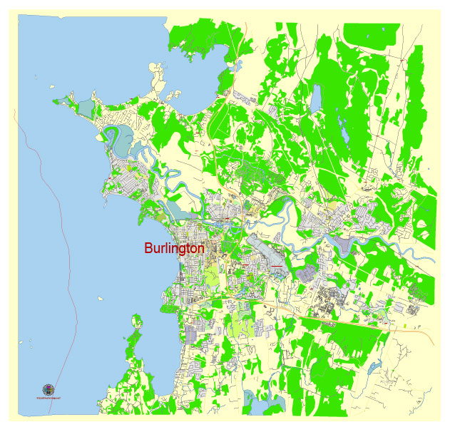
Principal streets and roads, names places, residential streets and roads, road number labels, water objects, land use areas.
Burlington Vermont US editable vector map svg free
DOWNLOAD ARCHIVE FOR FREE >>>
Distributed with Creative Commons Attribution 4.0 International License
SEE ALSO FULL VERSION OF THE Burlington Vermont US vector map (Adobe Illustrator, PDF etc.)
Burlington, Vermont, is a vibrant city known for its picturesque setting on the shores of Lake Champlain and its lively downtown area. Here is an overview of some of the principal streets, roads, and districts in Burlington:
Principal Streets and Roads
- Church Street
- This is the heart of downtown Burlington and is famous for the Church Street Marketplace, a pedestrian mall with shops, restaurants, and various events.
- Main Street
- Running east to west, Main Street is a major thoroughfare that connects the University of Vermont campus to the waterfront and downtown area.
- College Street
- Parallel to Main Street, College Street also runs east to west, linking the university area with downtown and the waterfront.
- Pine Street
- This street runs north to south through the South End, known for its arts district and numerous breweries and businesses.
- North Avenue
- Extending northward from the downtown area, North Avenue leads to the New North End, a largely residential area with parks and waterfront access.
- Shelburne Road (U.S. Route 7)
- A major north-south route that connects Burlington to the southern suburbs and beyond, Shelburne Road is lined with shops, restaurants, and commercial businesses.
City Districts
- Downtown
- The central business district with a mix of retail, dining, offices, and cultural institutions. Church Street Marketplace is a highlight here.
- Old North End
- A historic and diverse neighborhood north of downtown, known for its community atmosphere, ethnic eateries, and the vibrant North Street.
- South End
- An artsy and industrial area south of downtown, home to many galleries, studios, and the popular Pine Street corridor.
- Hill Section
- A residential area east of downtown, characterized by its stately homes, tree-lined streets, and proximity to the University of Vermont and Champlain College.
- New North End
- A primarily residential district north of downtown, featuring parks, schools, and waterfront access points like North Beach and Leddy Park.
- East Avenue District
- This area includes the University of Vermont, Fletcher Allen Health Care, and numerous student and faculty residences.
- Intervale
- A unique agricultural area near the Winooski River, featuring community gardens, farms, and natural landscapes.
Burlington’s layout, combining vibrant urban life with scenic natural beauty, makes it a unique and appealing place to live and visit.
 Author: Kirill Shrayber, Ph.D. FRGS