Editable Vector Map of the Bismarck North Dakota US in SVG format.
Can be edited in the following programs: Adobe Illustrator, CorelDraw, InkScape
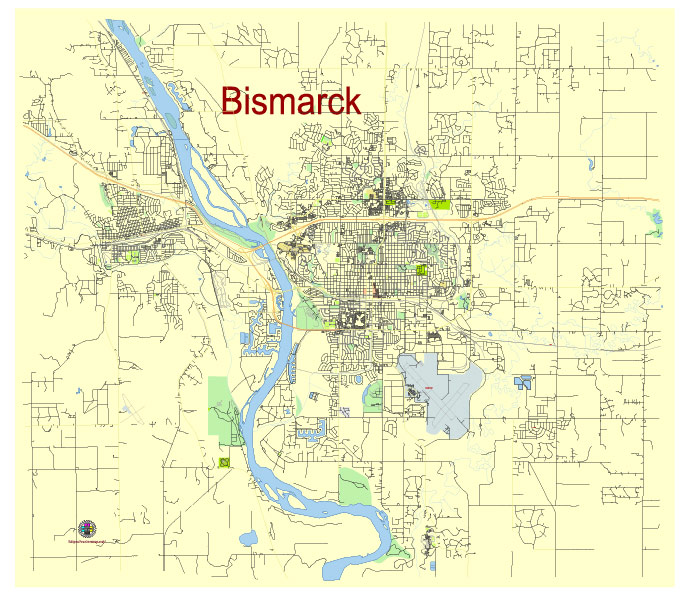
Principal streets and roads, names places, residential streets and roads, road number labels, water objects, land use areas.
Bismarck North Dakota US editable vector map svg free
DOWNLOAD ARCHIVE FOR FREE >>>
Distributed with Creative Commons Attribution 4.0 International License
SEE ALSO FULL VERSION OF THE Bismarck North Dakota US vector map (Adobe Illustrator, PDF etc.)
Bismarck, the capital city of North Dakota, has several principal streets, roads, and distinct city districts that contribute to its layout and character. Here are some key ones:
Principal Streets and Roads:
- Main Avenue: A major east-west thoroughfare running through downtown Bismarck, featuring many businesses, restaurants, and cultural landmarks.
- State Street (US 83): One of the main north-south routes in Bismarck, providing access to various commercial areas and connecting to residential neighborhoods.
- Boulevard Avenue: Another significant east-west street, intersecting with important north-south routes and providing access to several city parks and residential areas.
- Washington Street: A key north-south street that passes through both residential and commercial areas, intersecting with important east-west streets.
- Expressway Avenue: Serving as a major arterial road, it runs in the southern part of the city, providing connections to Interstate 94 and other main routes.
- Interstate 94 (I-94): A major interstate highway running east-west through the southern part of Bismarck, facilitating regional travel.
City Districts:
- Downtown Bismarck: The heart of the city, hosting government buildings, businesses, cultural institutions, restaurants, and historic sites. Key attractions include the North Dakota State Capitol, the Belle Mehus Auditorium, and numerous shops and cafes.
- North Bismarck: A rapidly growing area with extensive residential development, shopping centers, and recreational facilities. This district includes parts of State Street and Century Avenue.
- South Bismarck: Primarily residential, this area also features some commercial zones and parks. The Bismarck Airport is located here, adding to the district’s importance.
- Mandan: While a separate city, Mandan is closely linked to Bismarck, forming the Bismarck-Mandan metropolitan area. It lies directly across the Missouri River to the west and shares economic and social ties with Bismarck.
- University of Mary Area: Located in the southern part of Bismarck, this district is centered around the University of Mary, a significant educational institution. It includes campus facilities, student housing, and related amenities.
- Lincoln: A small city adjacent to Bismarck, often considered part of the greater Bismarck area. It primarily features residential neighborhoods and is known for its family-friendly environment.
These streets, roads, and districts form the backbone of Bismarck, facilitating its role as a central hub in North Dakota for governance, commerce, education, and culture.
 Author: Kirill Shrayber, Ph.D. FRGS