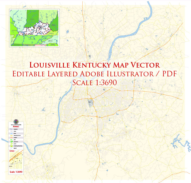
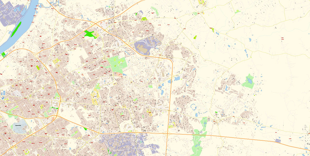
Urban plan Louisville Kentucky 3 10 PDF Vector City Maps
Gallery of Images "Urban plan Louisville Kentucky 3 10 PDF":
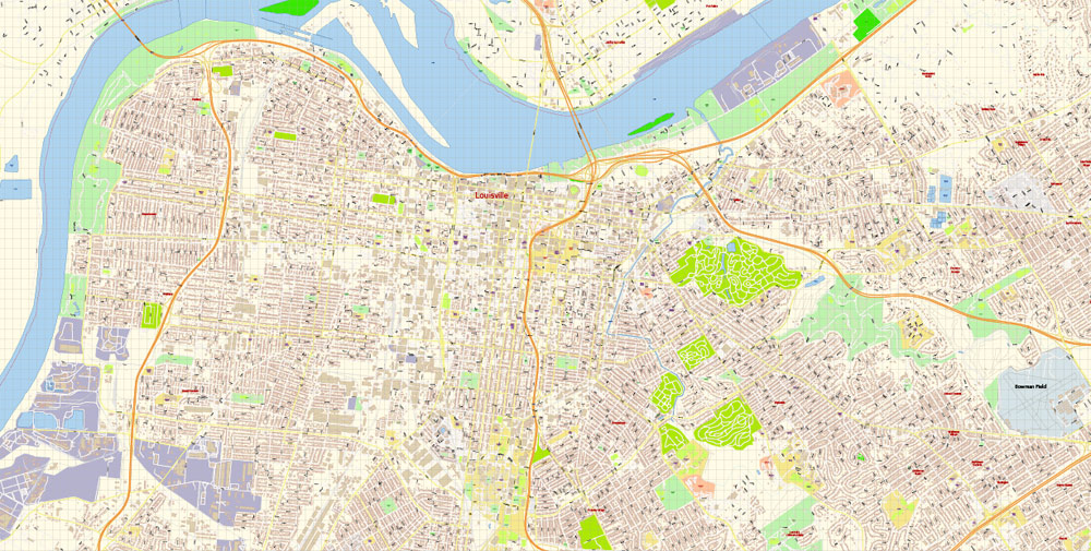
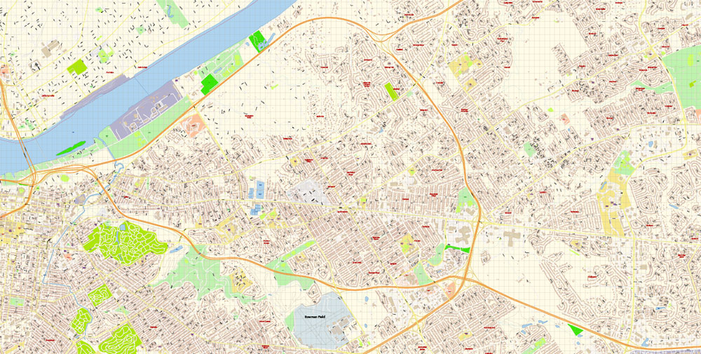
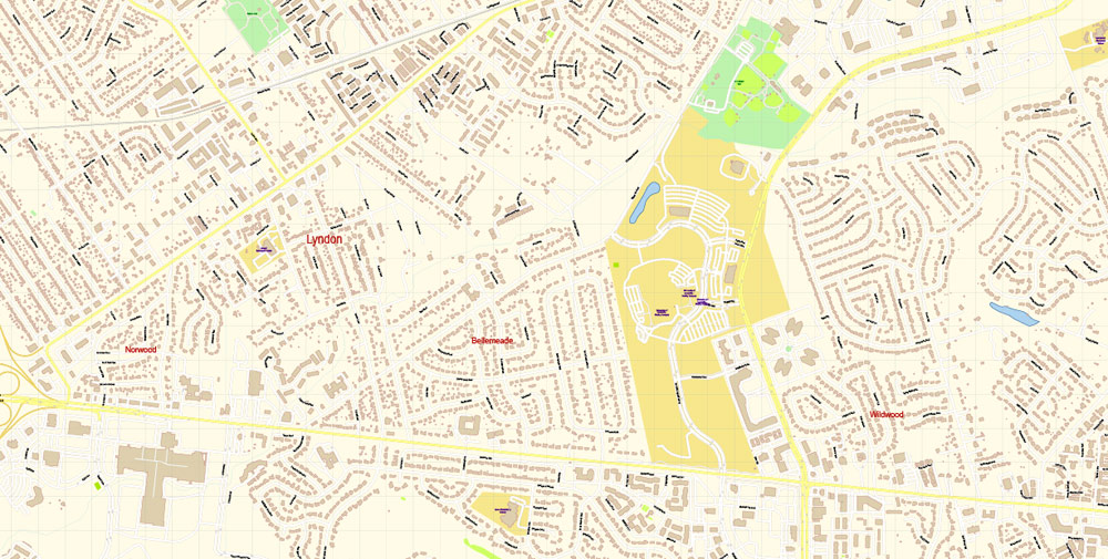
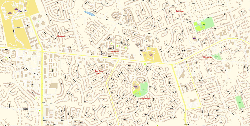
Urban plan Louisville Kentucky 3 10 PDF: City Maps in vector formats - AutoCAD DWG DXF, Illustrator, and others
Louisville is the largest city in Kentucky. The population of Louisville in 2021 was estimated at 772 thousand people. If we do not take into account settlements that have a semi-autonomous status, then the urban population is 627 thousand people. In total, more than 1.4 million people live in the urban agglomeration, the center of which is Louisville (in Kentucky and Indiana). Until 2003, when additional territories were included in Louisville (the area increased 6 times), the population within the city limits was estimated at only 245 thousand inhabitants.
Due to its geographical location, Louisville is considered the northernmost of the cities in the South of the United States. The city was influenced by both the culture of the southern states and the culture of the Midwest.
It is worth noting that there are several pronunciation variants of the name of the city: Luvel, Luivel, Lavel. However, the letter "c" is not pronounced in any of them.
The settlement, which eventually turned into Louisville, was founded in 1778 during the Revolutionary War. The founder of the city is Colonel George Rogers Clark, who conducted a military campaign against British troops north of the Ohio River. The city was named after King Louis XVI of France, whose soldiers assisted the Americans in the War of Independence.
The development of Louisville is largely due to the existence of a number of river rapids, nicknamed "waterfalls" (Falls of Ohio). The rapids were a serious obstacle to navigation, so the help of people who knew the area, who could ensure safe navigation on a 3-km segment, was needed. In many cases, the unloading of ships was required, which was provided by the forces of local colonies.
In the initial period of development, Louisville's economy was based on river navigation. Louisville has become an important link between the industrialized cities in the north of the country and the south. Today Louisville continues to be an important transportation hub. In addition to river transport, air and rail transport are developed. There are 2 large Ford automobile plants operating in the region. A third of all Bourbon whiskey is produced in Louisville. In the general structure of the workforce, 3/4 of the townspeople are blue-collar workers (working class), 1/4 are white-collar workers.
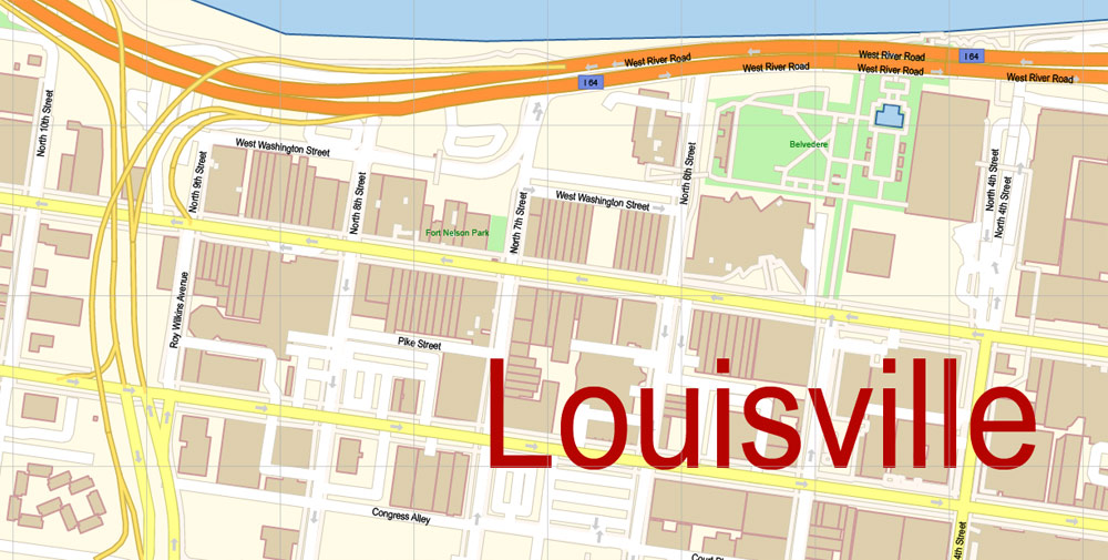
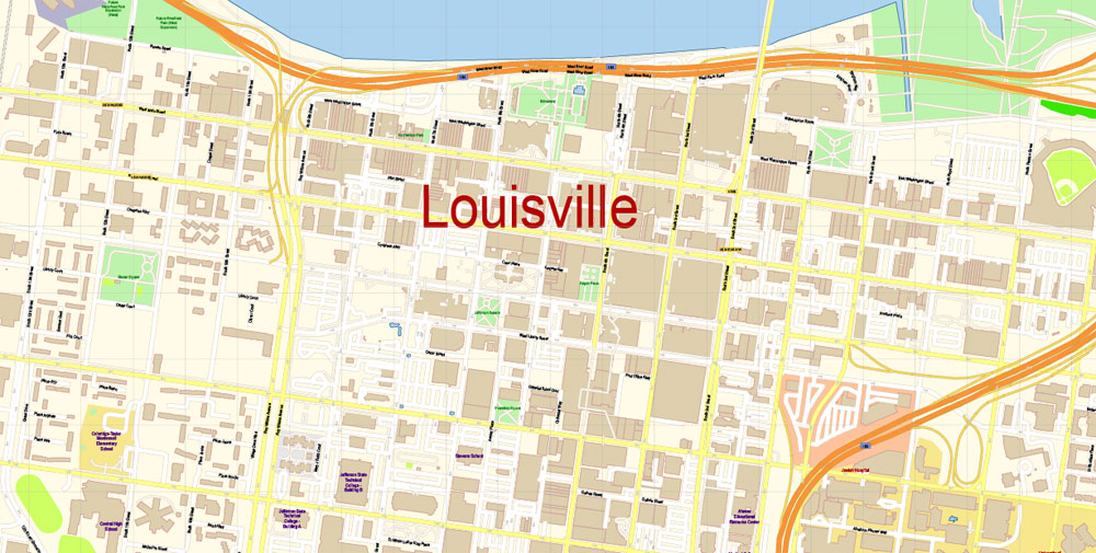
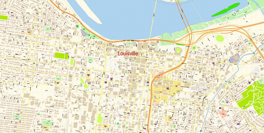
Downtown Louisville is located on the south bank of the Ohio River near the river rapids. On the north bank of the river in the territory of Indiana is the city of Jeffersonville (Jeffersonville). Residential areas of Louisville are spread to the southwest, south and east of downtown. Conventionally, the city is divided into 3 parts: West End, South End and East End. Historically, the West End is an African-American neighborhood, the South End is white. The East End is the most prestigious area where the middle and affluent class lives. As expected, the West End is the area with the lowest per capita income and the highest crime rate. Louisville Airport is located about 10 km south of downtown. Further south, as well as to the west of the airport, are industrial areas. Louisville's urbanized core is comparatively large for a city of this size.
The racial makeup of Louisville in 2021:
Whites - 68.3%
African Americans - 22.9%
Asians - 2.2%
Mixed races - 2.3%
Indians - 0.3%
Latinos of any race make up 4.5% of the population.
Socio-economic indicators:
the average income per person (as of 2021) is $27,274
population living below the poverty line (as of 2021) - 21.6%
unemployment in the region (as of March 2021) - 9.2%
cost of living index (as of March 2021) - 89.5 (10% lower than the US average).
The official name of the state is the Commonwealth of Kentucky
State region — Southeastern Central States, Southern USA
The area of the state is 104,659 km2 (including land - 102,896 km2 and water surface - 1,763 km2), the 37th place among the US states
The length of the state:
from north to south — 225 km
from west to east - 611 km
The elevation of the state relief above sea level:
maximum — 1,263 m
minimum - 78 m
The state's time zone is the Eastern time zone of the United States (about 60% of the state's territory) and the Central Time Zone of the United States (western counties)
The founding date of the state is June 1, 1792 (the 15th state in the United States)
The state capital is Frankfort
The largest city in the state is Louisville
The state's population is about 4,510,000 people (26th among US states)
The population density in the state is about 42.5 people/km2 (21st place among US states)
The average household income in the state is about $52,295 (44th among US states)
The state motto is United we stand, divided we fall ("United we will stand, divided we will fall") and Deo gratiam habeamus ("Let us be grateful to God")
The state nicknames are "Bluegrass State"
The abbreviation of the state is KY
The state of Kentucky is located in the Southern United States and belongs to the southeastern central states. Kentucky is bordered by the states of Illinois to the northwest, Indiana and Ohio to the north, West Virginia to the east, Virginia to the southeast, Tennessee to the south, and Missouri to the west.
Kentucky is located on the territory of two physical and geographical regions of the United States. The eastern counties of the "Bluegrass State— are the Cumberland Plateau, cut by gorges and ravines, part of the Appalachian mountain system. To the west is the Bluegrass region — hilly plains overgrown with steppe grasses (including meadow bluegrass, in English — bluegrass, hence the name of the region). Bluegrass, as well as western Kentucky counties, belong to the Inland Plains of the USA. South of the Bluegrass steppes and west of the Cumberland Plateau stretches the Mississippi Plateau (also known as "Pennyroyal" or "Mint Plateau"), it is here that the world's longest Mammoth Cave is located. In the northwest of the state, there are "Western coal fields", rich in coal deposits. The westernmost part of Kentucky, known as the "Jackson Purchase", is an alluvial lowland stretching along the Mississippi River.
Most of Kentucky is characterized by a humid subtropical climate with well-defined seasons: mild, cool winters and hot, humid summers. At the same time, weather conditions depend on the region: in the northern districts, the temperature is usually several degrees lower than in the western ones. In the mountains in the east of the state, the climate is colder (continental).
Obviously, the first Europeans to visit the lands of the modern state of Kentucky were the Frenchmen Jacques Marquette and Louis Joliet, who traveled along the Mississippi River in 1673. In 1681-1682, another Frenchman, the famous Rene de La Salle, descended the Mississippi from the Great Lakes to the Gulf of Mexico. For the English colonists who lived on the east coast, the lands located to the west of the Appalachians were inaccessible and of little interest, so at the end of the XVII-beginning of the XVIII century, only isolated attempts were made to establish trade with the Indians who lived in the region.
The origin of the name of the state of Kentucky is not known for certain, it is only certain that it was borrowed from the native inhabitants of America. Possible variants of the meaning of this word in the languages of different Indian peoples: "land of tomorrow", "at the source of the river" or "land of meadows".

The first organized expedition, the purpose of which was to explore the territory beyond the Appalachians, was sent from the colony of Virginia under the leadership of Thomas Walker in 1750. In 1751-1752, the Ohio River Valley was studied by the famous pioneer Christopher Gist. After the end of the French-Indian War of 1754-1763, the French ceased to claim the region and the exploration of the Kentucky lands continued. In 1774, the first European settlement in Kentucky was founded — Harrodstown (the modern city of Harrodsburg).
In the following decades, the number of settlers from Virginia, North Carolina and Pennsylvania to the undeveloped lands of Kentucky grew steadily. One of the most famous Kentucky pioneers of this period was Daniel Boone, who became a legend of American folklore. In 1775, Richard Henderson, a lawyer and entrepreneur from North Carolina, tried to establish a new colony in Kentucky (and neighboring ), "Transylvania". He appealed to the Continental Congress, trying to give the colony official status, but his request was rejected. In the summer of 1776, the Virginia General Assembly (namely, the colony of Virginia at that time formally controlled the territory of Kentucky) banned Transylvania from further attempts at self-organization. In December of the same year, 1776, the district of Kentucky was created as part of Virginia.
The remoteness from the central authorities of Virginia, the unwillingness of its legislators to allow Kentuckians to trade with the Spaniards in the Louisiana colony, the need for self-organization and rapid response to successfully resist Indian attacks - all these factors contributed to the growth of the number of supporters of independence. In 1784, the first Constitutional Convention met in Kentucky, and for several years the Constitution of the future new state was being developed. On June 1, 1792, the U.S. Congress recognized Kentucky as the fifteenth U.S. state.
Currently, about 620,000 people live in the largest city in Kentucky, Louisville (and about 1,270,000 people live in the urban agglomeration formed around it). In the capital of the "Bluegrass State", Frankfort, there are about 28,000 residents.
The main sectors of Kentucky's economy are industry, mining, agriculture, and tourism. The state has well-developed food, light, and chemical industries, mechanical engineering (including automotive). A uranium enrichment plant for nuclear power plants is operating in the Padaka area. Coal mining, previously one of the main sources of income for Kentucky, has gradually lost its importance, but, nevertheless, continues in significant volumes. Corn, soybeans, tobacco are grown in the fields of the "Bluegrass State"; cattle and pigs are bred on farms. The Bluegrass region is perfect for horse breeding and is famous for its thoroughbred horses. Kentucky is the birthplace of bourbon, a traditional American whiskey and one of the symbols of the USA. Bourbon production has traditionally remained an important branch of the state's economy. Numerous natural attractions (including Mammoth Cave), as well as traditional sports and entertainment events (such as the Kentucky Derby or Bourbon festivals), attract numerous tourists to the state.
Related Images "Urban plan Louisville Kentucky 3 10 PDF":
Louisville Kentucky US Editable Maps for Research
Louisville Kentucky City Maps: Digital Cartography
Louisville Kentucky US Fully Editable Layered Vector Maps
- Urban plan Kazan PDF Russia
- Urban plan Reno Nevada
- Urban plan Hong Kong China 17 AI ENG
- Urban plan London Center UK 16 PDF
- Urban plan Linz Austria PDF
- Urban plan Novgorod PDF Russia
- Urban plan US Main Roads
- Urban plan Charleston South Carolina 3 10 AI
- Urban plan Canberra Australia PDF
- Urban plan Palo Alto Mountain View California pdf
- Urban plan Las Palmas Spain
- Urban plan Flagstaff Arizona PDF
- Urban plan Sydney Australia 13 PDF
- Urban plan Quebec City Canada 13 PDF
- Urban plan World Political Roads PDF
- Urban plan Jackson Mississippi
- Urban plan Antwerpen Belgium ai
- Urban plan Amsterdam Netherlands 49
- Urban plan Reading Pennsylvania PDF
- Urban plan Wellington New Zealand 13
- Urban plan Karlsruhe Germany ai
- Urban plan Paris
- Urban plan Nizhny Novgorod
- Urban plan Basel Switzerland CDR
- Urban plan World Political Roads CDR
- Urban plan Adelaide Metro
- Urban plan La Porte Baytown Texas ai 17
- Urban plan Istanbul Turkey
- Urban plan Duke University Durham North Carolina SVG
- Urban plan Kalamazoo County Michigan
- Urban plan Khabarovsk Russia
- Urban plan Saint Petersburg S1
- Urban plan Manchester UK
- Urban plan Eugene Springfield Oregon PDF
- Urban plan Helena Montana
- Urban plan Antwerpen Belgium
- Urban plan San Jose
- Urban plan Utrecht Netherlands 25
- Urban plan Kansas City Lawrence Topeka
- Urban plan Perm
- Urban plan Auckland New Zealand PDF
- Urban plan Cork Ireland pdf
- Urban plan Perm pdf
- Urban plan Volgograd
- Urban plan Rastatt Baden Baden Germany ai
- Urban plan Charleroi Belgium ai
- Urban plan Washington DC ai
- Urban plan Colchester UK
- Urban plan Belgium Administrative
- Urban plan Stuttgart Germany
- Urban plan Tampa Bay Florida
- Urban plan Boston
- Urban plan Buenos Aires Argentina
- Urban plan Vantaa Finland ai
- Urban plan Tucson Arizona
- Urban plan Memphis Tennessee PDF
- Urban plan Dallas Fort Worth TX
- Urban plan Marseille France
- Urban plan Toronto Canada
- Urban plan Fairbanks PDF
- Urban plan Toronto Canada PDF
- Urban plan Barcelona Spain
- Urban plan Bremen
- Urban plan Novgorod PDF Russia
- Urban plan Winnipeg Canada
- Urban plan Quebec City Canada ai 17
- Urban plan Albany New York PDF
- Urban plan Spokane