Urban plan Buenos Aires Argentina Digital Cartography
Video: Simple tutorial Vector Map Works
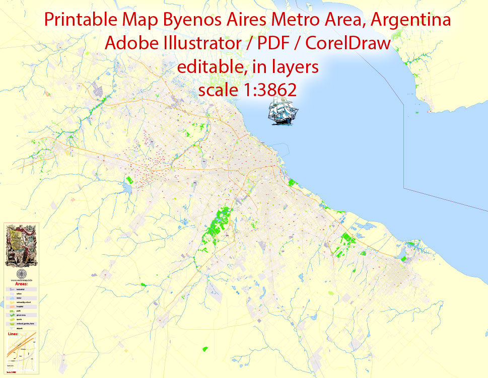
Urban plan Buenos Aires Argentina: Vector Maps of the Metropolitan Area
Buenos Aires, the capital and largest city of Argentina. Forms an independent administrative unit - the autonomous City of Buenos Aires (Ciudad Autónoma de Buenos Aires, CABA; charter 1996).
Transport and geographical location
It is located in the central-eastern part of the country, within the Pampas, in the western part of the southern coast of the gulf-the estuary of La Plata, which is a continuation of the mouth of the Paraná River. The Matanza River flows along the southeastern border of the city.
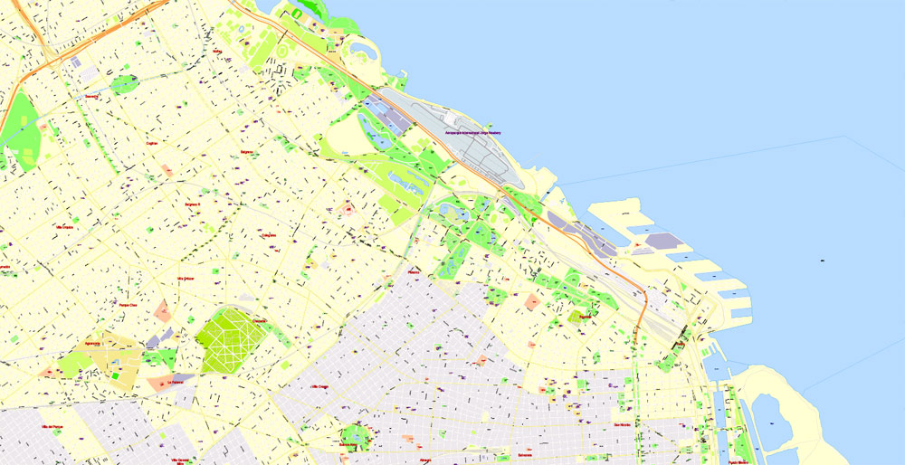
The largest transport hub of the country. Main highways: "Ricardo Balbin" Buenos Aires - La Plata, "Pablo Riccheri"; length 24.3 km; connects the city with the international airport, Ministro Pistarini, "Ministro Pistarini"; its continuation is the national highway No. 3 to Ushuaia – the southern tip of the country on the island of Tierra del Fuego, "Acceso Oeste"; 55 km; passes into the national highway No. 7 to Mendoza in western Argentina; the national highway departs from it No. 5 to Santa Rosa in the central part of the country, "Acceso Norte"; 120 km; its continuation is National Highway No. 9, connecting Buenos Aires with other major cities of Argentina – Rosario, Cordoba, and San Miguel de Tucuman and the border with Bolivia; national Highway No. 11 departs from it to Santa Fe and further to Asuncion, Paraguay. Retiro Bus Station; 1983 - the main bus station of Argentina (75 platforms; serves 2 thousand flights daily). The largest railway junction; the railway line "General Mitre"; 1862 connects Buenos Aires with the provinces of Rosario, Santa Fe, Cordoba and Tucuman, "Coastal" "Tren de la Costa"; part of the "General Mitre" - with the northwestern suburb of Buenos Aires - Tigre, "General Belgrano"; 1876 - with the province of Jujuy, "General San Martin"; 1888 - with the provinces of San Luis and Mendoza. There are five railway passenger terminals in the city – the stations "Retiro", "Constitución", "Onse", "Buenos Aires" and "Federico Lacroze". There are suburban railway lines: "Domingo Faustino Sarmiento"; 1857; western direction, "General Roca"; 1865; southern direction, "Urquiza"; 1888; north-western direction, etc.
A large seaport complex.
Ministro Pistarini International Airport; 1949; 22 km south-east of the city center, in the city of Esseisa; 9.1 million passengers, 2020; in the Palermo area, 2 km from the center, there is an international airport "Jorge Newbery; 1947; domestic and international flights to Uruguay, Brazil, Chile and Paraguay; 11 million passengers. Many railway lines are used for intercity passenger traffic, "Sarmiento" and "General Roca" are leaders in passenger traffic; connected to the subway "Subte"; 1913, the first construction in Latin America; 6 lines, 86 stations, length 53.9 km). In the southern part of the city there is a light railway line "Premetro" (1987; 17 stations, length 7.4 km).
Population
The population is 3.06 million people (2020, estimate; 2.89 million people, 2019, census). Greater Buenos Aires is the third-largest urban agglomeration in Latin America after Mexico City and Sao Paulo (12.8 million people, 2010, census; St. 14.9 million people, 2016, estimate); includes the territory of the autonomous city of Buenos Aires and 24 suburban districts (municipalities, or "partidos", which are administratively part of the province of Buenos Aires), including northwest - Vicente Lopez, General–San Martin, San Isidro, San Fernando, and Tigre, west - Tres de Febrero, Moron, Urlingam, Itusaingo, San Miguel, Malvinas Argentinas, Jose Clemente Paz, Merlo and Moreno, southwest - La Matanza, south - Ezeiza and Esteban Echeverria, southeast - Lomas de Zamora, Lanus, Avellaneda, Almirante-Brown, Berasategui, Quilmes and Florencio–Varela. Since 2006, the agglomeration of Greater Buenos Aires partially includes four more suburban districts (Escobar, General Rodriguez, Marcos Paz, and Pilar).
History
Founded in 1536 by the Spanish conquistador Pedro González de Mendoza. In 1541, due to constant attacks by Indians and lack of food, it was abandoned by residents by order of an official of the Spanish colonial administration A. Cabrera (according to another version, it was destroyed by fire). It was re-founded on 11.6.1580 by the Spanish conquistador Juan de Garay, known as the City of the Holy Trinity and the port of Our Lady of St. Mary of Good (fair) winds (Ciudad de la Santísima Trinidad y Puerto de Nuestra Señora de Santa María de los Buenos Aires), was part of the viceroyalty of Peru. The population of the city has repeatedly repelled attacks: from the English (1582, 1587) and Danish (1699) privateers, the French fleet (1658). By the beginning of the 18th century, it had become one of the largest shopping and cultural centers in the New World.
In 1716, the Spanish government awarded it the honorary title of "A very noble and very loyal City" ("Ciudad Muy Noble y Muy Leal"). Since 1776, the capital of the viceroyalty of Rio de la Plata. Since 1785, the port of Buenos Aires has been open for international trade; one of the centers of immigration of Europeans, primarily Italians, Spaniards, and French. In 1806-07, the city was briefly captured by a British naval landing. 25.5.1810 became the center of the May Revolution, as a result of which Argentina achieved independence. In 1816-26, the capital of the United Provinces of La Plata. In the following years, being the de facto main political center of the country, he fought with the provinces for national leadership. In 1838-40 he withstood the blockade of the French fleet, in 1845-48 - the British and French fleets. In 1852, he declared secession from the Argentine state (at that time it was a confederation of semi-independent provinces), returned to Argentina in 1859-60. In 1880, it acquired the de jure status of the capital of Argentina, separated administratively from the province of the same name. According to the constitutional reform of 1994, he received his own constitution and self-government. In the beginning. 21 in . one of the centers of opposition speeches.

Architecture
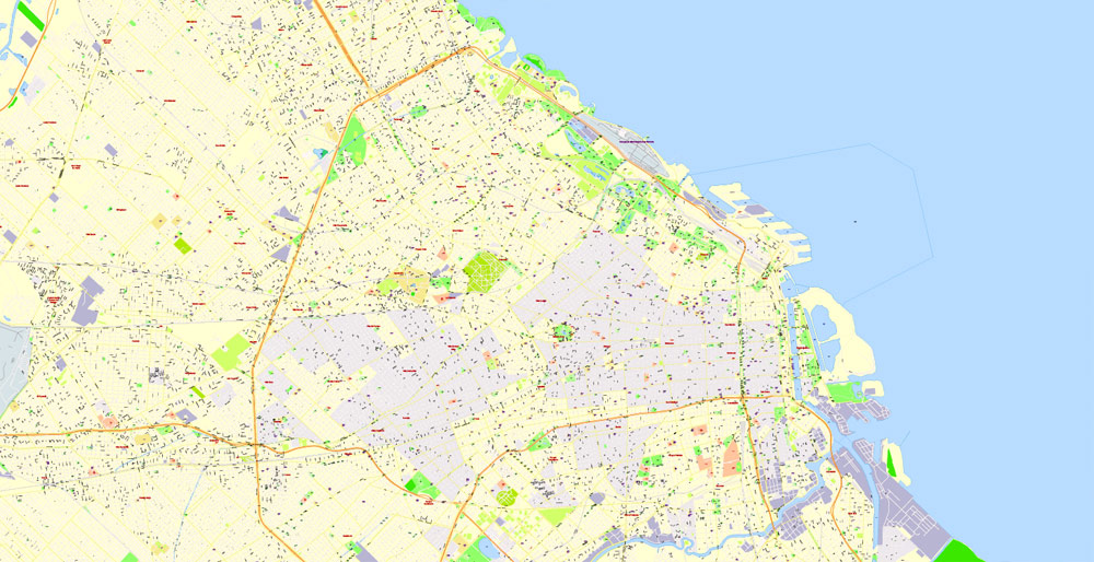
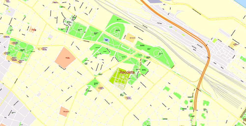
The layout is based on a rectangular network of streets (July 9 Avenue, width 140 m; Avenida Rivadavia, length approx. 20 km, etc.) and the main square with the President's House open to the Gulf of La Plata [Casa Rosada, 1873-98, architects K. Kilberg and H. Aberg (Sweden), F. Tamburini (Italy)]. The architecture combines the magnificent Baroque, the influence of the Portuguese Manueline style and the Peruvian Rococo, elements of classicism and various modern styles. Churches of San Ignacio (1710-34, architects X. Kraus, A. Blanks), El Pilar (1716-32, the basement is tiled), Santa Catalina (1737-52), San Francisco (construction completed in 1754), Town Hall (Cabildo, 1719-86; all - architects A. Blanks, H. B. Primoli, etc.); Basilica Nuestra Senhora del Rosario of the monastery of Santo Domingo (1752-73, architects A. Macella and F. Alvarez), cathedral (founded in 1593; 1752-91, architect A. Macella; construction completed in 1822-63, architect P. Katelen). Multi-storey apartment buildings and mansions in the Art Nouveau style; buildings in the spirit of eclecticism (Congress Building, 1898-1906, architects V. Meano, H. Dormal), etc.; constructivist buildings (El Kavanagh skyscraper, 1935-36). There are many green boulevards, squares and parks in Buenos Aires. Monuments: General M. Belgrano (1898, sculptors A. E. Carrie-Bellez and E. de Santa Coloma), H. Columbus in the Colon Park (1921, sculptor A. Zocchi), General C. M. de Alvear (1926, sculptor E. A. Bourdelle), S. Bolivar (1942, sculptor H. Fioravanti), an obelisk in honor of the 400th anniversary of the city (1936, architect A. Prebish).
Science and education
The leading scientific, educational and cultural center of the country. Main scientific institutions: National Council for Scientific and Technical Research (CONICET; 1958); National Academy of Sciences (1935); Academies: medicine (1822), exact, physical and natural sciences, law and Social Sciences (both 1874), history (1893), Literature (1931), Fine Arts (1936), morality and Political sciences (1938), Geography (1956). Over 130 research institutes, associations, research centers, and societies. Among the leading ones are the Argentine Scientific Society (1872), the Society of Friends of Astronomy (1929); National associations: architects (1886), medical (1891), Dante Alighieri (1896); research institutes: numismatics and Antiquities (1872), National Geographic (1879; before 2009 military), statistics and census (1894), clinical surgery (1923), experimental biology and medicine (1944), etc. The National Atomic Energy Commission [1950; the Constituyentes Atomic Center (CAC) is located in Buenos Aires itself, and the atomic center of the same name (CAE– is located in the suburban district of Ezeiza; it includes a plant for the enrichment of uranium ores and the disposal of spent nuclear fuel, as well as a semi-industrial irradiation facility)], the National Institute of Technology of Agriculture (INTA; 1956), the National Agency of Mining Technologies, Geology and Mineral Resources (SEGEMAR; 1996). Institute of the History of Buenos Aires (1949). Naval Observatory of Buenos Aires (1882).
Scientific and Technological Policy (2011; on its territory – the headquarters of the Ministry of Science and the National Agency for Scientific and Technical Innovations, institutions in the field of nanotechnology, biophysics and biochemistry, exact sciences, and IT). The Miguelete Technology Park ["Miguelete"; in the suburban district of General San Martin; includes the National Institute of Industrial Technology (INTI; 1958), the Institute of Biotechnological Research, etc.]. In the suburban district of Vicente Lopez - the Institute of Scientific and Technical Research on Defense (1954); The district also hosts the Technopolis exhibition of science, technology, industry and art (since 2011; the largest in Latin America).
A significant amount of scientific research is carried out by the universities of the city. The largest public universities: The University of Buenos Aires [UBA; 1821; it has 13 faculties, three higher schools (National College of Buenos Aires, Higher School of Commerce named after Carlos Pellegrini and the Institute of Free Second Education), 6 clinics, and 10 museums]; National University of Technology (UTN; 1948), General San Martin National University (UNSAM; 1992; a head campus in the suburban district of General San Martin), National University of the Arts (UNA; 1996; it includes the Faculty of Music, the former National Conservatory named after C. Lopez Bucardo, 1924); the Higher Pedagogical Institute named after Dr. Joaquin Victor Gonzalez (1904). Leading private universities: Universities of Business of Argentina (UADE; 1957), Catholic (UCA; 1958), "Belgrano" ("Belgrano"; 1964), "Palermo" ("Palermo"; UP; 1986); Buenos Aires Institute of Technology (1959); Naval Academy "Delegaciones Navales" ("Delegaciones Navales").
Major libraries: National Library of Argentina (1810; the largest in the country), Congress (1859), National Medical Association (1914), Agricultural (1866) and pedagogical "Nacional de Maestros" (1870); network of national libraries (CONABIP; 1870). St. 26 public libraries, among them – named after Leopoldo Lugones (1907), named after Jose Marmol (1928), named after Miguel Cane (1927; in 1953, the first city library for the blind was opened on its basis), named after Martina del Barco-Centenera (1944; since 1985, the Children's Department has been functioning. Antoine de Saint-Exupery), named after Joaquin Gonzalez (1960), named after Julio Cortazar (1984), children's. Enrique Bunchsa (1952) and others. Documentation Center of the Ministry of Culture of Argentina.
Archives: the General National (1821; in the structure of the Ministry of Internal Affairs of Argentina), the historical City of Buenos Aires (at the Institute of History of Buenos Aires; since 1962 includes a library), the Historical University of Buenos Aires (1931), etc.
Museums
St. 140 museums, including National Museums: Argentine Natural Sciences named after Bernardino Rivadavia (MACN; 1812), Historical of Argentina (1889), Fine Arts (1895), decorative Arts (1937), historical "Cabildo and the May Revolution" (1939), prints (1960), Oriental Art (1965) and the National Academy of Tango (1990); among other museums – ethnographic (1904), historical Buenos Aires. Cornelio Saavedra, Spanish-American Art. Isaac Fernández Blanco ("Isaac Fernández Blanco"; both 1921), art im. Benito Quinquela Martin ("Benito Quinquela Martín"; 1936), art im. Eduardo Sivori, popular Art im. Jose Hernandez (both 1938), sculptures by Luis Perlotti (1954), contemporary art (1956), musical "Rock Museum - Institute of Historical Research" (1961), Spanish art named after Enrique Larreta (1962), urban (1968), railway named after Raúl Scalabrini Ortiz ("Raúl Scalabrini Ortiz"; 1968), cinema named after Pablo Ducro Hicken (1971), Latin American art of Buenos Aires (2001), humor (2012). The historical cultural complex "Manzana de las Luces" ("Manzana de las Luces"; 1971); the tower "Torre Monumental" ("Torre Monumental"; 1916; with an observation deck). Museum-frigate "President Sarmiento" (1964). In the suburban district of Tigre - Maritime Museum (1892).
Museum houses: General Bartolome Mitre (1907), sculptor Rogelio Irerti (1949), teacher and writer Ricardo Rojas (1958), singer Carlos Gardel (2003). Planetarium "Galileo Galilei" (1966).
Theaters
Over 200 theaters and 230 concert halls. Leading state theaters: opera "Colon" ("Colón"; 1908; one of the main opera stages of the world); multi-genre: National "Cervantes" ("Cervantes"; 1921), city "Regio" ("Regio"; 1929), "Sarmiento" ("Sarmiento"; 1938), "Presidente Alvear" ("Presidente Alvear"; 1942), "San Martin" ("San Martín", TGSM; 1960) and "Teatro de la Ribera" ("Teatro de la Ribera"; 1971; all five are part of the Buenos Aires Theater Community, CTBA). Among the leading private theaters: multi-genre: "Politeama" ("Politeama"; 1879), "Apolo" ("Apolo"; 1892), "Nacional" (1906), "Avenida" ("Avenida"), "Maipo" ("Maipo"; both 1908), "Lola Membrives" ("Lola Membrives"; 1927) and "Broadway" (1930). National Folklore Ballet (1990). National Contemporary Dance Company (2009).
National Palace of Arts (1932; former "Palais de Glace"; since 1960, art exhibitions and musical events have been held). Cultural centers: General San Martin (1970), "Recoleta" (1980), etc.
Music
Orchestras: National Symphony of Argentina (1948); National Argentine Music named after Juan de Dios Filiberto (1932), Philharmonic of Buenos Aires (1946; based on the orchestra of the theater "Colón").
Festivals
Annual international festivals: music (guitarists; since 1995), independent cinema (since 1999), tango (since 1999); design (at the site of "Centro Metropolitano de Diseño"; in the Barracas area); Fashion Week (since 2001), etc. International Book Fair (since 1974; one of the five most important in the world).

Gallery of Images "Urban plan Buenos Aires Argentina":
Urban Plans South America Argentina Buenos Aires: Digital Maps for Business and Education
Buenos Aires Printable Editable Maps for Tourism and Logistics
Integrated urban plans of Buenos Aires, Argentina, Fully editable in Vector Formats

Buenos Aires urban planning: Digital Cartography for Architect Projects


- Urban plan Geelong Australia PDF
- Urban plan Nantes France
- Urban plan Zaragoza Spain pdf
- Urban plan Little Rock Arkansas PDF
- Urban plan Des Moines Iowa
- Urban plan Madison Wisconsin
- Urban plan Vancouver Canada
- Urban plan Lagos Nigeria 16
- Urban plan Christchurch New Zealand 17
- Urban plan Kansas City Missoury 3 10 PDF
- Urban plan Calgary City SVG
- Urban plan Tallahassee Florida
- Urban plan Canada Admin Road PDF
- Urban plan Kazan PDF Russia
- Urban plan US Relef Rivers
- Urban plan Jamaica full CDR
- Urban plan Charlotte North Carolina PDF
- Urban plan Saint Petersburg S1
- Urban plan Lancaster Pennsylvania PDF
- Urban plan Winnipeg Canada PDF
- Urban plan Greenwich Connecticut
- Urban plan Seattle Washington PDF
- Urban plan Chita Russia
- Urban plan Fort Worth Texas
- Urban plan Victoria Canada
- Urban plan Kemerovo Russia
- Urban plan Flags Countries
- Urban plan Denver Colorado CDR
- Urban plan Karachi Pakistan PDF
- Urban plan Finland
- Urban plan Kyoto Japan 16 ai
- Urban plan Albany New York PDF
- Urban plan Florence Firenze Italy
- Urban plan Cambridge UK
- Urban plan Rochester New York PDF
- Urban plan Bratislava Slovakia PDF
- Urban plan Leeds Bradford UK
- Urban plan Cambridge UK PDF
- Urban plan Bangkok Thailand
- Urban plan Palo Alto Mountain View California pdf
- Urban plan Irkutsk PDF Russia
- Urban plan Lisbon PDF
- Urban plan Lahore Pakistan PDF
- Urban plan Cincinnati Ohio
- Urban plan Miami Florida 3 P
- Urban plan admin Indonesia
- Urban plan Concord New Hampshire
- Urban plan Bremen
- Urban plan Helsinki Espoo Vantaa PDF
- Urban plan Adelaide Australia PDF 13
- Urban plan Barnaul PDF
- Urban plan San Luis Obispo California
- Urban plan Columbia Jefferson City Missouri
- Urban plan Montpellier France
- Urban plan Saratov pdf
- Urban plan Antwerpen Belgium ai
- Urban plan Barcelona Spain
- Urban plan Dallas Fort Worth TX
- Urban plan Nuremberg Germany pdf
- Urban plan Boston Massachusetts low
- Urban plan Louisville Kentucky 3 10 PDF
- Urban plan Novgorod Russia
- Urban plan Prague Praha metro Czech Republic
- Urban plan Rotterdam Netherlands
- Urban plan Oulu Finland
- Urban plan Austria Vector Roads CDR
- Urban plan Germany Full Admin
- Urban plan Genova Genoa Italy
- Urban plan Ballarat Australia PDF 17
- Urban plan San Antonio Texas ai
- Urban plan Boston Massachusetts
- Urban plan Mobile Alabama PDF
- Urban plan Adelaide Australia pdf
- Urban plan Vilnius Lithuania
- Urban plan Dusseldorf Germany pdf
- Urban plan Kelowna PDF
- Urban plan Eilat Israel Aqaba Jordan
- Urban plan Copenhagen Kobenhavn Denmark pdf
- Urban plan Copenhagen Kobenhavn Denmark PDF low
- Urban plan Geneva Switzerland
- Urban plan Dayton Ohio
- Urban plan Kharkiv Ukraine CDR
- Urban plan New Orleans Louisiana PDF
- Urban plan Jamaica full DWG DXF
- Urban plan Columbus Ohio ai
- Urban plan Las Vegas Nevada PDF
- Urban plan Moscow
- Urban plan Spokane PDF
- Urban plan Geneve Switzerland PDF
- Urban plan Sacramento California PDF
- Urban plan Liege Belgium
- Urban plan Sochi Russia
- Urban plan Santo Domingo Dominicana
- Urban plan Charleston South Carolina 3 10 PDF
- Urban plan Cleveland Ohio
- Urban plan Vigo County Terre Haute Indiana PDF
- Urban plan Munich Munchen Germany
- Urban plan Delray Beach PDF
- Urban plan Astrakhan
- Urban plan Vladimir pdf