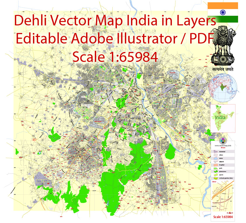
Urban plan Delhi India ENG PDF: Digital Cartography
Gallery of Images "Urban plan Delhi India ENG PDF":

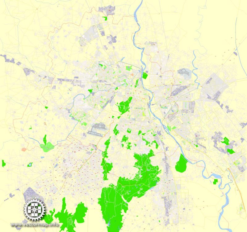
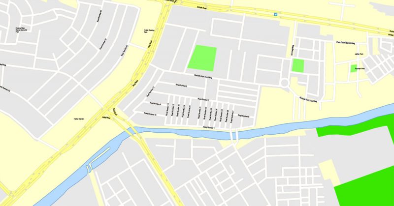
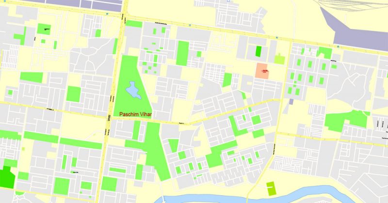
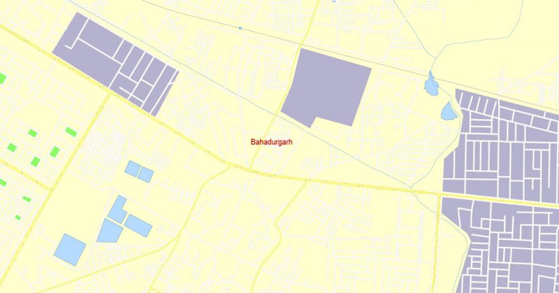
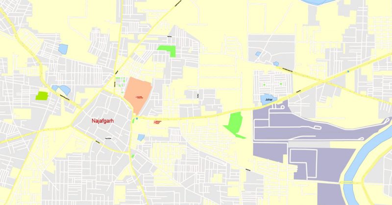
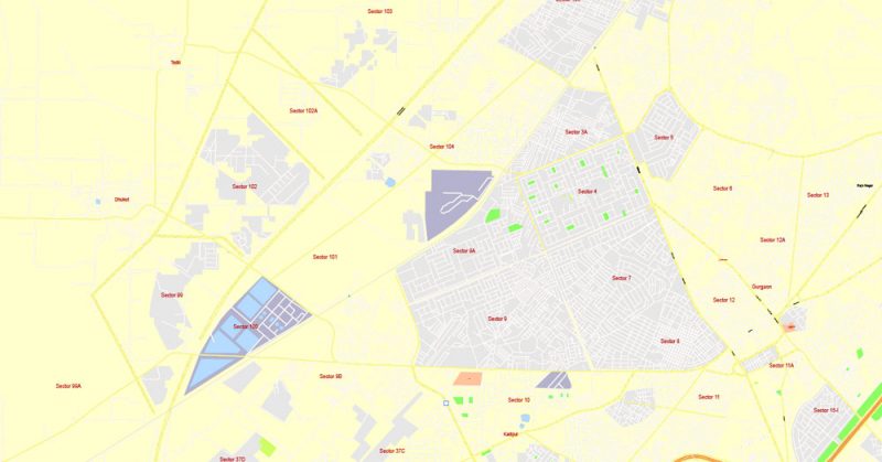
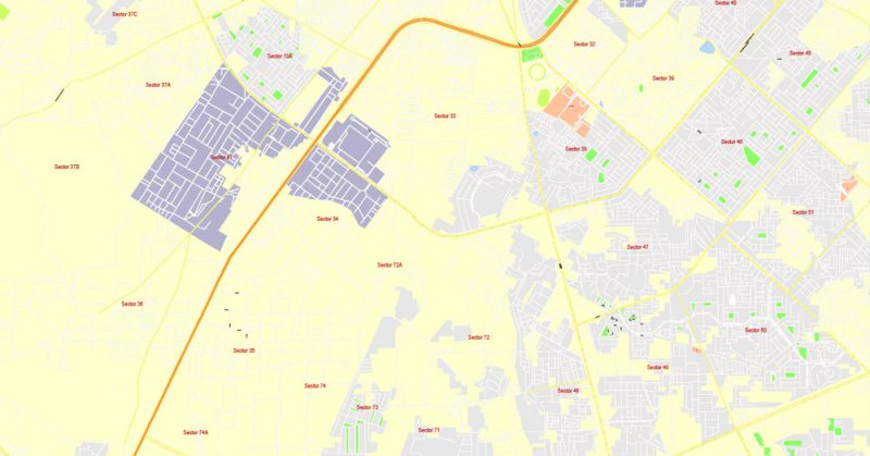
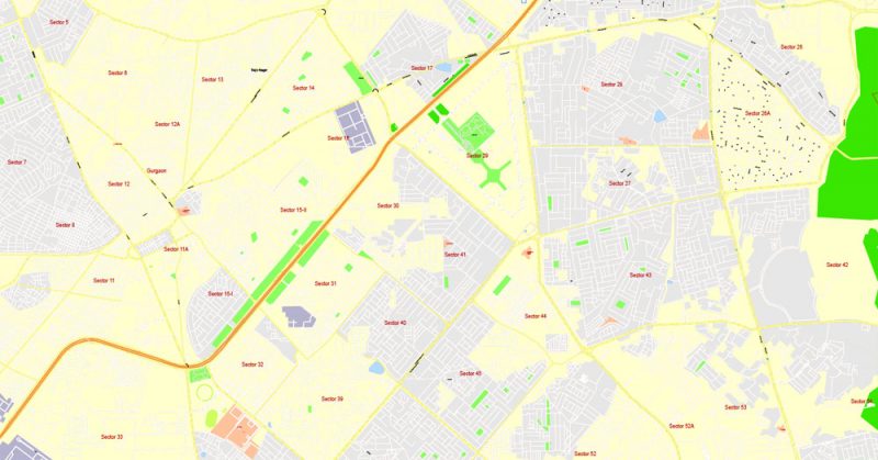
Urban plan Delhi India ENG PDF: City Maps for printing, business, logistics
Delhi India Geography and Climate
The capital of India, Delhi– is the second-largest metropolis after Mumbai. The city is located in the very center of the country on the western bank of the Jamna, a tributary of the Ganges. The main railway, highway, and aviation routes of India are located here.
Delhi is the economic and cultural center of the country, which has absorbed the traditions of Hindu and Islamic cultures.
The modern appearance of the city began to take shape during the reign of the Mughals. The abundance of cultures and religions has made the Indian capital colorful and unlike any other city in the world. Here, the rich architectural heritage could not only be preserved but some monuments of the past are still being used for their intended purpose.
Local temples deserve special mention. Everyone can get into the complexes, regardless of religion. There are restrictions only on the time of the behavior of the services, and it is also necessary to observe the rules of conduct and dress code. Akshardham, Lotus Temple, Gurdwara Bangla Sahib, Jama Masjid Mosque are beautiful both outside and inside. Each religious object has a rich history, reflected in the details of the design.
Akshardham
The temple complex covers an area of 12 hectares. It is called "the residence of God, which cannot be moved." The main temple is a massive structure. Its design combines various Indian styles. Due to its size, it is included in the Guinness Book of Records. It is surrounded by picturesque parks and gardens. Nearby there is a cinema and a light and music fountain. Water was brought to the local lake from many reservoirs of the country.
Red Fort
The attraction dates back to the time of the Mughal rule. The first stone of the citadel was laid in 1639. The name is derived from the color of the walls of the fort. Hindu motifs predominate in architecture, but there are also Persian decorative elements. At the moment it is a tourist destination. However, the place remains iconic: here, on the Independence Day of the country, the Prime Minister reads an address to the nation.
Gateway of India and Rajpath
The Gate of India monument is one of the most recognizable symbols of the city. It was created in honor of the soldiers who died on the fields of the Anglo-Afghan war and the First World War. The massive arch has a height of 42 meters and was inaugurated in 1931. The attraction is located on the "royal road" — this is how the name of the ceremonial Rajpath Avenue is translated. There are parks on both sides of it.
Rashtrapati-Bhavan
One of the largest residences of the head of state in the world. It was built at the beginning of the XX century for the Viceroy of India. When the country gained independence, it was decided to place the state apparatus in the guest wing. The rest of the building is used for receiving official delegations and large events. Getting inside is problematic for an ordinary tourist: only by prior request and at certain times of the year.
Humayun's Tomb
At the initiative of the widow of the Mongol ruler, in 1562, a tomb began to be built for Hamayun, more like a palace. The complex of buildings is surrounded by a garden. It is divided by two channels into four parts. Since Persian architects were responsible for the project, there are details of their culture in the architecture of the main building. There are several other iconic burials near Humayun's tomb, including the tomb of Nila Gumbad.
Lotus Temple
An unusual building appeared in the city in 1986. 27 marble petals are arranged in 3 rows and form a single composition. The height of the temple is about 40 meters. Since a pool is built around it, it seems as if the "flower" is in the water. There are no straight lines inside the premises – this is the idea of the designers. In addition, there are no inscriptions and objects of worship. The worshipper, as it were, communicates directly with God.
Qutb Minaret-Minar
The construction of the tower stretched from 1193 to 1368. The minaret turned out to be five-tiered. To climb to its top, you need to overcome 300 steps. This object was conceived as a symbol of the victory of Islam over other religions. Calls to prayer should have sounded from its top, but the tower came out too big for this purpose. History has preserved references to several suicides who jumped from the minaret.
Chandni Chowk Market
It is located in the district of the same name. The name translates as "moonlit square". Retail shops and pavilions occupy an impressive area. Almost all the goods sold here are locally produced. You can find anything on the market: traditional spices, freshly cooked food, electronics, national costumes, decorative and applied art objects.
Mahatma Gandhi Memorial
Gandhi's body was cremated at this place in 1948. The memorial is made of marble and is often decorated with flowers. The last words of the Indian leader are engraved on it. They translate as "Oh, God!". The Eternal Flame is burning nearby. The Gandhi National Museum was opened across the street in 1961. Among the exhibits: Mahatma's bed, clothes soaked in his blood, and the bullet that ended his life.
Gandhi Smriti Museum
It was founded in 1973 and occupies the house where Mahatma Gandhi spent his last days and was killed. The museum collection consists of the personal belongings of the Indian leader. A Martyr's Pillar is installed at the place where he was shot. Another notable detail of the house is the column with the image of a swastika. It shows how much the original meaning of the symbol can be changed. The Om sound symbol is also applied to the column.
At the end of the 40s, a large exhibition "The Art of India" was held in London. Since it was a success, they decided to move the exposition to Delhi and place it in the presidential residence. This became the basis for the creation of a full-fledged museum, which opened in 1949, and 11 years later occupied the current building. At the moment, 200 thousand exhibits tell about 5 thousand years of Indian history and culture.
India / Geographical location, area, borders
India occupies most of the South Asia region within three major orographic areas: the Himalayan Mountains, the Indo-Gangetic Plain, and the Deccan Plateau on the Hindustan Peninsula (which occupies its inner part). It extends from the north from 37°06' to 80°4' north latitude for 3,214 km and from the west from 68°07' to 97°25' east longitude for 2,933 km. Its area is 3,287,263 km2 (taking into account the 83,787 km2 part of the state of Jammu and Kashmir, which is held by Pakistan, and the 37,555 km2 part of the same state, which is held by the PRC; from the point of view of the Republic of India, these territories are illegally occupied and New Delhi is considered its own).
In fact, India's sovereignty extends to an area of 3,166 thousand km2. The total length of India's borders is 14,103 km. In the northwest, India borders Pakistan (the length of the border is 2,912 km), in the north — Bhutan (605 km), China (3,380 km) and Nepal (1,690 km), in the east — Bangladesh, and Myanmar (4,053 km and 1,463 km, respectively). From the south, it is washed by the waters of the Indian Ocean, in the west by the waters of the Arabian Sea of the Indian Ocean, in the east by the Bay of Bengal of the Indian Ocean. The seashore accounts for about 5,686 km (according to other sources, 6,083 km).
Population. India is the second-most populous country in the World. The last census was conducted in 2021 (the 14th in a row). According to its data, the population was 1,128,610,328 people. According to estimates for the middle of 2021, the population was 1,191.029 million people.
According to estimates for the middle of 2021, natural population growth was 1.6%; birth rate per 1,000 people - 23; mortality per 1,000 people - 7; the share of the population under 15 years of age - 32%, 65 years and older - 5%. The average life expectancy in India is 64 years; for men, this figure is 63 years, for women - 65 years. 29% of the population lives in cities.
India is a multinational country. The main ethnic groups living in India include Hindustanis, Punjabis, Bengalis, Marathis, Gujaratis, Assamese, Kashmiris, Telugu, Tamils, Malayalis and a number of others. The small peoples of the Mongoloid group, living mainly in the northeastern part of the country, include Manipur's, Nagas, Mizo, Tipera, and a number of others.
According to the UN Human Development Report 2021, the literacy rate of the adult population (15 years and older) in India was 66.0% (estimated). The total number of students in primary, secondary and higher educational institutions is 61.0%, the education level index is 0.643.
According to the UN Human Development Report 2021, the Human Development Index (HDI) for India was 0.612, which allowed it to take 134th place in the world (out of 182) in the overall ranking of countries by this indicator (a group of countries with an average level of human development).
Gallery of Images "Urban plan Delhi India ENG PDF":
Urban Map Delhi - Cartography Service Experts: Digital Maps


Delhi India Exact City Map: Labeled streets


Delhi India Urban Plans and City Maps: For Wall Printing Large Formats

- Urban plan Karlsruhe Germany
- Urban plan Boston Massachusetts high PDF
- Urban plan Sydney Australia ZIP PDF
- Urban plan Tampere Finland PDF
- Urban plan Romania Topo Road
- Urban plan Eilat Israel Aqaba Jordan PDF
- Urban plan Istanbul Turkey
- Urban plan Salisbury UK PDF
- Urban plan Memphis Tennessee PDF
- Urban plan Zurich Switzerland ai
- Urban plan Tyumen pdf
- Urban plan Chicago Illinois PDF
- Urban plan Concord New Hampshire
- Urban plan Newport Norfolk Virginia Beach CDR
- Urban plan La Porte Baytown Texas ai
- Urban plan London 4 parts pdf
- Urban plan La Plata Argentina PDF
- Urban plan Czech Republic Roads Relief
- Urban plan Kemerovo PDF Russia
- Urban plan Jakarta Grande Indonesia 13 AI
- Urban plan Novokuznetsk PDF Russia
- Urban plan Delray
- Urban plan Wroclaw Poland
- Urban plan Izhevsk Russia
- Urban plan New York City 15 AI
- Urban plan Staten Island New York PDF
- Urban plan Evansville Indiana 3 10 PDF
- Urban plan Orlando Florida CDR
- Urban plan Canberra Australia PDF
- Urban plan Cleveland Ohio 25
- Urban plan Ottawa Canada pdf
- Urban plan Shanghai China AI ENG LOW
- Urban plan Toowoomba Australia
- Urban plan Heathrow Feltham Hounslow AI
- Urban plan San Juan Puerto Rico PDF
- Urban plan Cardiff Newport Wales UK PDF
- Urban plan Eugene Springfield Oregon
- Urban plan Lisbon PDF
- Urban plan Jamaica full CDR
- Urban plan Kansas City Missoury 3 10 PDF
- Urban plan Seattle Washington PDF
- Urban plan Spokane PDF
- Urban plan Santo Domingo
- Urban plan Columbia Jefferson City Missouri
- Urban plan Ivanovo PDF Russia
- Urban plan Nantucket Marthas Vineyard Massachusetts 17 ai
- Urban plan Boston
- Urban plan Eugene Oregon
- Urban plan Norfolk Virginia Beach
- Urban plan Florence Firenze Italy PDF
- Urban plan Hong Kong China PDF
- Urban plan Novgorod PDF Russia
- Urban plan Rochester New York
- Urban plan Greensboro North Carolina
- Urban plan Quebec City Canada ai 17
- Urban plan Indianapolis PDF
- Urban plan Buffalo New York ai
- Urban plan Amsterdam Netherlands 49
- Urban plan St Petersburg Florida pdf
- Urban plan Aston Birmingham PDF
- Urban plan Budapest Hungary
- Urban plan Khabarovsk Russia
- Urban plan Tel Aviv Israel ai
- Urban plan Charleston West Virginia PDF
- Urban plan Montreal Canada
- Urban plan Rastatt Baden Baden Germany ai
- Urban plan Montgomery Alabama
- Urban plan Flagstaff Arizona
- Urban plan Birmingham Alabama pdf
- Urban plan Omsk
- Urban plan San Francisco California
- Urban plan Chita Russia
- Urban plan Raleigh North Carolina PDF
- Urban plan Oklahoma City PDF
- Urban plan Menlo Park California 13
- Urban plan Onancock Virginia PDF
- Urban plan Amiens France PDF
- Urban plan Wind Point Wisconsin AI
- Urban plan Jackson Mississippi PDF
- Urban plan Sevastopol Ukraine
- Urban plan Cape Town South Africa PDF
- Urban plan full state Colorado
- Urban plan Delray Beach PDF
- Urban plan Santiago Chile PDF
- Urban plan Toa Baja Puerto Rico PDF
- Urban plan Paris full Grande France pdf
- Urban plan Jakarta Indonesia 16 ai
- Urban plan Santa Fe New Mexico PDF
- Urban plan Beirut Lebanon pdf
- Urban plan Copenhagen Kobenhavn Denmark PDF low
- Urban plan Liverpool UK
- Urban plan Tucson Arizona ai
- Urban plan Santa Clara California
- Urban plan Abu Dhabi United Arab Emirates
- Urban plan Vigo County Terre Haute Indiana
- Urban plan Cleveland Ohio PDF
- Urban plan Chicago Illinois PDF
- Urban plan Jerusalem Israel 17 PDF
- Urban plan Galway Ireland PDF
- Urban plan Albuquerque ai
- Urban plan Guangzhou China PDF ENG