Urban plan Greenwich Connecticut
Video: How to work with the vector map?

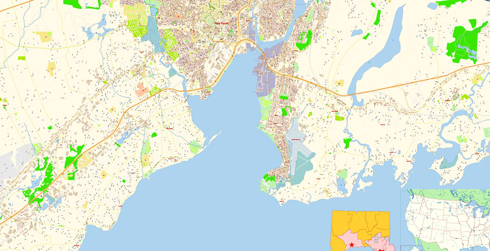
Urban plan Greenwich Connecticut: Digital Geography and Cartography
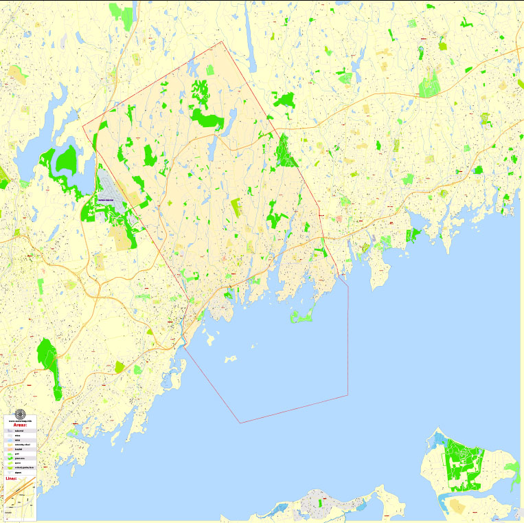
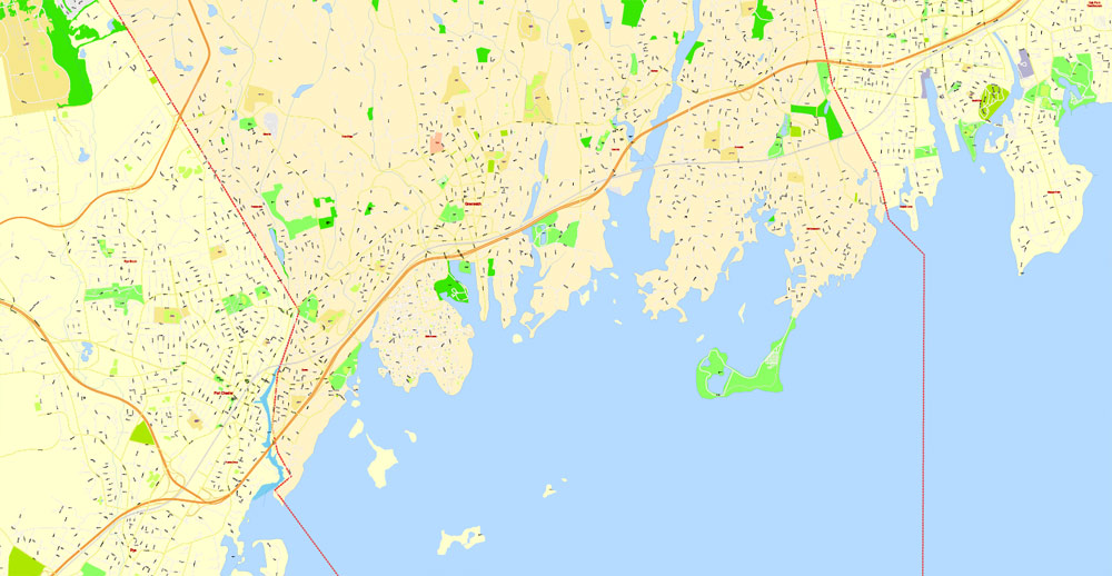
Greenwich is a city in Fairfield County, Connecticut. It is the southernmost city in the state, the westernmost city in New England.
The population is 63476 people (2020), of which 90.02% are white. About 4% of residents live below the poverty line.
Greenwich was founded in 1640 as part of the New Haven Colony. It is one of the oldest settlements in Connecticut.
Connecticut has the highest median income in the entire United States, so you'll find a lot of expensive branded stores and luxury restaurants here. However, the city offers more than just splendor, you will see, for example, historical houses, beautiful beaches, and interesting museums.
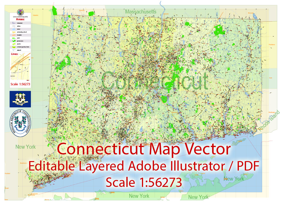
Connecticut is a state in the northeastern United States, part of the New England region. The capital is Hartford, the largest city is Bridgeport. The population is 3.577 million people (29th place in the USA; 2020 data). It is the forty-eighth largest state in the USA.
If you do not take into account the District of Columbia, the state ranks first in terms of GDP per capita in the United States ($54,397). The name of the state comes from an expression in the Algonquian language, which translates as "on a long river subject to tides."
The official nickname since 1959 is Constitution State. Previously, the official nickname was Nutmeg State. The first settlers in the state were the Dutch, who founded the settlement, which later became the city of Hartford.
Until 1667, half of the territory was part of the New Netherlands, then it was transferred to the British Empire, and the colony of Connecticut itself was founded by Englishman Thomas Hooker in 1636.
Connecticut was among the first 13 states to declare its independence from England. The state is located in a temperate climate zone and has a long coastline, which has made navigation part of the traditions of the state.
Connecticut's Human Development Index is the highest among American states.
Year of education: 1788 (5th in order)
State slogan: freedom and unity
Formal name: State of Connecticut
The largest city in the state: Bridgeport
State Capital: Hartford
Population: more than 3.5 million people (29th place in the country).
Area: 14.3 thousand sq. km. (48th in the country.)
Even larger cities in the state: New Haven, Stamford, Waterbury, Norwalk, Danbury, New Britain, Bristol, West Hartford, Marsden, Camden, Fairfield, Manchester, Milford, West Haven.

Geography of the State of Connecticut
The territory of the state in the south is washed by the waters of the Long Island Strait, in the west it borders with the state of New York, in the north — with the state of Massachusetts, in the east - with the state of Rhode Island.
The largest cities are Bridgeport, Hartford (the capital), New Haven, Stamford, and Waterbury. The Territory is divided into eight regions, mostly (though not always) coinciding with the eight counties included in Connecticut.
There are 169 cities and towns in the state.
The highest point is Mount Frissell on the northwestern border of the state (748 m above sea level).
The Connecticut River of the same name flows through the central part of the state from north to south and enters the Long Island Sound. The territory of the state is mostly covered with forests. Closer to the south, there are swampy places and sandy beaches. The western part is mountainous (the Berkshire and Taconic ranges).
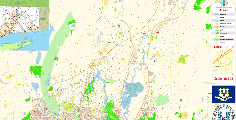
Despite its small size, the state has its own contrasts. From the mansions of the southwest Gold Coast to horse farms in the northwest hills. From rural villages in the north to industrial cities in the south. Almost all major cities have a "green zone" (a park in the city center), near which buildings of the past centuries are usually located, attracting tourists.
The cities of Connecticut are concentrated mainly in the southwest of the state. In the northeastern part of Connecticut, the terrain is more forested and agricultural.
The main official nickname of the state is due to the fact that in 1639 the British colony of Connecticut adopted the world's first constitution — the "Basic Laws of Connecticut".
History of the State of Connecticut
After the American Revolutionary War, Connecticut became one of the 13 states that first became part of the United States. Until 1875, the status of the capital of Connecticut alternately passed from Hartford to New Haven. Then he was permanently assigned to Hartford.
On May 10, 1933, the All-Russian National Revolutionary Labor and Workers' and Peasants' Party of Fascists were established on the territory of the state (the cities of Thompson and Putnam). For convenience, another name was usually used — the All-Russian Fascist Organization (VFO). It operated from 1933 to 1942 under the leadership of Anastasia Vonsyatsky. In 1942 Wonsyatsky was arrested by the FBI and convicted by a Hartford court, and the party was banned.
Related Images "Urban plan Greenwich Connecticut":
Greenwich, Connecticut Digital City Maps


Connecticut Editable Vector Maps


New Haven, Connecticut - Printable Editable City Maps in PDF, Illustrator


- Urban plan Abu Dhabi United Arab Emirates
- Urban plan Ivanovo PDF Russia
- Urban plan Frankfurt am Main Germany pdf
- Urban plan Christchurch New Zealand
- Urban plan Lviv Ukraine
- Urban plan Rochester New York AI
- Urban plan Galway Ireland
- Urban plan Tel Aviv Israel ai
- Urban plan Greenwich Connecticut
- Urban plan Jamaica full CDR
- Urban plan Hong Kong China 17 AI ENG
- Urban plan Italy Admin
- Urban plan Minneapolis Saint Paul Minnesota CDR
- Urban plan Murmansk Russia
- Urban plan Washington Baltimore
- Urban plan Frankfurt am Main metro PDF
- Urban plan Gdansk Poland PDF
- Urban plan Ryazan Russia PDF
- Urban plan Belgium Administrative PDF
- Urban plan Oakland Berkeley Richmond Alameda San Leandro Albany California
- Urban plan Ankara Turkey pdf
- Urban plan Wind Point Wisconsin
- Urban plan Bremen
- Urban plan Camden New Jersey CDR
- Urban plan Dortmund Germany ai
- Urban plan Savannah Chatham County Georgia PDF
- Urban plan Little Rock Arkansas
- Urban plan Plainfield Connecticut
- Urban plan Denmark Admin
- Urban plan Wellington New Zealand 13 PDF
- Urban plan Tampa Florida pdf
- Urban plan Allentown Pennsylvania PDF 4 10
- Urban plan Tomsk
- Urban plan Kansas City Missoury 3 10
- Urban plan France Admin
- Urban plan Boston Massachusetts pdf
- Urban plan Nigeria Full PDF
- Urban plan Boston Massachusetts
- Urban plan Liege Belgium PDF 13
- Urban plan Santa Clara California
- Urban plan Beijing China AI 17 eng
- Urban plan Evansville 75 Indiana
- Urban plan Cherepovets pdf
- Urban plan Batumi Georgia PDF
- Urban plan Plainfield Connecticut
- Urban plan Atlanta Georgia pdf
- Urban plan Kemi Tornio Finland
- Urban plan Brasilia City Brazil
- Urban plan Frankfurt am Main metro PDF
- Urban plan Sydney Australia 13 PDF
- Urban plan Rotterdam Netherlands pdf
- Urban plan Liverpool UK
- Urban plan Hobart Tasmania PDF
- Urban plan Hobart Tasmania 3 10 PDF