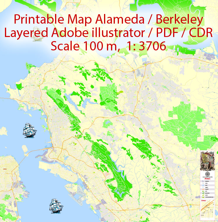
Urban plan Oakland Berkeley Richmond Alameda San Leandro Albany California PDF
Video: Oakland Berkeley California Vector Map
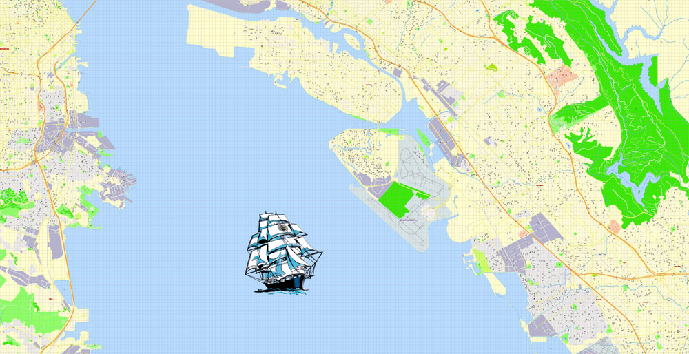
Urban plan Oakland Berkeley Richmond Alameda San Leandro Albany California PDF City Map
The name of the state of California comes from the name of the province "Las Californias", which was part of the Spanish colony in North America. The province itself got its name from the fictional Spanish writer Garcia Rodriguez de Montalvo island of California, which he described in his novel at the beginning of the XVI century. According to the book, the mythical island inhabited by Amazons was located to the east of the Asian mainland, next to the earthly paradise, and was ruled by Queen Califia.
The indigenous population before the arrival of European settlers consisted of many Indian tribes: Chumash, Salinan (Salins), Maidu, Utians (Miwok, Oloni), Modoki, Mojave, Pomo, Shasta, Tongva, Vintu, Esselen, Yokuts, Washo, Yana, Chimariko, Karuk, Hupa, Cahuilla. The European foot set foot on the land of California in 1542, when the expedition of the Spaniard Juan Rodriguez Cabrillo arrived on the North American continent, and then Sir Francis Drake arrived in these parts in 1579.
The city of Berkeley adorns the eastern shore of San Francisco Bay and is located in California's Alameda County. It belongs to the San Francisco Bay Area.
Berkeley has long earned the fame of a scientific center. It was he who became the birthplace of the oldest campus of the University of California, the University of Berkeley. There are also buildings of the Lawrence National Laboratory and a number of other institutes and laboratories.
The local University of California is considered the oldest of all ten campuses of this university and, according to a number of ratings, is the best public university in the country.
It was the physicists from this city who were destined to play a key role in the development of the nuclear bomb, which was conducted during the Second World War, as well as the development of the hydrogen bomb, which unfolded in the post-war years. Local scientists invented a cyclotron and investigated an antiproton, as well as developed a laser. Berkeley scientists are also known for explaining several processes underlying photosynthesis and discovering many chemical elements, including californium, laurencium, berkeley, plutonium, and seaborgium. The development of the famous BSD operating system began in this city.
Berkeley is considered to be one of the most liberal American cities. It was here that for the first time in recent history, same-sex marriages were recognized, which in the legislation passed under the term "domestic partnership".
After Mexico gained independence, California became part of it, and in the XVIII century, Russians began to penetrate into California, creating several settlements on the coast, the most famous of which is Fort Ross. In 1847, as a result of the Mexican-American War, the territory was divided between Mexico and the United States, and a year later a new independent state was proclaimed – the California Republic. California officially became part of the United States in 1850.
Most of the state of California has a Mediterranean climate characterized by rainy winters and dry summers. The proximity of the ocean affects the air temperature both in summer and in winter. Because of the cold California ocean current, there is often fog along the coast. As you move deeper into the territory, the climate becomes more continental, with a large temperature spread in winter and summer. Westerly winds from the ocean bring moisture, and the northern part of the state receives more precipitation than the southern part. The climate is also influenced by the mountains, which do not allow moist air from the ocean far into the continent.
Public transportation in California is functioning very well. Long-distance communication is represented by long-distance Amtrak night trains. Suburban communication is developed – several transport companies serve the suburbs of Los Angeles, San Diego. Rapid tram systems operate on the territory of the state, an extensive network of bus routes covers the environs of Los Angeles, San Diego, San Francisco, and other cities of California, as well as settlements in rural areas. San Francisco has a trolleybus network, a tram line, and a San Francisco ferry system. The San Francisco cable tram stands apart, but it is more of a tourist attraction
California is like a separate country, sunny, warm, a little fabulous. Feelings of another world - the world of cinema. The streets, houses, and the atmosphere itself are reminiscent of films, revised many times in childhood. The people around are friendly, polite, like all Americans. The majority of the population of California - live in sports and everything related to it. In the morning, they prefer clothes that are comfortable for the body, and in the evening or for dinner they transform like Hollywood stars. Luxury dresses or suits, sandals or shoes, diamond necklaces or watches are an integral part of the wardrobe for going to a restaurant, bar club, or just for an evening walk along the California coast.
California ranks first in terms of the number of residents among the US states, more than 37,250,000 people live here. If California were a separate state, it would rank thirty-fourth in the world in terms of population. Los Angeles County alone, the most populous of all U.S. counties, has more than 9,800,000 people (there are forty-two states with smaller populations in the U.S.). The average population density in California is about 91 people per km2 (11th place in the USA).
The largest cities in California are Los Angeles (more than 3,800 000 inhabitants, second place in the list of the largest cities in the USA), San Diego (more than 1,310,000 inhabitants, 8th place), San Jose (more than 950,000 inhabitants, 10th place), San Francisco (more than 800,000 inhabitants, 13th place), Fresno (about 500,000 inhabitants, 34th place). About 470,000 people live in the state capital, Sacramento.
The largest megacities (urban agglomerations) of California were formed around Los Angeles (about 12,850,000 people, second place in the USA after New York), San Francisco (about 4,350,000 people, eleventh place in the USA), Riverside (about 4,230,000 people, thirteenth place in the USA), San Diego (about 3,100,000 people, seventeenth place in the USA) and Sacramento (about 2,250,000 people, twenty-fourth place in the USA).
Although there are no official statistics, it is believed that more than two million illegal immigrants live in California (about 7% of the state's population).
Despite the vast mountainous territories of California, the economic life of the state is concentrated in the lower reaches of the valley, where four of the twenty largest US cities are located: Los Angeles, San Diego, San Jose and San Francisco.
The capital of California is the city of Sacramento, in the metropolis of which 1340 thousand people live. During the California Gold Rush of 1849, Sacramento became the center of the prospectors' area.
Los Angeles is the largest city in California and the largest center for the production of what is called the American Dream all over the world. Famous Hollywood stars drive along these very streets in luxury cars.
The sixth-largest city in the United States is California San Diego - the most important base of the U.S. Navy. On the territory of the city park Balboa Park, there are many museums, botanical gardens, and the famous San Diego Zoo.
The Californian city of San Francisco is one of the most beautiful, interesting, and huge centers of culture, the financial world, and manufacturing in the USA. The funicular city tram, the fabulous Chinatown district, and the beautiful green hills on which Frisco stretches envelop the guests of the city with the inimitable charm and charm of San Francisco.
The racial composition of the population of the State of California:
White - 57.6%
Asians - 13%
Blacks (African Americans) - 6.2%
Native Americans (Indians or Eskimos of Alaska) - about 1%
Indigenous people of Hawaii or Oceania - 0.4%
Other races - 17%
Two or more races - 4.9%
Hispanic or Latino (of any race) - 37.6%
California is one of four (along with Hawaii, New Mexico and Texas) US states in which "minorities make up the majority". This means that there are less than half of the white and non-Hispanic residents in the state (or rather, about 42%).
Gallery of Images "Urban plan Oakland Berkeley Richmond Alameda San Leandro Albany California PDF":
Oakland Berkeley Alameda California US: Digital Cartography
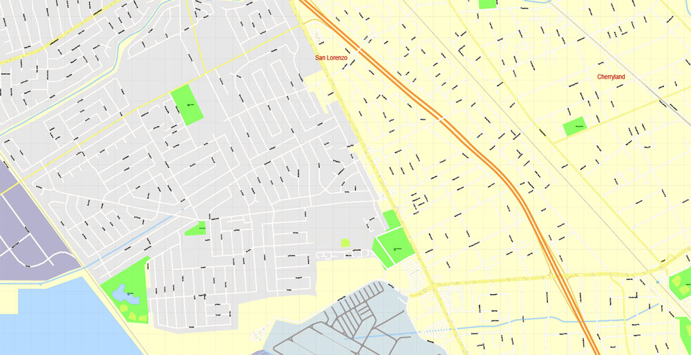
San Leandro California Vector Maps for Business and Education

- Urban plan Nizhny Novgorod
- Urban plan Biertan Romania PDF
- Urban plan Belgrad Serbia pdf
- Urban plan Seattle Washington PDF
- Urban plan Toulon France
- Urban plan Walt Disney World Florida
- Urban plan Orlando Florida CDR
- Urban plan New York Grande
- Urban plan Athens Pireas Greece
- Urban plan Jerusalem Israel Hebrew 12 PDF
- Urban plan Dresden Germany
- Urban plan Mumbai India
- Urban plan Kostroma PDF Russia
- Urban plan Tampa Bay Florida
- Urban plan North East Tasmania CDR
- Urban plan Amsterdam Netherlands 17 AI
- Urban plan Raleigh North Carolina PDF
- Urban plan Golden Gate Park San Francisco PDF
- Urban plan Saint Louis Missouri ai
- Urban plan Tucson Arizona ai
- Urban plan Tuscaloosa Alabama
- Urban plan Bremen Germany
- Urban plan Cincinnati Ohio
- Urban plan Sioux Falls South Dakota
- Urban plan London 4 parts pdf
- Urban plan Toulouse France
- Urban plan Veracruz Mexico
- Urban plan Lipetsk Russia
- Urban plan Baku Azerbaijan PDF
- Urban plan Genova Genoa Italy
- Urban plan Milan Milano Italy
- Urban plan Budapest Hungary
- Urban plan full Italy Roads
- Urban plan Portland Oregon
- Urban plan Vienna Wien Buildings Austria
- Urban plan Osaka Japan
- Urban plan Gothenburg Sweden Goteborg Sverige
- Urban plan Los Angeles
- Urban plan Bruges Brugge Belgium pdf
- Urban plan Ostrava Czech Republic pdf
- Urban plan Dublin Ireland PDF
- Urban plan Hampton Newport News Norfolk Chesapeake Portsmouth Virginia Beach pdf
- Urban plan Victoria Canada pdf
- Urban plan Brasilia City Brazil
- Urban plan Voronezh PDF
- Urban plan Penza PDF Russia
- Urban plan Hungary ai
- Urban plan Baltimore Maryland
- Urban plan Liege Grande Belgium PDF
- Urban plan Relief Spain
- Urban plan Tokyo Japan
- Urban plan Boston
- Urban plan Sioux City Iova ai
- Urban plan ai Finland
- Urban plan Cincinnati Ohio PDF
- Urban plan Milwaukee Wisconsin low
- Urban plan Cincinnati Ohio pdf
- Urban plan Amsterdam Netherlands 13 PDF
- Urban plan Jerusalem Israel pdf
- Urban plan Banyuwangi
- Urban plan Portland Oregon 25
- Urban plan Montpellier France
- Urban plan Namur Belgium ai
- Urban plan Hillsboro Oregon CDR
- Urban plan Santo Domingo 2
- Urban plan Ballarat Australia 17
- Urban plan Raleigh North Carolina
- Urban plan Dublin Ireland
- Urban plan Columbia South Carolina PDF
- Urban plan Terre Haute Indiana pdf
- Urban plan Delray
- Urban plan Kyoto Japan 13 ai
- Urban plan Albury Wodonga Australia 17
- Urban plan Austria Roads
- Urban plan Arcata Eureka California PDF
- Urban plan Bologna Italy pdf
- Urban plan Aarhus Denmark pdf
- Urban plan Port Moresby Papua New Guinea
- Urban plan Prague Czech Republic
- Urban plan Pforzheim Germany ai
- Urban plan Lille France pdf
- Urban plan US Canada Road Mercator
- Urban plan Inari Ivalo Saariselka PDF
- Urban plan Brownsville Texas pdf
- Urban plan Lahore Pakistan
- Urban plan Jerusalem Israel PDF
- Urban plan Miami
- Urban plan Corrientes Resistencia
- Urban plan Sydney Australia
- Urban plan Copenhagen Denmark
- Urban plan Onancock Virginia PDF
- Urban plan Frankfurt Germany ai
- Urban plan Duke University Durham North Carolina SVG
- Urban plan Beijing China PDF 13
- Urban plan World Gall Peters PDF
- Urban plan Karachi Pakistan PDF
- Urban plan Copenhagen Kobenhavn Denmark
- Urban plan Texas Counties