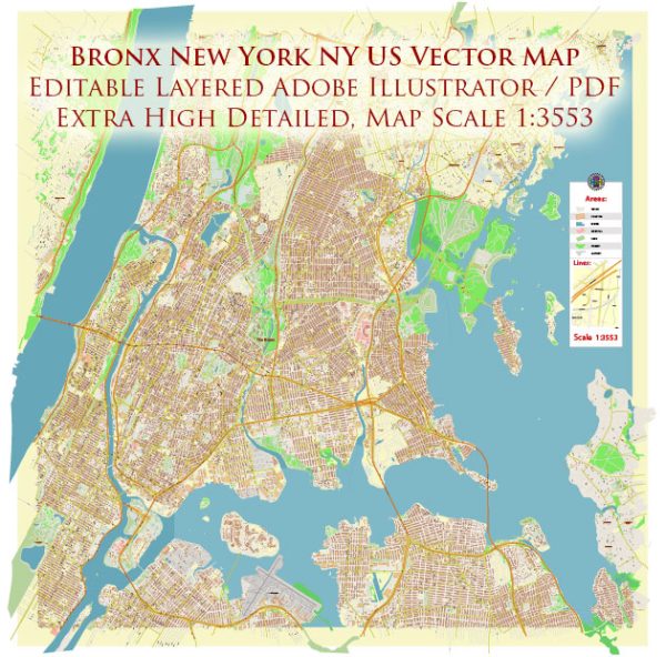
Vector Maps of the Bronx New York City : Bronx, one of the five boroughs of New York City, southeastern New York, U.S.,
coextensive with Bronx county, formed in 1912. The Bronx is the northernmost of the city’s boroughs. It is separated from Manhattan (to the south and west) by the narrow Harlem River and is further bordered by Westchester county (north), the Hudson River (west), the East River (south), and Long Island Sound (east).
The Bronx, the only mainland borough, is connected to Manhattan by a dozen bridges and railroad tunnels and to Queens by the Robert F. Kennedy (formerly called Triborough), Bronx-Whitestone, and Throgs Neck bridges. The site was called Keskeskeck by the Indians
who sold it in 1639 to the Dutch West India Company. In 1641 Jonas Bronck, a Scandinavian, purchased 500 acres (200 hectares). Shortly thereafter religious dissenters and New England settlers moved there, trespassing on Dutch territory. The borough was a part of Westchester
county until 1898, when it was incorporated in the city of New York.
Although the Bronx is primarily residential, much of its waterfront (more than 80 miles [130 km]) is used for shipping, warehouses, and industry (textiles, foods, machinery, and paper products).
The borough’s educational institutions include Fordham University (1841); Manhattan College (1853); Lehman College (1968), a division of the City University of New York; and the Albert Einstein College of Medicine of Yeshiva University. Bronx Park, the New York Zoological Gardens, and Yankee Stadium (home of the New York Yankees baseball team) are in the borough. Area 41 square miles (106 square km).
Instant download archives: royalty free, editable vector maps of Bronx New York City in high resolution digital PDF and Adobe Illustrator format.
All of our editable Bronx New York City vector maps are digital files,
which can be instantly downloaded in editable PDF or Adobe Illustrator format.
Objects on maps are usually divided into layers according to their types – lines, polygons, street names, object names (see map description!!!!)
Each of our Bronx New York City digital maps is available in Adobe Illustrator or editable PDF format, (or on request in any other known format for the same price)
which use a vector approach to display images,
you can easily enlarge any part of our maps without compromising text, line or graphic quality,
with any increase or decrease ratio.
Using a vector graphics editor such as Adobe Illustrator, CorelDraw, Inkscape, or Freehand
you can easily crop parts of the map, add custom characters, and change colors and font attributes as needed.
We have a variety of Bronx New York City vector maps with different levels of detail, from simple empty paths to highly detailed maps with roads and terrain layers.
Don’t see exactly what you’re looking for? Contact us to receive a special offer for an individual Bronx New York City map for your project.


 Author: Kirill Shrayber, Ph.D.