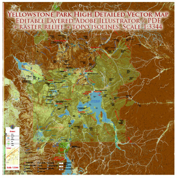
Yellowstone National Park is crisscrossed by a network of roads that provide access to various points of interest, thermal features, wildlife habitats, and scenic vistas. Here are some of the principal roads and notable tourist attractions within Yellowstone:
1. Grand Loop Road:
- The Grand Loop Road is the primary road system in Yellowstone, forming a figure-eight shape. It connects the park’s major attractions, and visitors can access different sections of the park by following its loops.
2. Norris to Mammoth Hot Springs:
- This section of the Grand Loop Road takes visitors from Norris Geyser Basin to Mammoth Hot Springs. Norris Geyser Basin is one of the park’s hottest and most dynamic thermal areas, while Mammoth Hot Springs features terraces of colorful mineral deposits.
3. Mammoth Hot Springs to Tower-Roosevelt:
- This stretch of road takes visitors through the scenic Lamar Valley, known for its wildlife viewing opportunities. Tower-Roosevelt area offers views of the Tower Fall and Calcite Springs.
4. Tower-Roosevelt to Canyon Village:
- The road takes you to the Grand Canyon of the Yellowstone, featuring the iconic Upper and Lower Falls. The South Rim Drive provides stunning viewpoints of the canyon.
5. Canyon Village to Lake Village:
- This part of the loop connects the Grand Canyon of the Yellowstone to Yellowstone Lake. Visitors can explore the Fishing Bridge area and enjoy the picturesque views of the lake.
6. Lake Village to West Thumb:
- West Thumb Geyser Basin is located along Yellowstone Lake. It features hot springs and geysers along the lake’s shoreline.
7. West Thumb to Old Faithful:
- This section takes you to the famous Old Faithful area, where you can witness the regular eruptions of the Old Faithful geyser. The Upper Geyser Basin nearby is home to a high concentration of geothermal features.
8. Old Faithful to Madison Junction:
- This part of the loop connects Old Faithful to Madison Junction, passing through the Firehole Canyon Drive and providing access to various thermal features.
9. Madison Junction to Norris Junction:
- Completing the loop, this section connects Madison Junction back to Norris Junction, passing through the Gibbon Falls area.
Tourist Objects and Points of Interest:
- Old Faithful Geyser: A famous and predictable geyser known for its regular eruptions.
- Grand Prismatic Spring: Located in the Midway Geyser Basin, it is one of the largest hot springs in the world.
- Grand Canyon of the Yellowstone: Features stunning waterfalls and colorful canyon walls.
- Mammoth Hot Springs: Terraces of travertine formations created by geothermal activity.
- Lamar Valley: A prime location for wildlife viewing, including bison, wolves, and bears.
- Yellowstone Lake: The largest high-elevation lake in North America.
- Artist Point: Overlooks the Grand Canyon of the Yellowstone and provides a breathtaking view of the Lower Falls.
- Hayden Valley: Another popular spot for wildlife watching, particularly for bison and elk.
These roads and attractions offer a comprehensive way for visitors to explore the diverse landscapes and natural wonders within Yellowstone National Park.
NOTE:
There were no wolves in the park for 70 years, and all this time deer reigned there, which, over the years of uncontrolled reproduction (all human efforts to control their population were unsuccessful) caused severe damage to the local flora.
Fourteen wolves, of course, could not eat all the deer, but they forced them to choose places for grazing more carefully and avoid certain areas of the park. Vegetation began to revive in those places. In six years, the number of trees has increased fivefold. Beavers have appeared and need trees to build dams.
Muskrats, ducks and fish appeared in the creeks. Wolves reduced the jackal population, which led to an increase in the number of hares and mice, which in turn attracted hawks, ferrets and foxes to the park. Bears came to the park because they were able to drive wolves away from their prey or eat their scraps.
The number of berries in the park has increased.
But the most amazing thing is that the wolves changed the flow of the rivers. Their channels have straightened and stabilized, and bank erosion has decreased.
This happened because the influence of wolves on deer led to the explosive growth of trees and grass along the river banks, which led to their strengthening.
The very geography of the park has changed, and all thanks to fourteen wolves released there less than twenty years ago.


 Author: Kirill Shrayber, Ph.D.