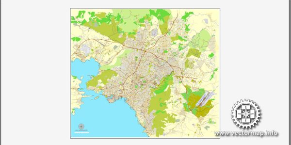
Vector Maps of the Athens : the capital of Greece. It was also at the heart of Ancient Greece, a powerful civilization and empire. The city is still dominated by 5th-century BC landmarks, including the Acropolis, a hilltop citadel topped with ancient buildings like the colonnaded Parthenon temple. The Acropolis Museum, along with the National Archaeological Museum, preserves sculptures, vases, jewelry and more from Ancient Greece.
Area: 38.96 km²
Vector Maps of the Piraeus is a port city within the Athens urban area, in the Attica region of Greece. It is located in the Athens Riviera, 8 kilometers southwest of Athens’ city center, along the east coast of the Saronic Gulf.
Area: 10,865 km²
Download royalty free, editable vector maps of Athens Piraeus Greece in high resolution digital PDF and Adobe Illustrator format.
PDF Map — Athens Piraeus Greece
An editable PDF map of Athens Piraeus Greece designed as a dependable base for print and digital layouts. Layer structure separates arterials and locals, districts, hydrography, parks and landmarks. Named layers let you restyle colors, line weights and label classes without cleanup passes. District and neighborhood labels are arranged to avoid collisions around dense cores. Crisp vectors preserve edges at high DPI and export compactly for web delivery. Waterfronts and parks receive extra separation for better contrast on light palettes.
Use it for visitor guides, city infographics, investment decks and municipal communications. Saves prepress time by reducing manual fixes and keeping the visual system consistent. The map integrates neatly with common DTP and GIS workflows. Reliable as a base layer; easy to adapt when projects or sponsors change. Files remain compact thanks to clean geometry and disciplined labeling.


 Author: Kirill Shrayber, Ph.D.