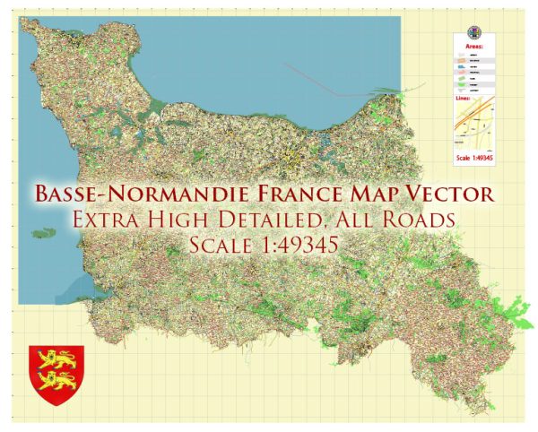
Road System of Normandie France
Normandy, located in northwestern France, has a well-developed road system that provides efficient transportation throughout the region. Here is an overview of the road system in Normandy:
Highways: Normandy is served by several major highways (autoroutes) that connect it to other regions of France and neighboring countries. Some key highways include:
A13: This highway runs from Paris to Caen and continues towards Cherbourg, passing through the heart of Normandy. It provides a direct route from the capital to major cities in Normandy.
A84: This east-west highway connects Caen to Rennes in Brittany, providing an important link between Normandy and western France.
A29: This highway connects Le Havre to Amiens, passing through Rouen and providing a route towards northern France and Belgium.
National Roads: Normandy is also well-connected by a network of national roads (routes nationales) that serve as primary routes within the region. These roads, designated with an “N” followed by a number, provide links between major cities, towns, and rural areas.
Regional and Departmental Roads: Normandy has an extensive network of regional and departmental roads, designated with a “D” followed by a number. These roads connect smaller towns, villages, and rural areas within the region. They offer scenic drives through Normandy’s picturesque countryside, including its charming coastal areas, rolling hills, and historic sites.
Scenic Routes: Normandy is renowned for its natural beauty, cultural heritage, and historical landmarks. Several scenic routes have been designated to showcase these attractions. For example, the Route du Cidre (Cider Route) takes you through the picturesque orchards and cider-producing areas of the Pays d’Auge, while the Route des Abbayes (Abbey Route) leads you to some of the region’s most impressive abbeys and monasteries.
Road Safety: Road safety is a priority in Normandy, as in the rest of France. Speed limits are enforced, and it is important to adhere to traffic laws and regulations. Be aware of specific rules, such as carrying a warning triangle, reflective vests, and an alcohol breathalyzer in the car, as required by French law.
Travel Information: When planning your journey in Normandy, it is advisable to check traffic conditions and any road closures or construction works beforehand. Websites such as Bison Futé (www.bison-fute.gouv.fr) and regional traffic centers provide up-to-date information on road conditions and real-time traffic updates.
The road system in Normandy ensures convenient access to its historic sites, charming towns, picturesque landscapes, and beautiful coastal areas. Whether you are exploring the D-Day landing beaches, visiting the iconic Mont Saint-Michel, or enjoying the scenic drives through the countryside, the road network in Normandy facilitates travel and allows you to discover the region’s unique attractions.
Water Resources of Normandie France
Normandy, located in northwestern France, is endowed with a variety of water resources, including rivers, lakes, estuaries, and a picturesque coastline. Here are some key features of the water resources in Normandy:
Rivers: Normandy is traversed by several rivers that contribute to its water resources and shape the region’s landscapes. The Seine River, one of the longest rivers in France, flows through Normandy, passing through the cities of Rouen and Le Havre. The Seine is a vital waterway for transportation and commerce. Other significant rivers in Normandy include the Orne, Eure, and Risle rivers, which provide water for irrigation, support ecosystems, and offer recreational opportunities such as fishing and boating.
Estuaries: Normandy is home to estuaries, where rivers meet the sea, creating a unique and diverse ecosystem. The Seine Estuary, one of the largest in Europe, is a significant feature of the region. Estuaries serve as a breeding ground for various fish and bird species and provide habitats for other wildlife. They also offer opportunities for recreational activities such as birdwatching and sailing.
Coastal Areas: Normandy boasts a picturesque coastline along the English Channel, characterized by cliffs, sandy beaches, and charming seaside towns. The coastal areas provide not only scenic beauty but also opportunities for swimming, surfing, and other water sports. Normandy’s coastline is known for iconic landmarks such as the white cliffs of Étretat and the historic Mont Saint-Michel, which is surrounded by the sea at high tide.
Lakes and Reservoirs: Normandy features several lakes and reservoirs, both natural and artificial, which contribute to the region’s water resources. These lakes, such as Lake Dathée and Lake Rabodanges, offer opportunities for fishing, boating, and water-based recreational activities. They also serve as sources of freshwater supply and contribute to the region’s biodiversity.
Groundwater: Normandy has significant groundwater resources that are tapped for drinking water supply, agricultural irrigation, and industrial use. The region’s geological composition, including permeable limestone and aquifers, allows for the storage and extraction of groundwater. Sustainable management of groundwater resources is important to ensure their long-term availability.
Water Management: Water resources in Normandy are managed by local authorities, water agencies, and environmental organizations. Their focus is on preserving water quality, protecting aquatic ecosystems, and promoting sustainable water use. Normandy has implemented measures to prevent pollution, manage water distribution, and ensure the efficient and responsible use of water resources.
The diverse water resources in Normandy contribute to the region’s natural beauty, support various economic activities, and provide recreational opportunities for residents and visitors. From the rivers and estuaries to the coastline and lakes, water plays a significant role in shaping the region’s identity and offering enjoyable experiences to those who explore its landscapes.


 Author: Kirill Shrayber, Ph.D. FRGS