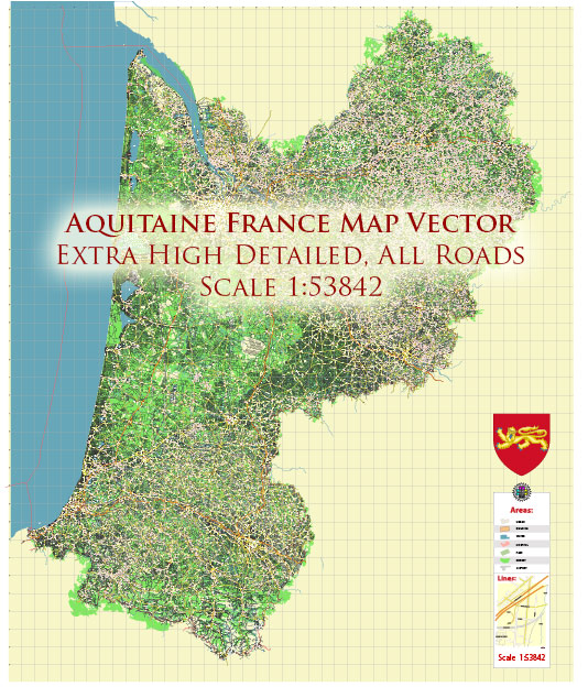
Road System of Nouvelle-Aquitaine France
Nouvelle-Aquitaine is the largest administrative region in France, located in the southwestern part of the country. It encompasses a vast territory and has a well-developed road system that connects its cities, towns, and rural areas. Here is an overview of the road system in Nouvelle-Aquitaine:
Highways: Nouvelle-Aquitaine is served by a network of highways (autoroutes) that provide efficient transportation across the region. Some major highways include:
A10: This highway runs north-south and connects Bordeaux, the largest city in the region, to Paris and other parts of France.
A63: This coastal highway connects Bordeaux to the Basque Country and the Spanish border, passing through popular beach towns such as Biarritz and Saint-Jean-de-Luz.
A89: This east-west highway connects Bordeaux to Lyon, passing through the scenic landscapes of the Dordogne and Périgord regions.
National Roads: Nouvelle-Aquitaine is also served by a network of national roads (routes nationales) that connect major cities and towns within the region. These roads provide alternative routes to highways and serve as important transportation arteries. They are designated with an “N” followed by a number.
Regional and Departmental Roads: Nouvelle-Aquitaine has an extensive network of regional and departmental roads, designated with a “D” followed by a number. These roads connect smaller towns, villages, and rural areas within the region. They offer scenic drives through the diverse landscapes of Nouvelle-Aquitaine, including vineyards, forests, and coastal areas.
Scenic Routes: Nouvelle-Aquitaine is known for its beautiful landscapes, including the Atlantic coastline, the Pyrenees mountains, and the Dordogne River Valley. Scenic routes have been designated to showcase these natural and cultural treasures. Examples include the Route de la Corniche Basque along the Basque Coast and the Route des Vins (Wine Route) in the Bordeaux wine region.
Road Safety: Road safety is a priority in Nouvelle-Aquitaine, as in the rest of France. Speed limits are strictly enforced, and it is important to adhere to traffic laws and regulations. Be aware of specific rules, such as carrying a warning triangle, reflective vests, and an alcohol breathalyzer in the car, as required by French law.
Travel Information: When planning your journey in Nouvelle-Aquitaine, it is advisable to check traffic conditions and any road closures or construction works beforehand. Websites such as Bison Futé (www.bison-fute.gouv.fr) and regional traffic centers provide up-to-date information on road conditions and real-time traffic updates.
The road system in Nouvelle-Aquitaine provides convenient access to its diverse landscapes, vibrant cities, and cultural attractions. Whether you are exploring the wine regions, enjoying coastal towns, or visiting historical sites, the road network in Nouvelle-Aquitaine facilitates travel and allows you to discover the region’s unique charms.
Water Resources of Nouvelle-Aquitaine France
Nouvelle-Aquitaine is known for its diverse and abundant water resources. The region is home to rivers, lakes, estuaries, and coastal areas that contribute to its natural beauty and support various activities. Here are some key features of the water resources in Nouvelle-Aquitaine:
Rivers: Nouvelle-Aquitaine is crossed by several significant rivers that shape the region’s landscape and provide water resources. The Garonne River, running through Bordeaux, is one of the main rivers in the region. It is navigable and serves as an essential waterway for transportation and commerce. Other major rivers include the Dordogne River, the Charente River, and the Adour River. These rivers support agriculture, fishing, and water-based recreation.
Coastal Areas: Nouvelle-Aquitaine has a long coastline along the Bay of Biscay, providing access to the Atlantic Ocean. Coastal areas such as the Côte d’Argent offer sandy beaches, dunes, and opportunities for swimming, surfing, and other water sports. The region’s estuaries, including the Gironde Estuary, are ecologically rich areas where rivers meet the sea, supporting diverse marine and birdlife.
Lakes: Nouvelle-Aquitaine is home to several lakes, both natural and artificial, that add to the region’s water resources and offer recreational opportunities. The largest lake in France, Lake Hourtin-Carcans, is located in Nouvelle-Aquitaine and attracts visitors for swimming, boating, and fishing. Other notable lakes include Lake Cazaux-Sanguinet and Lake Vassivière.
Wetlands: Nouvelle-Aquitaine is characterized by a variety of wetland areas, including marshes, swamps, and lagoons. These wetlands provide important habitats for plant and animal species, contribute to biodiversity, and serve as nesting grounds for migratory birds. The Marais Poitevin, also known as the Green Venice, is a vast wetland area that offers scenic boat tours.
Aquifers and Groundwater: Nouvelle-Aquitaine benefits from extensive aquifers and groundwater resources. The region’s geological composition, including limestone and sandstone formations, allows for the presence of underground water reserves. These resources are tapped for drinking water supply, agriculture, and industry, ensuring a reliable water source for the region.
Water Management: Water resources in Nouvelle-Aquitaine are managed by local authorities, water agencies, and environmental organizations. Their focus is on preserving water quality, protecting aquatic ecosystems, and promoting sustainable water use. Initiatives are in place to monitor water resources, manage water distribution, and implement measures for water conservation and protection.
The diverse water resources in Nouvelle-Aquitaine contribute to the region’s natural beauty, support various economic activities, and offer recreational opportunities. From the rivers and lakes to the coastal areas and wetlands, water plays a crucial role in shaping the region’s identity and providing enjoyment for residents and visitors alike.


 Author: Kirill Shrayber, Ph.D.