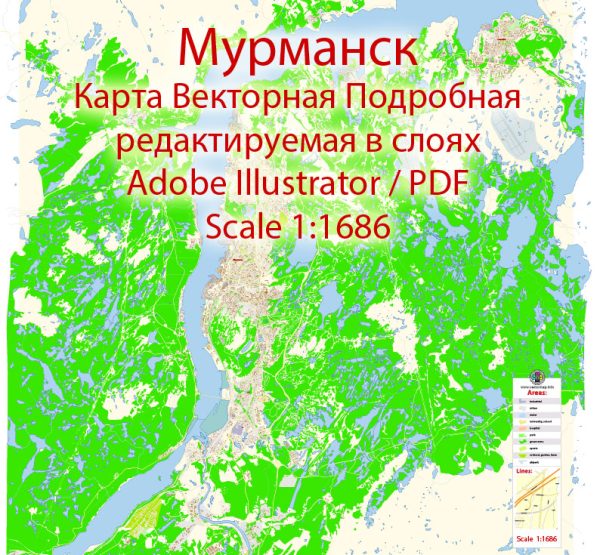
Murmansk, a major port city in Russia’s Arctic region, is divided into several districts, each with its own character and significance.
Vectormap.Net provide you with the most accurate and up-to-date vector maps in Adobe Illustrator, PDF and other formats, designed for editing and printing. Please read the vector map descriptions carefully.
Here’s a detailed overview of Murmansk’s districts, communities, and main streets:
Districts and Communities of Murmansk
1. Central District
- Description:
- The Central District is the heart of Murmansk, encompassing the city center and key administrative and commercial areas. It is characterized by its mix of historical buildings, modern infrastructure, and cultural institutions.
- Key Areas:
- Leninsky Prospekt: One of the main thoroughfares in the Central District, featuring a mix of residential, commercial, and administrative buildings.
- Murmansk City Administration: Located in the Central District, this area houses key government offices and municipal facilities.
- Kirov Square: A prominent public space that serves as a focal point for civic activities and cultural events.
2. Leninsky District
- Description:
- Named after the prominent Soviet leader Vladimir Lenin, the Leninsky District is a primarily residential area with a mix of old and new housing. It is known for its family-friendly environment and local amenities.
- Key Areas:
- Prospekt Lenina: The main street running through the district, lined with residential buildings, shops, and services.
- Sovetsky District: An area within Leninsky District, known for its schools, parks, and local community centers.
- Yugo-Zapad: A residential neighborhood in the Leninsky District, featuring a mix of Soviet-era and modern apartment buildings.
3. Oktyabrsky District
- Description:
- The Oktyabrsky District is known for its industrial and commercial activities, as well as residential areas. It includes a significant portion of Murmansk’s industrial zone, with factories and warehouses.
- Key Areas:
- Gogolya Street: A major road in the Oktyabrsky District, featuring various industrial facilities and commercial enterprises.
- Aviakonstruktorov Street: Another key street in the district, known for its proximity to industrial areas and transportation links.
- Vostok: A neighborhood within the Oktyabrsky District, primarily residential and home to local amenities.
4. Kola District
- Description:
- The Kola District is located to the east of the city center and is known for its residential areas and proximity to the Kola Bay. It is a mix of residential and industrial zones.
- Key Areas:
- Kola Bay: The bay is an important geographical feature and economic asset for the city, with various maritime activities taking place in this area.
- Kola Street: A significant road in the Kola District, connecting residential areas to the port and industrial zones.
- Sovetsky District: A part of Kola District, known for its community facilities and residential buildings.
5. Severny District
- Description:
- The Severny District is located to the north of the city and is known for its residential areas and proximity to the natural landscapes of the Kola Peninsula. It is one of the more suburban areas of Murmansk.
- Key Areas:
- Severny Prospekt: A major road running through the district, providing access to residential neighborhoods and local services.
- Ski Resorts and Recreation Areas: The district is near several recreational facilities, including ski resorts and nature parks, popular during the winter months.
Main Streets of Murmansk
1. Prospekt Lenina
- Description: One of Murmansk’s principal streets, Prospekt Lenina runs through the heart of the city, connecting various districts and serving as a major commercial and administrative thoroughfare.
- Features: Lined with shops, offices, and historical buildings, it is a key route for both local and through traffic.
2. Leninsky Prospekt
- Description: This street is a major thoroughfare in the Central District, featuring a mix of residential, commercial, and institutional buildings.
- Features: It is home to several government buildings and is a central part of the city’s infrastructure.
3. Gogolya Street
- Description: A key street in the Oktyabrsky District, known for its industrial and commercial significance.
- Features: It connects various industrial facilities and is an important route for logistics and transportation.
4. Aviakonstruktorov Street
- Description: Another major road in the Oktyabrsky District, serving as a link between residential areas and industrial zones.
- Features: The street is important for local traffic and transportation, with various businesses and services located along it.
5. Kola Street
- Description: A significant road in the Kola District, providing access to residential areas and the port.
- Features: It is a key route for accessing the Kola Bay and industrial facilities in the area.
6. Severny Prospekt
- Description: A major road in the Severny District, known for its suburban character and access to recreational areas.
- Features: It connects residential neighborhoods with nature parks and ski resorts, offering scenic views and access to outdoor activities.
Summary
Murmansk is a diverse city with a variety of districts each serving different functions, from industrial and commercial areas to residential and recreational zones. Main streets like Prospekt Lenina, Leninsky Prospekt, and Gogolya Street are central to the city’s transportation and economic activities, while areas like Kola Bay and Severny District offer access to natural landscapes and recreational facilities. The city’s layout reflects its historical development and strategic importance in the Arctic region.


 Author: Kirill Shrayber, Ph.D. FRGS