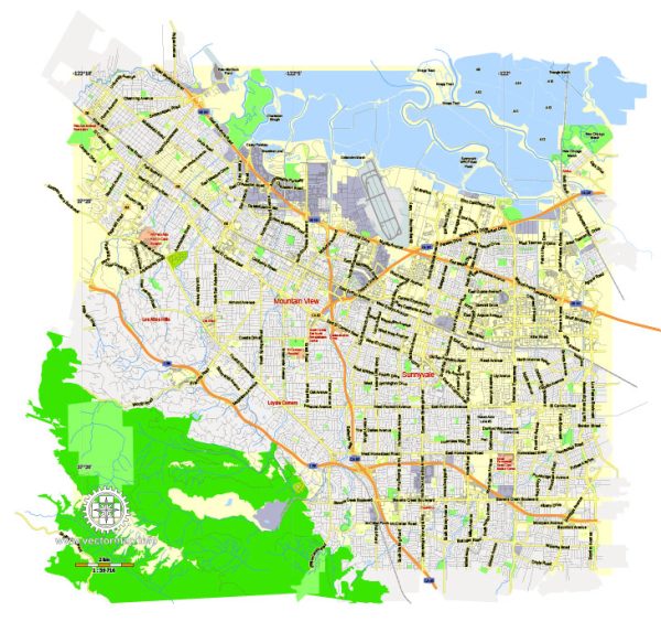
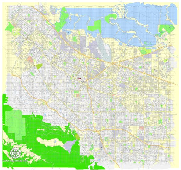
Mountain View, California, has a rich urban history that reflects the broader trends of development in Silicon Valley. From its early days as an agricultural community to its transformation into a hub for technology and innovation, the city’s evolution is mirrored in its street system and urban planning.
Vectormap.Net provide you with the most accurate and up-to-date vector maps in Adobe Illustrator, PDF and other formats, designed for editing and printing. Please read the vector map descriptions carefully.
Here’s a detailed look at the urban history and street system of Mountain View:
Urban History of Mountain View
Early History and Founding (19th Century)
- Origins:
- Mountain View was originally inhabited by the Ohlone people before European settlers arrived in the 18th century. The area that would become Mountain View was part of the Rancho Pastoria de las Borregas land grant given to Mariano Castro in 1842 during the Mexican era of California.
- The city’s name, “Mountain View,” likely comes from its views of the Santa Cruz Mountains. It was established in 1852 as a stagecoach stop between San Francisco and San Jose.
- Agricultural Community:
- In its early years, Mountain View was predominantly an agricultural community, with orchards, vineyards, and ranches. The fertile land made it ideal for growing fruit, particularly apricots, cherries, and prunes. The area’s development was closely tied to the agricultural industry, which played a central role in its economy for much of the 19th century.
- Arrival of the Railroad:
- The arrival of the Southern Pacific Railroad in 1864 was a pivotal moment in Mountain View’s development. The railroad brought increased connectivity, enabling farmers to ship their produce to markets more efficiently and encouraging more settlers to move to the area. The town grew around the railroad station, which became the focal point of early urban development.
Growth and Development (Early 20th Century)
- Incorporation as a City:
- Mountain View was officially incorporated as a city in 1902. By this time, it had established itself as a small but thriving community, with a growing population and a downtown area centered around Castro Street, which remains the city’s main thoroughfare.
- Suburbanization:
- The early 20th century saw Mountain View begin to transition from a rural community to a more suburban area. The development of residential neighborhoods expanded as more people moved to the area, attracted by its climate and proximity to larger cities like San Francisco and San Jose.
- Military Influence:
- During World War II, the establishment of Moffett Field Naval Air Station just north of Mountain View brought significant changes to the area. The airfield’s presence spurred economic growth and led to the development of housing for military personnel and their families. This period also marked the beginning of Mountain View’s association with high-tech industries, as the airfield attracted related industries and research facilities.
Post-War Boom and Silicon Valley Era (1950s-1980s)
- Post-War Suburban Boom:
- After World War II, Mountain View experienced rapid suburbanization. The population grew significantly as new housing developments were built to accommodate returning veterans and their families. The city’s layout expanded with new residential neighborhoods, schools, and shopping centers.
- During the 1950s and 1960s, Mountain View, like many other American cities, developed a car-centric infrastructure, with wide streets, ample parking, and suburban-style homes. The city’s grid pattern began to take shape during this period, with major arterials like El Camino Real and Shoreline Boulevard becoming important connectors.
- Rise of Silicon Valley:
- The 1960s and 1970s marked the beginning of Mountain View’s transformation into a key player in what would become Silicon Valley. The growth of the technology industry in nearby Palo Alto and Sunnyvale had a spillover effect on Mountain View. The establishment of companies like Shockley Semiconductor Laboratory and Fairchild Semiconductor in the area laid the groundwork for the city’s future as a tech hub.
- During the 1980s, more tech companies, including some of the earliest computer firms, established offices in Mountain View. The city’s proximity to Stanford University and other research institutions made it an attractive location for tech startups and established firms alike.
Modern Era (1990s-Present)
- Tech Boom and Urban Growth:
- The 1990s and 2000s saw Mountain View’s complete transformation into a modern city at the heart of Silicon Valley. Google, which was founded in 1998, established its headquarters (the Googleplex) in Mountain View, bringing unprecedented growth and global attention to the city.
- The influx of tech companies led to significant urban development, including the construction of new office buildings, residential complexes, and commercial areas. The city’s infrastructure was upgraded to accommodate the growing population and the demands of the tech industry.
- Downtown Mountain View, particularly Castro Street, became a vibrant area with a mix of historic buildings and new developments, featuring restaurants, shops, and cultural venues.
- Sustainability and Innovation:
- In recent years, Mountain View has focused on sustainable urban development, including initiatives to reduce carbon emissions, promote public transportation, and create green spaces. The city has embraced innovative urban planning practices to accommodate continued growth while maintaining a high quality of life for residents.
Street System of Mountain View
Grid Pattern and Major Roads
- Grid Layout:
- Mountain View’s street system primarily follows a grid pattern, especially in its older neighborhoods like Downtown, Old Mountain View, and Shoreline West. The grid pattern is a common feature of American suburban development, allowing for easy navigation and efficient use of space.
- Principal Roads:
- El Camino Real (State Route 82):
- One of the oldest and most significant roads in California, El Camino Real runs through Mountain View and serves as a major commercial corridor. It connects Mountain View to neighboring cities and is lined with a mix of shops, restaurants, and residential buildings.
- Shoreline Boulevard:
- A major north-south route that begins near the city center and extends northward to the Shoreline Amphitheatre, Shoreline Park, and Googleplex. This road is crucial for accessing the city’s major tech campuses and recreational areas.
- Central Expressway:
- Running parallel to the Caltrain railway line, Central Expressway is an important east-west route that provides a fast connection between Mountain View and nearby cities like Sunnyvale and Santa Clara. It’s a key road for commuters, particularly those working in the tech industry.
- Rengstorff Avenue:
- Another important north-south route that connects residential areas with commercial and industrial zones. Rengstorff Avenue intersects with major roads like El Camino Real and Central Expressway, serving as a key connector within the city.
- El Camino Real (State Route 82):
Residential Streets and Neighborhoods
- Residential Streets:
- Residential neighborhoods in Mountain View are characterized by quieter, narrower streets compared to the major arterials. These streets often feature sidewalks, street parking, and traffic-calming measures like speed bumps and roundabouts to ensure safety.
- Old Mountain View:
- Features a mix of historic homes and modern residences, with streets designed to maintain the neighborhood’s charm and walkability.
- Monta Loma and Waverly Park:
- Suburban neighborhoods with mid-century homes, where streets are designed for low traffic and provide easy access to local schools and parks.
Bicycle and Pedestrian Infrastructure
- Bike Lanes and Trails:
- Mountain View is known for being a bike-friendly city, with dedicated bike lanes on major streets like Shoreline Boulevard and Middlefield Road. The city also has several multi-use trails, including the Stevens Creek Trail, which provides a scenic route for cyclists and pedestrians through natural areas and parks.
- Pedestrian-Friendly Areas:
- Downtown Mountain View, particularly Castro Street, is designed to be pedestrian-friendly, with wide sidewalks, pedestrian crossings, and public spaces that encourage walking. The area hosts regular community events, farmers’ markets, and festivals, making it a vibrant part of the city’s street life.
Freeway Access and Connectivity
- U.S. Route 101 (Bayshore Freeway):
- U.S. 101 is a major freeway running along the western coast of the United States. In Mountain View, it provides a crucial north-south connection, linking the city to San Francisco to the north and San Jose to the south. The freeway is essential for regional connectivity, particularly for tech commuters.
- State Route 85 (West Valley Freeway):
- SR 85 runs through the western part of Mountain View, providing an alternative route for traffic between San Jose and the Peninsula. It connects with U.S. 101 and Interstate 280, offering residents and commuters multiple options for travel.
- Interstate 280 (Junipero Serra Freeway):
- While I-280 does not pass directly through Mountain View, it is nearby and provides a scenic and fast route for north-south travel through the Peninsula. It’s often used as an alternative to U.S. 101 for those traveling to San Francisco.
Urban Planning and Modern Development
- Downtown Revitalization:
- The revitalization of Downtown Mountain View, particularly Castro Street, has been a focal point of the city’s urban planning efforts. The area combines historic preservation with modern development, creating a vibrant mixed-use district that attracts both residents and visitors.
- Sustainable Development:
- Recent urban planning in Mountain View has emphasized sustainability, with initiatives to reduce car dependency, increase public transportation use, and create more green spaces. The city’s street system has been adapted to support these goals, with more bike lanes, pedestrian-friendly areas, and electric vehicle charging stations.
- Tech Campus Influence:
- The presence of major tech companies like Google has influenced the


 Author: Kirill Shrayber, Ph.D. FRGS