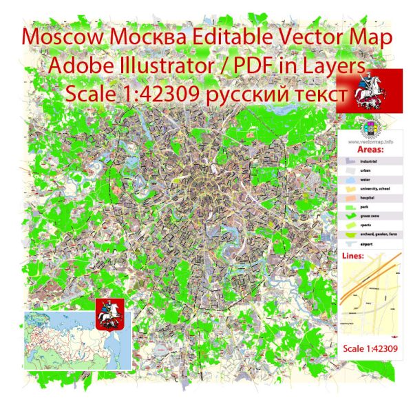
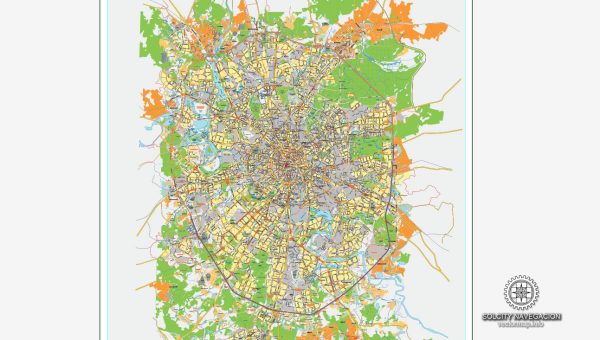
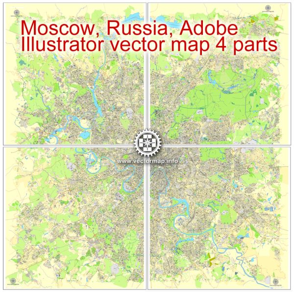
Moscow, the capital of Russia, has an extensive and complex network of roads and railways, which are integral to the city’s transportation infrastructure.
Vectormap.Net provide you with the most accurate and up-to-date vector maps in Adobe Illustrator, PDF and other formats, designed for editing and printing. Please read the vector map descriptions carefully.
Here’s a detailed overview:
Road Infrastructure
- Ring Roads:
- MKAD (Moscow Automobile Ring Road): This is the outermost ring road encircling Moscow, spanning approximately 108.9 kilometers (67.7 miles). It forms a major arterial route for traffic entering or bypassing the city.
- Third Ring Road: Located closer to the city center than MKAD, the Third Ring Road is a critical highway that connects several districts and key points within the city. It’s heavily trafficked and often serves as a demarcation line for different areas of Moscow.
- Garden Ring (Sadovoe Koltso): This road is even closer to the center and passes through some of Moscow’s most historical areas. It was originally the boundary of the city in the 18th century and now acts as a vital traffic artery for inner-city movement.
- Boulevard Ring: The innermost of the rings, this road runs through central Moscow, passing many of the city’s cultural landmarks. It’s more of a scenic route than a major highway, offering beautiful views of historic sites.
- Radial Roads:
- Leninsky Avenue: One of the longest avenues in Moscow, it extends from the center of the city southward. It is a major thoroughfare that connects the city with the southern regions.
- Leningradsky Avenue: This road connects the city center with the northwest, leading towards Saint Petersburg. It’s a vital link to Moscow’s airports and northern regions.
- Kashirskoye Highway: This is a major route leading from the city center to the southern outskirts, and beyond to the southern regions of Russia.
- Kutuzovsky Avenue: A major radial road that runs westward, it is known for its wide lanes and the presence of major government buildings along its route.
- Prospect Mira: Connecting the northeastern parts of the city with the center, this avenue passes by several key landmarks and is crucial for access to the Moscow Ring Railway.
- Bridges and Tunnels:
- Moscow River Bridges: Numerous bridges cross the Moscow River, including the Bolshoy Moskvoretsky Bridge near the Kremlin, and the Luzhniki Bridge, which supports both road and metro traffic.
- Lefortovo Tunnel: One of the longest urban tunnels in Europe, it passes beneath several districts and is part of the Third Ring Road.
- Traffic and Parking:
- Moscow’s roads are often congested, especially during peak hours. The city has implemented paid parking zones in the central areas to manage traffic, along with a growing system of parking garages.
Railroad Infrastructure
- Moscow Metro:
- Overview: The Moscow Metro is one of the busiest and most extensive metro systems in the world. It consists of 15 lines, over 250 stations, and a total track length of more than 400 kilometers (248 miles).
- Ring Lines: The Koltsevaya Line (Line 5) is a circular metro line that encircles the city center and connects to most of the radial lines, making it a critical hub for transfers.
- Radial Lines: Numerous metro lines radiate out from the city center to the outskirts, connecting different districts and integrating with the broader transport network.
- New Lines and Extensions: Moscow has been expanding its metro system, including the construction of the Large Circle Line (Bolshaya Koltsevaya Line), which will become one of the longest circular metro lines in the world.
- Suburban and Intercity Rail:
- Moscow Central Circle (MCC): This is an urban commuter rail line that circles the city, connecting to metro and suburban rail services. It’s part of the city’s public transport system and is integrated with the metro for seamless transfers.
- Moscow Central Diameters (MCD): These are a set of suburban train lines that run through Moscow, providing direct links between distant parts of the city and the surrounding Moscow Oblast. They function like the RER in Paris or the S-Bahn in Berlin.
- Suburban Rail Services: Moscow’s suburban trains (elektrichkas) connect the city with its surrounding regions, operating from nine major railway terminals (e.g., Leningradsky, Kazansky, Yaroslavsky, and others). These are critical for daily commuters.
- High-Speed Rail: The Sapsan high-speed train operates between Moscow and Saint Petersburg, with plans for additional high-speed rail connections to other major Russian cities.
- Railway Terminals:
- Major Terminals: Moscow has nine main railway terminals (vokzals), each serving different regions of Russia and international destinations. These include:
- Leningradsky Railway Station: Serving northwest routes, including Saint Petersburg.
- Kazansky Railway Station: Serving southeast routes, including Kazan and the Volga region.
- Yaroslavsky Railway Station: The start of the Trans-Siberian Railway, serving eastern routes towards Siberia and the Far East.
- Interchange Hubs: Stations like Komsomolskaya, where Leningradsky, Kazansky, and Yaroslavsky terminals are located, form key interchange hubs for both local and long-distance travel.
- Major Terminals: Moscow has nine main railway terminals (vokzals), each serving different regions of Russia and international destinations. These include:
- Freight Rail:
- Freight Terminals: Moscow has a number of freight rail terminals that handle a significant volume of goods, making it a critical logistics hub for Russia. The city is served by several large rail yards, including the Kuntsevo and Biryulevo rail yards.
- Rail Connections: Moscow is well-connected to the national and international rail freight networks, playing a pivotal role in the distribution of goods throughout Russia and beyond.
Future Developments:
- Moscow continues to expand its transportation infrastructure with new metro lines, road projects, and railway upgrades. Major projects include the extension of the metro system, the expansion of the MCC and MCD lines, and improvements to road connectivity to ease traffic congestion.
Moscow’s transportation network is one of the most comprehensive in the world, reflecting the city’s status as Russia’s capital and its largest metropolis. The system is constantly evolving to meet the demands of its growing population and economic activities.

 Author: Kirill Shrayber, Ph.D. FRGS