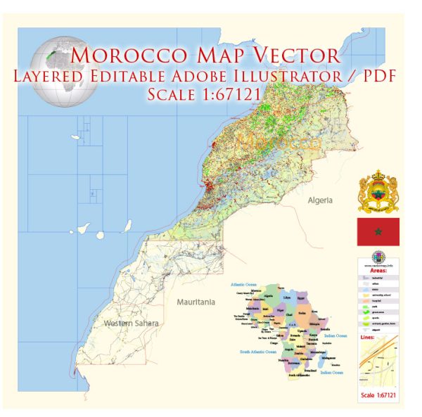
Morocco is a country with a rich cultural heritage and diverse landscapes.
Vectormap.Net provide you with the most accurate and up-to-date vector maps in Adobe Illustrator, PDF and other formats, designed for editing and printing. Please read the vector map descriptions carefully.
Here’s an overview of its principal cities, towns, and main roads:
Principal Cities and Towns
- Rabat:
- Description: The capital city of Morocco, located on the Atlantic coast. Rabat is known for its historical landmarks, including the Royal Palace, the Hassan Tower, and the Mausoleum of Mohammed V. The city is also a center of government and culture.
- Casablanca:
- Description: Morocco’s largest city and economic hub, situated on the Atlantic coast. Casablanca is known for its modern architecture, including the Hassan II Mosque, one of the largest mosques in the world. The city is a major port and commercial center.
- Marrakech:
- Description: A historic city in central Morocco famous for its vibrant souks, the medina (old city), and landmarks such as the Koutoubia Mosque and the Jardin Majorelle. Marrakech is a major tourist destination known for its rich cultural experiences.
- Fes (Fez):
- Description: An ancient city in northern Morocco known for its well-preserved medieval architecture, including the Fes el-Bali medina, a UNESCO World Heritage Site. Fes is also renowned for its traditional crafts and historic university, Al Quaraouiyine.
- Tangier:
- Description: A port city in northern Morocco, located on the Strait of Gibraltar. Tangier is known for its international influence, historical sites, and vibrant arts scene. The city serves as a gateway between Europe and Africa.
- Agadir:
- Description: A coastal city in southern Morocco, known for its modern beachfront and tourist resorts. Agadir is a popular destination for its sandy beaches, marine activities, and temperate climate.
- Ouarzazate:
- Description: Often referred to as the “Gateway to the Sahara,” Ouarzazate is located in southern Morocco and is known for its film studios and the nearby Ait Benhaddou, a historic ksar (fortified village) and UNESCO World Heritage Site.
- Essaouira:
- Description: A historic port city on the Atlantic coast known for its well-preserved medina, sea views, and relaxed atmosphere. Essaouira is a UNESCO World Heritage Site and popular for its arts and crafts, as well as its seafood.
Main Roads
- Autoroute A1:
- Description: A major motorway connecting Casablanca to Rabat. It is an important route for travel between these two key cities and supports both passenger and freight traffic.
- Autoroute A2:
- Description: This motorway connects Tangier with Casablanca, passing through cities such as Kenitra. It facilitates travel between the northern and central parts of Morocco.
- Autoroute A3:
- Description: Running from Casablanca to Marrakech, this motorway connects the economic center of Morocco with one of its most popular tourist destinations.
- Autoroute A4:
- Description: A motorway connecting Rabat with the northern city of Tangier. It serves as a key route for travel between the capital and northern Morocco.
- N1 Road:
- Description: A major national road running along the Atlantic coast from Tangier in the north to Agadir in the south. It provides access to several coastal cities and towns.
- N9 Road:
- Description: This road connects Marrakech with Ouarzazate, passing through the Atlas Mountains. It is a scenic route that provides access to southern Morocco and the Sahara region.
- N13 Road:
- Description: Running through the Rif Mountains, this road connects Fes with the northern town of Chefchaouen and provides access to the mountainous regions of northern Morocco.
- N10 Road:
- Description: Connecting Agadir with Ouarzazate, this road travels through the Anti-Atlas Mountains and provides access to various desert and mountain regions.
Morocco’s transportation network supports its diverse geography and economic activities, linking its historic cities, modern urban centers, and scenic regions. The major roads and highways facilitate travel and trade across the country, while the principal cities and towns offer a rich blend of culture, history, and modern amenities.


 Author: Kirill Shrayber, Ph.D. FRGS