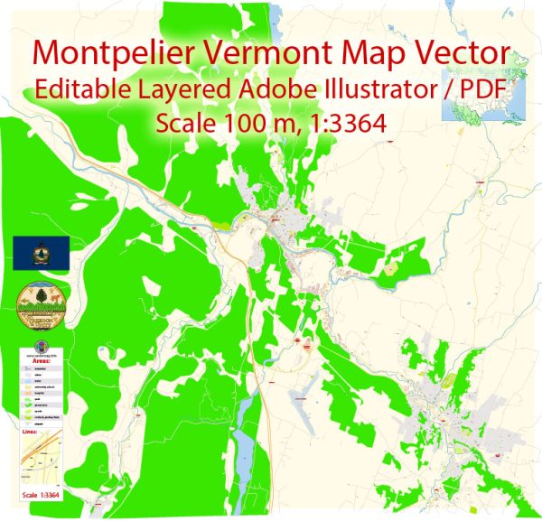
Montpelier, Vermont, the state capital, is known for its small-town charm and historical significance.
Vectormap.Net provide you with the most accurate and up-to-date vector maps in Adobe Illustrator, PDF and other formats, designed for editing and printing. Please read the vector map descriptions carefully.
Here’s an overview of its principal streets, roads, and key attractions:
Principal Streets and Roads
- State Street:
- Description: A central thoroughfare running through downtown Montpelier, State Street is home to many of the city’s government buildings, including the Vermont State House. It is also lined with shops, restaurants, and historic buildings.
- Main Street:
- Description: Another major street in Montpelier, Main Street runs parallel to State Street and features a variety of local businesses, dining options, and cultural attractions. It is a key commercial area in the city.
- Northfield Street:
- Description: A significant road leading out of Montpelier to the neighboring town of Northfield. It provides access to various residential areas and connects to major highways.
- Blanchard Street:
- Description: A local street that intersects with Main Street and provides access to residential neighborhoods and local businesses.
- Elm Street:
- Description: Runs parallel to State Street and Main Street, providing access to various parts of the downtown area and residential neighborhoods.
City Attractions
- Vermont State House:
- Description: The seat of Vermont’s government, the State House is a historic building located on State Street. It features distinctive architecture with a gold-domed roof and offers tours to visitors interested in Vermont’s political history.
- Hubbard Park:
- Description: A large public park located near downtown Montpelier, Hubbard Park offers scenic trails, picnic areas, and a historic observation tower. It is a popular spot for outdoor activities and enjoying nature.
- Montpelier City Hall:
- Description: An historic building located on Main Street, City Hall hosts various municipal functions and serves as a center for local government activities.
- T.W. Wood Gallery and Arts Center:
- Description: Located on Main Street, this gallery features exhibitions of local and regional art, as well as historical artifacts. It plays a key role in promoting the arts in Montpelier.
- Vermont History Museum:
- Description: Situated in the Pavilion Building on State Street, this museum offers exhibits and collections related to Vermont’s history and culture.
- Montpelier Historical Society Museum:
- Description: Located in the historic Kellogg-Hubbard Library building, this museum offers exhibits on the history of Montpelier and its development over the years.
- Kellogg-Hubbard Library:
- Description: A historic library on Main Street offering a variety of programs and resources for the community. It is also known for its beautiful architecture and historical significance.
- Lost Nation Theater:
- Description: A local theater located in downtown Montpelier, known for its productions of classic and contemporary plays. It is a key part of the city’s cultural scene.
- Montpelier Farmers’ Market:
- Description: Held in downtown Montpelier, the farmers’ market features local produce, crafts, and goods from regional vendors. It is a popular spot for shopping and community interaction.
- Morse Farm Maple Sugarworks:
- Description: Located just outside Montpelier, Morse Farm offers tours and demonstrations on maple syrup production, along with a gift shop featuring maple products.
Montpelier’s blend of historical landmarks, cultural institutions, and outdoor spaces makes it a unique and appealing destination for visitors and residents alike. The city’s compact size and vibrant community contribute to its charm and character.


 Author: Kirill Shrayber, Ph.D. FRGS