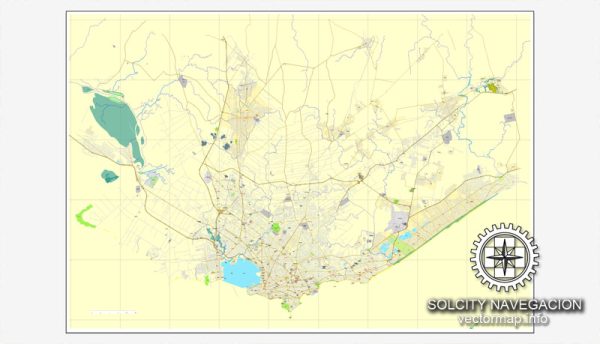
Montevideo, the capital city of Uruguay, is known for its rich cultural heritage, vibrant neighborhoods, and scenic coastal views.
Vectormap.Net provide you with the most accurate and up-to-date vector maps in Adobe Illustrator, PDF and other formats, designed for editing and printing. Please read the vector map descriptions carefully.
Here’s an overview of its principal streets, roads, and key attractions:
Principal Streets and Roads
- Avenida 18 de Julio: One of Montevideo’s main thoroughfares, Avenida 18 de Julio runs east-west through the city center. It is lined with shops, restaurants, and historic buildings, and serves as a major commercial and cultural artery.
- Avenida Libertador: This major avenue runs parallel to the coastline, providing scenic views of the Rio de la Plata. It connects various neighborhoods and features several important landmarks.
- Avenida Brasil: A significant north-south road that connects Montevideo with the suburbs and provides access to various residential and commercial areas.
- Avenida General Flores: This avenue is a key route for connecting different parts of the city and features a mix of residential and commercial establishments.
- Rambla of Montevideo (Rambla República Argentina): A prominent coastal road that stretches along the waterfront, offering stunning views of the Rio de la Plata. It is popular for jogging, cycling, and leisurely walks.
City Attractions
- Ciudad Vieja (Old City): The historic district of Montevideo, featuring colonial-era architecture, cobblestone streets, and landmarks such as the Plaza Independencia, where the iconic Solís Theatre is located.
- Plaza Independencia: The main square in Montevideo, which marks the transition between the old city and the new city. It features the statue of Artigas, a prominent Uruguayan national hero, and is surrounded by important buildings and monuments.
- Palacio Salvo: An iconic skyscraper located on Plaza Independencia, known for its distinctive architectural style and historic significance.
- Museo Nacional de Artes Visuales (National Museum of Visual Arts): A museum housing a significant collection of Uruguayan art, including works by notable artists such as Pedro Figari and Joaquín Torres García.
- Parque Rodó: A large urban park offering green spaces, walking paths, and a lake. It’s a popular spot for outdoor activities and relaxation.
- Mercado del Puerto: A bustling market known for its lively atmosphere and diverse selection of food stalls, restaurants, and shops. It’s a great place to sample traditional Uruguayan cuisine and experience local culture.
- Montevideo’s Rambla: The scenic coastal promenade that stretches for several kilometers along the Rio de la Plata. It’s ideal for walking, cycling, and enjoying views of the water.
- Museo del Carnaval: A museum dedicated to the history and traditions of Uruguayan Carnival, featuring costumes, masks, and exhibits about the vibrant festival.
- Estadio Centenario: The national stadium of Uruguay, known for its historic significance in international football. It hosted the first FIFA World Cup in 1930.
- Jardín Botánico (Botanical Garden): A peaceful retreat showcasing a variety of plant species, gardens, and green spaces. It offers a tranquil environment for visitors to enjoy nature.
Montevideo’s blend of historic charm, cultural attractions, and scenic coastal areas make it a dynamic and appealing destination for residents and visitors alike.


 Author: Kirill Shrayber, Ph.D. FRGS