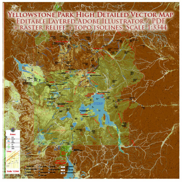
Yellowstone National Park is home to several mountain ranges and canyons, each contributing to the park’s diverse and picturesque landscape.
Vectormap.Net provide you with the most accurate and up-to-date vector maps in Adobe Illustrator, PDF and other formats, designed for editing and printing. Please read the vector map descriptions carefully.
Here are some of the notable mountains and canyons in Yellowstone:
Mountains:
- Absaroka Range:
- The Absaroka Range runs along the eastern boundary of Yellowstone National Park. This mountain range is known for its rugged terrain and diverse wildlife.
- Emigrant Peak is one of the prominent peaks in the Absaroka Range.
- Gallatin Range:
- Situated to the northwest of the park, the Gallatin Range offers stunning vistas and is known for its alpine scenery.
- Electric Peak, part of the Gallatin Range, is one of the higher peaks in the park.
- Beartooth Mountains:
- Although the Beartooth Mountains are located just northeast of the park, they influence the landscape and add to the overall mountainous character of the region.
- Granite Peak, the highest point in Montana, is part of the Beartooth Range.
Canyons:
- Grand Canyon of the Yellowstone:
- Carved by the Yellowstone River, the Grand Canyon of the Yellowstone is a dramatic and colorful canyon in the central part of the park.
- The canyon features vibrant hues of yellow, pink, and orange, and is home to the Upper and Lower Falls of the Yellowstone River.
- Lamar Valley:
- While not a traditional canyon, Lamar Valley in the northeastern part of the park is often referred to as the “Little Grand Canyon.” It offers sweeping views and is a prime location for wildlife viewing.
- The Lamar River flows through the valley, contributing to its scenic beauty.
- Hellroaring Canyon:
- Located in the northern part of the park, Hellroaring Canyon is known for its rugged terrain and the Hellroaring Creek that flows through it.
- Visitors can explore the canyon via hiking trails that provide access to its impressive landscapes.
- Tower Fall Canyon:
- Tower Fall is a waterfall on Tower Creek, a tributary of the Yellowstone River. The surrounding canyon is known for its geological formations and the unique columnar basalt formations near the falls.
These mountains and canyons collectively contribute to the diverse and stunning scenery that makes Yellowstone National Park a unique and geologically dynamic destination. Whether visitors are exploring high alpine peaks, deep canyons, or the thermal features that dot the landscape, Yellowstone offers a wealth of natural wonders to discover.


 Author: Kirill Shrayber, Ph.D. FRGS