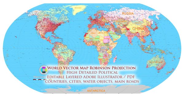
The Robinson Projection is often chosen for specific use cases where its characteristics align with the requirements of the mapping task.
Vectormap.Net provide you with the most accurate and up-to-date vector maps in Adobe Illustrator, PDF and other formats, designed for editing and printing. Please read the vector map descriptions carefully.
Here are some situations in which it makes sense to use a World Map in the Robinson Projection:
- General Reference Maps: The Robinson Projection is well-suited for general reference maps, especially those intended for educational purposes or casual use. Its attempt to balance distortions across the entire map makes it visually appealing and suitable for presenting an overview of the world.
- World Atlases: Many world atlases use the Robinson Projection for their world maps. The projection’s compromise between various types of distortions makes it a good choice for presenting a comprehensive view of the Earth’s surface in an atlas format.
- Educational Materials: The Robinson Projection is commonly employed in educational materials, such as textbooks and classroom maps. Its balanced distortion properties make it useful for conveying a realistic representation of continents and oceans without extreme distortions in specific areas.
- Multimedia Presentations: When creating multimedia presentations or interactive maps for general audiences, the Robinson Projection can be a suitable choice. Its aesthetic appeal and overall balance in distortion make it user-friendly for a wide range of viewers.
- Wall Maps: The Robinson Projection is often used for wall maps in offices, schools, and other public spaces. Its visually pleasing design makes it suitable for decorative purposes while still providing a recognizable representation of the world.
- Global Business and Marketing: In cases where a map is used for global business or marketing purposes, the Robinson Projection may be preferred. Its balance of distortions allows for a more accurate representation of the spatial relationships between continents and major geographical features.
It’s important to note that the choice of a map projection depends on the specific goals and requirements of the mapping application. While the Robinson Projection has its advantages in terms of visual appeal and balanced distortions, it is not without its limitations, such as distortions near the poles and the lack of equal area representation. For applications that prioritize equal area or conformality, other map projections may be more suitable.


 Author: Kirill Shrayber, Ph.D. FRGS