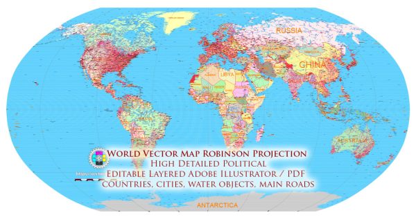
Vectormap.Net provide you with the most accurate and up-to-date vector maps in Adobe Illustrator, PDF and other formats, designed for editing and printing. Please read the vector map descriptions carefully.
Key Features of the Robinson Projection:
- Pseudocylindrical Projection: The Robinson Projection is a pseudocylindrical map projection, meaning that it attempts to balance the distortion of size and shape across the entire map by curving parallels and meridians.
- Balanced Distortions: One of the main features of the Robinson Projection is its attempt to provide a compromise that minimizes distortion in terms of size, shape, distance, and direction throughout the map. This makes it suitable for a wide range of uses.
- Global Coverage: The Robinson Projection is designed to represent the entire globe, providing a world map that offers a visually pleasing and balanced depiction of the Earth’s surface.
- Favorable for General Reference: The projection is often used for general reference maps and world atlases due to its aesthetic appeal and its attempt to maintain a realistic representation of continents and oceans.
Advantages of the Robinson Projection:
- Visual Appeal: The Robinson Projection is known for its visually pleasing appearance, making it popular for world maps used in educational materials, atlases, and wall maps.
- Balanced Distortion: Compared to some other projections, the Robinson Projection attempts to distribute distortions more evenly across the map, minimizing extreme distortions in any particular area.
- Suitable for General Use: The projection is suitable for general-purpose world maps where an aesthetically pleasing representation is desired without sacrificing too much in terms of accuracy.
Disadvantages of the Robinson Projection:
- Distortion at Poles: Similar to many other pseudocylindrical projections, the Robinson Projection introduces distortion towards the polar regions. This can lead to misrepresentations of the sizes of polar land masses.
- Not Equal Area: The Robinson Projection is not an equal-area projection, which means that it does not accurately represent the relative sizes of land masses. Areas may still be distorted, although less so than in some other projections.
- Not Conformal: Unlike conformal projections that preserve local shapes and angles, the Robinson Projection sacrifices conformality to achieve a more balanced overall representation. This can result in distortions of shapes in various regions.
In summary, the Robinson Projection is chosen for its attempt to strike a balance between various types of distortions, making it suitable for general reference maps where a visually pleasing representation is important. However, users should be aware of its limitations, especially in terms of distortions near the poles and its non-conformal nature. The choice of map projection depends on the specific requirements of the intended use.


 Author: Kirill Shrayber, Ph.D. FRGS